Qualification of 90 Engineers to Produce Crop Mapping using GIS to support water accounting in three governorates

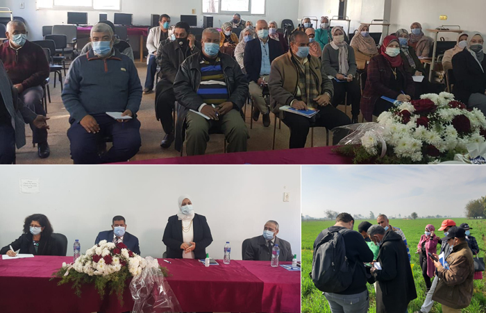
Cairo, Egypt - Ninety irrigation and farming engineers from three Egyptian governorates benefited from the first phase of a training on crop mapping using remote sensing under the project "Implementing the 2030 Agenda for Water Efficiency/Productivity & Water Sustainability in NENA," implemented by FAO in collaboration with the Ministry of Water Resources and Irrigation (MWRI) and the Ministry of Agriculture and Land Reclamation (MARL) and financed by the Swedish International Development Agency (SIDA).
A team of specialists from both ministries led the training aiming to equip governorates with the most recent tools to monitor changes in crops coverage and their implication for crop water consumption (evapotranspiration-ET).
In the second phase, 18 engineers who have passed the first phase will be trained on how to map the crop combinations using satellites, to identify the exact water needs of agricultural crops and maximizing the utilization of each drop of water.
Support sessions have also been implemented to develop crop combinations using satellite in three Egyptian governorates, which are: El-Menya (54,000 acres), Kafr El-sheikh (58,000 acres), El-Sharkia (147,000 acres). Crop combinations have also been lifted in the three governorates for the previous four seasons (winter and summer).
“This project comes within the framework of the FAO Regional Initiative on Water Scarcity, which aims to support Egypt and a number of countries in the Middle East and North Africa region to develop strategic plans for water resource management and sustainable allocation” Nasredine Hag Elamin, FAO Representative in Egypt stated.
“With the expansion of the MWRI's modern irrigation methods and the development of irrigation infrastructure at the Egyptian governorate level, there is a need to monitor accurately spatial distribution of agriculture to determine the actual consumption of water through irrigationfor different crops, which this training provides through the use of technology to obtain accurate information from all Egyptian climatic regions and to make use of it to maximize the yield of water” Iman Alsayed, Head of the Planning Sector, MWRI, pointed.
Domitille Vallee, Chief Technical Advisor, FAO Regional Office, and Project Manager, stated that project aims to bring together three main areas: establishing a robust water accounting system that inform on the situation of water resources and uses; enhancing knowledge on water efficiency and productivity status and opportunity for improvement in the diverse Egyptian agricultural systems; and ensuring higher return per water drops by 2030.
“Water accounting has been able to realistically determine the exact water requirements of agricultural crops which helps in making proper decisions on agricultural production and identify the needs of the State" said Alaa Albabli the director of Soil, Water and Environment Research Institute (SWERI) and the project coordinator for the crop mapping using remote sensing activity.
These courses are implemented through two phases. The first phase concerns training on uploading field data using a practical application with ODK collect in order to produce a spatial view of crop distribution and coverage. This phase aimed to train 90 irrigation and agricultural engineers in the three governorates.
Then comes the advanced level that includes the training on the creation of crop maps using free satellite images which is designed to train 18 engineers, at the rate of six from each province.
It is noted that overcoming the challenges facing Egypt's agricultural and water sector will help to meet the growing and diverse demands for food, thereby reducing the number of malnourished populations, and will also contribute in improving living standards in rural areas, preserving natural resources and ensuring food quality and safety through reliance on usual approaches and new technology to increase the productivity of land and water.