|
Current Fishing Area Maps |
|
Major Fishing Areas for Statistical Purposes
|
|
01 - Africa-Inland Water
|
|
02 - America, North - Inland Waters
|
|
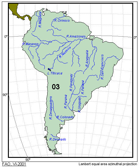
03 - America, South - Inland Waters
|
|
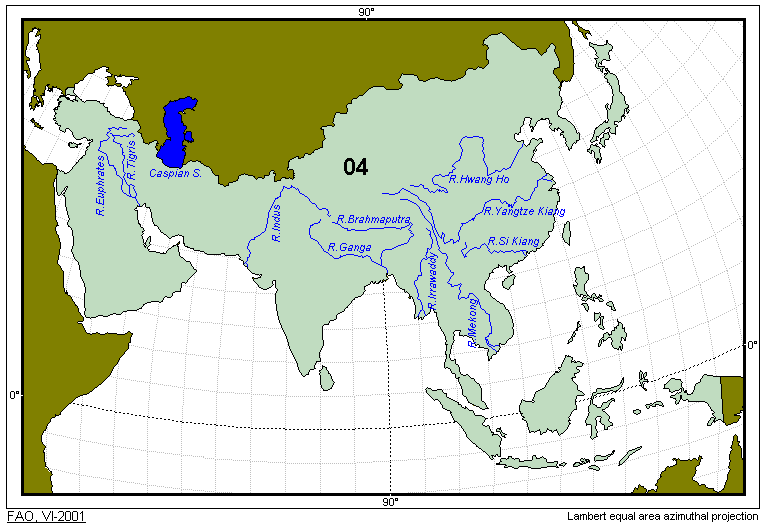
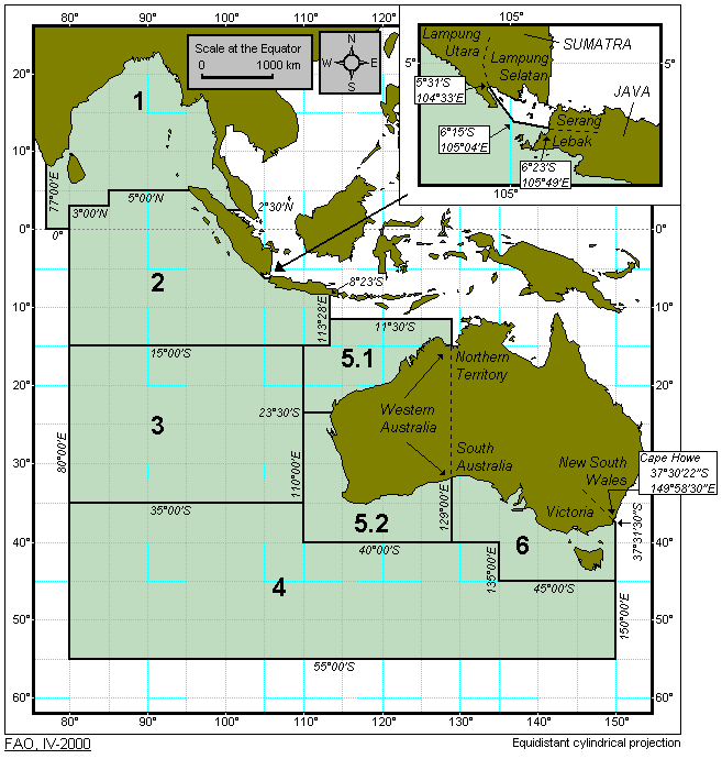
04 - Asia - Inland Waters
|
|
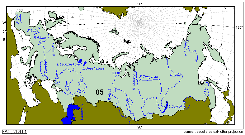
05 - Europe - Inland Waters
|
|
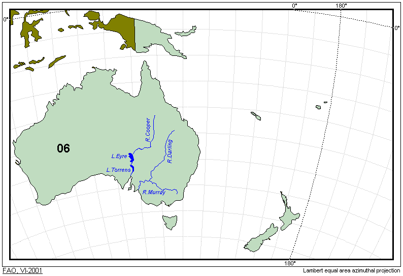
06 - Oceania - Inland Waters
|
|
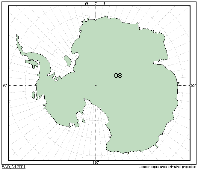
08 - Antarctica - Inland Waters
|
|
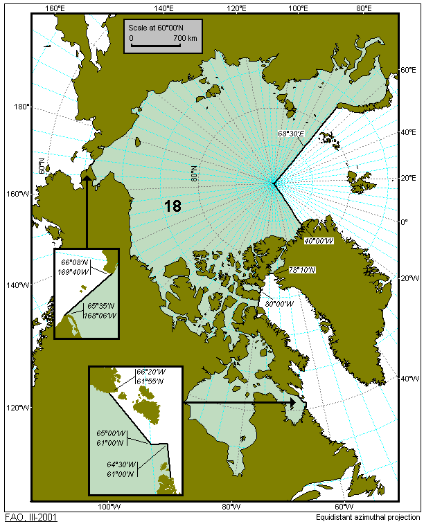
18 - Arctic Sea
|
|
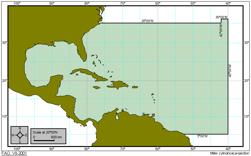
21 - Atlantic, Northwest
|
|
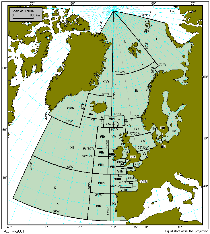
27 - Atlantic, Northeast
|
|
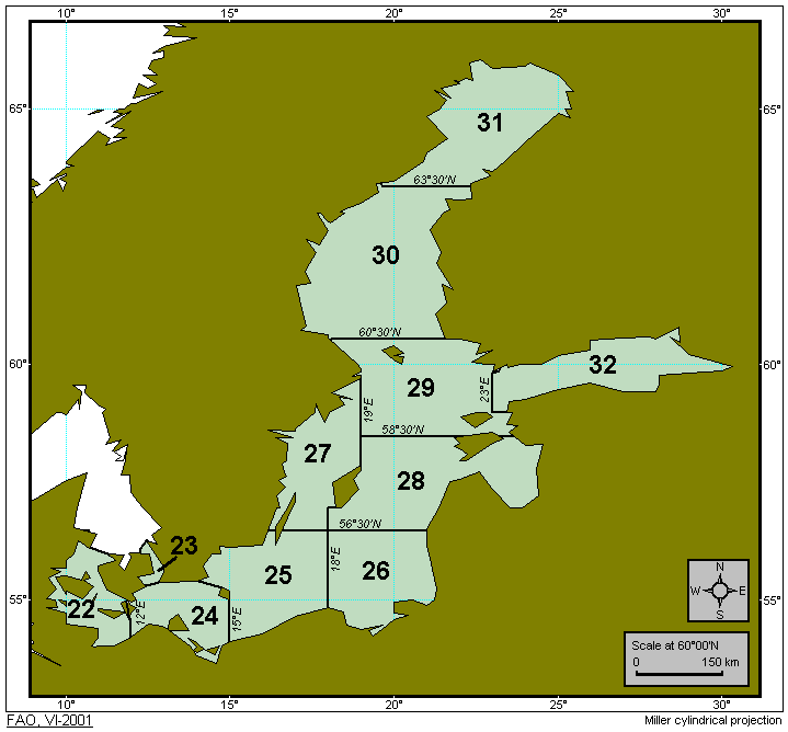
Baltic Sea Subdivisions
|
|
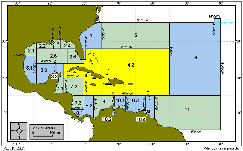
31 - Atlantic, Western Central
|
|
34 - Atlantic, Eastern Central
|
|
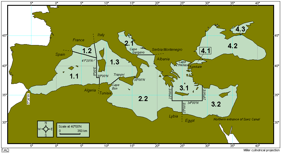
37 - Mediterranean and Black Sea
|
|
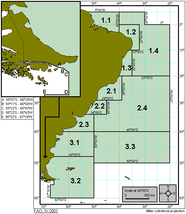
41 - Atlantic, Southwest
|
|
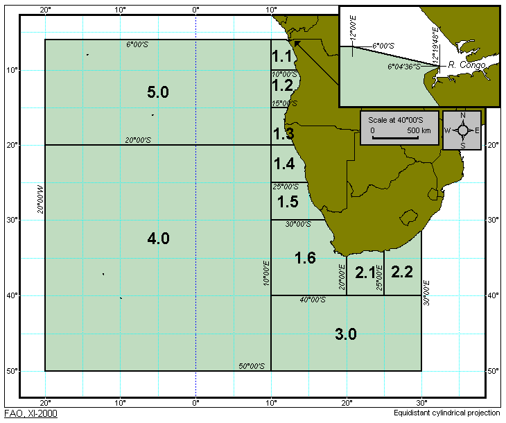
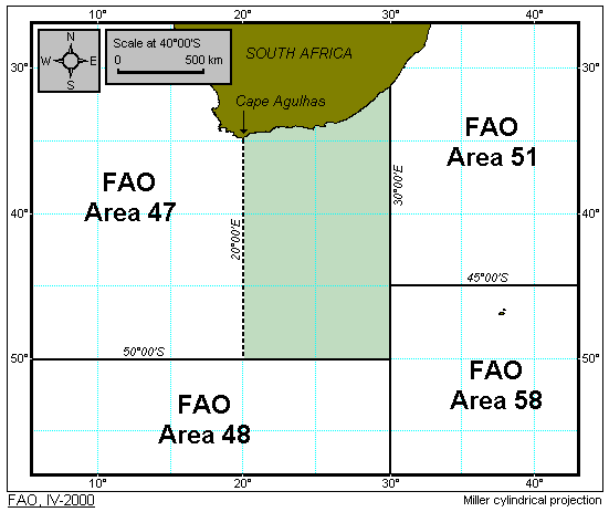
47 - Atlantic, Southeast
|
|
48 - Atlantic, Antarctic
|
|
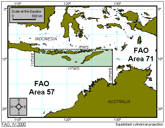
51 - Indian Ocean, Western
|
|
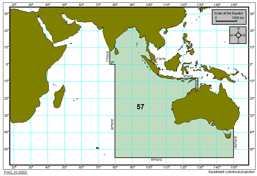
57 - Indian Ocean, Eastern
|
|
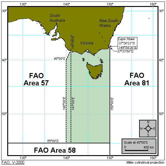
Modification to boundary between areas 51 and 57 - Indian
Ocean, Western and Eastern respectively (approved and operational as of 2001)
|
|
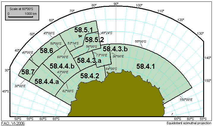
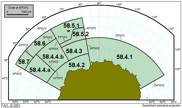
58 - Indian Ocean, Antarctic
|
|
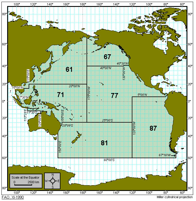
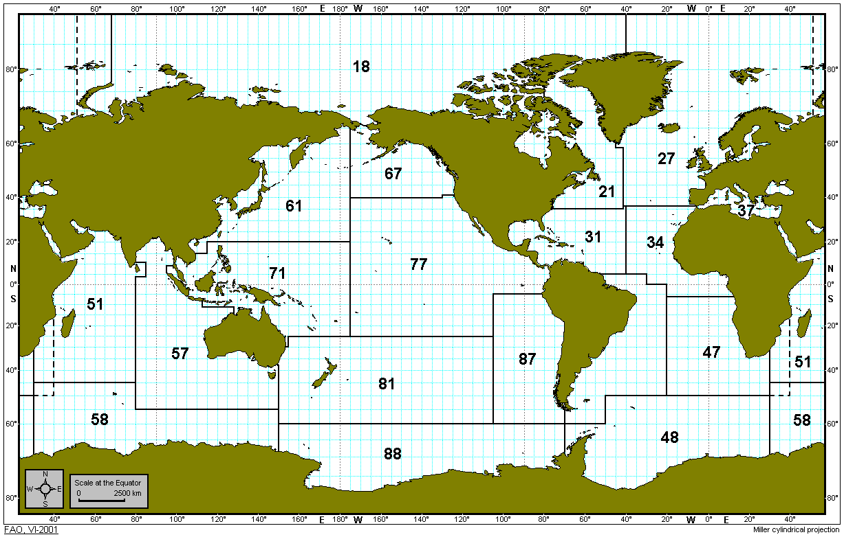
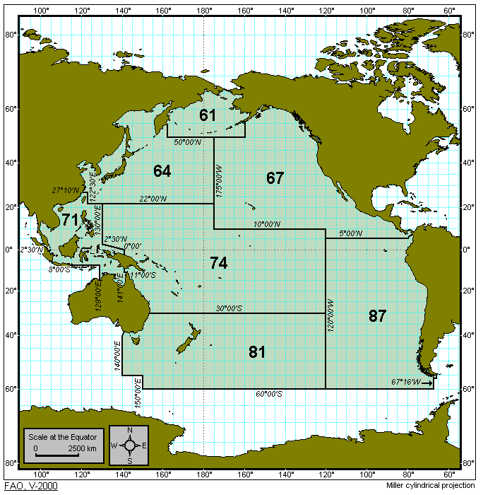
Pacific Ocean (existing) (Major fishing areas 61,
67, 71, 77, 81 and 87)
|
|
61 - Pacific, Northwest
|
|
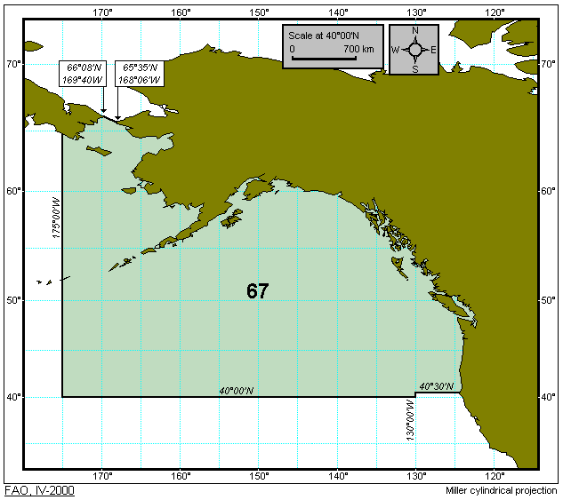
67 - Pacific, Northeast
|
|
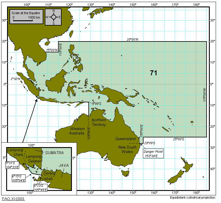
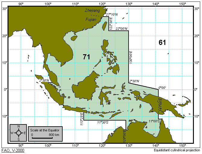
71 - Pacific, Western Central
|
|
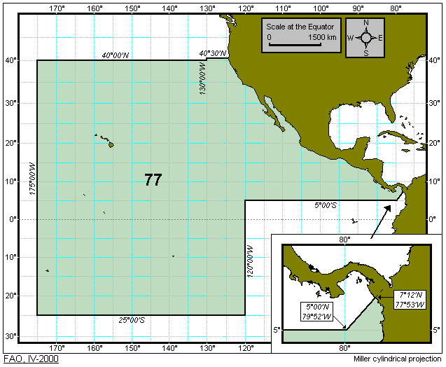
77 - Pacific, Eastern Central
|
|
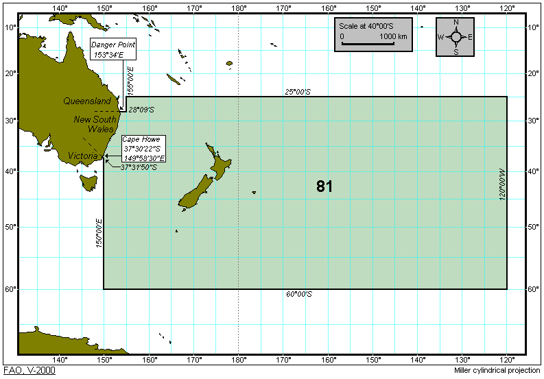
81 - Pacific, Southwest
|
|
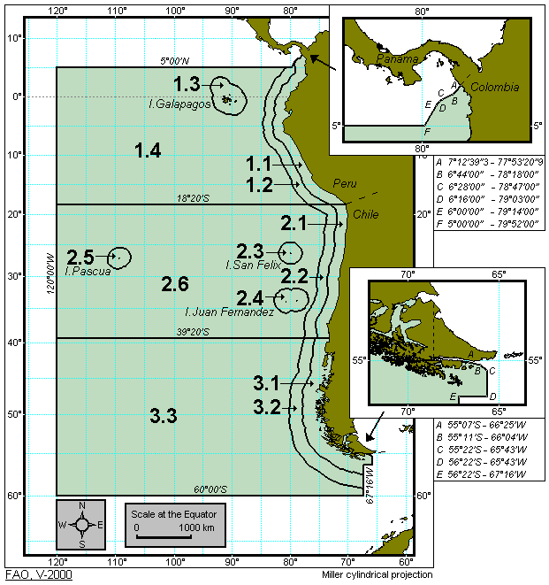
87 - Pacific, Southeast
|
|
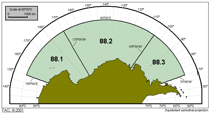
88 - Pacific, Antarctic
|
| Historical Fishing Area Maps |
|
04 - Asia - Inland Waters - (Yearbook of fishery statistics - volume 84 - 1997)
|
|
05 - Europe - Inland Waters - (Yearbook of fishery statistics - up to volume 84 - 1997)
|
|
chart used in 'Yearbook of fishery statistics': volumes
VI(1956), VII(1957), IX(1959), XII(1960), XIV(1961), XV(1962)
|
|
chart used in 'Yearbook of fishery statistics': volume
16(1963)
|
|
chart used in 'Yearbook of fishery statistics': volumes
18(1964), 20(1965)
|
|
chart used in 'Yearbook of fishery statistics': volumes
22(1966), 24(1967), 26(1968), 28(1969)
|
|
chart used in 'Yearbook of fishery statistics': volume
30(1970)
|
|
chart used in 'Yearbook of fishery statistics': volumes
32(1971), 34(1972), 36(1973), 38(1974), 40(1975)
|
|
chart used in 'Yearbook of fishery statistics': volumes
42(1976), 44(1977), 46(1978)
|
|
chart used in 'Yearbook of fishery statistics': volumes
48(1979), 50(1980), 52(1981)
|
|
chart used in 'Yearbook of fishery statistics': volumes
54(1982), 56 (1983), 58(1984), 60(1985), 62(1986), 64(1987), 66(1988), 68(1989), 70(1990),
72(1991), 74(1992), 76(1993), 78(1994), 80(1995), 82(1996), 84(1997)
|
|
chart used in 'Yearbook of fishery statistics': volume
86/1(1998)
|
|
chart used in 'Yearbook of fishery statistics': volumes
88/1(1999), 90/1(2000)
|
|
51 - Indian Ocean, Western - (Yearbook of fishery statistics - up to volume 86/1(1998) and
possible subareas)
|
|
57 - Indian Ocean, Eastern - (Yearbook of fishery statistics - up to volume 86/1(1998) and
possible subareas)
|
|
57 - Indian Ocean, Eastern - (Yearbook of fishery statistics - from volume 88/1(1999) to volume 90/1(2000) and
possible subareas)
|
|
58 - Indian Ocean, Antarctic - (before splitting of division 58.4.3)
|
|
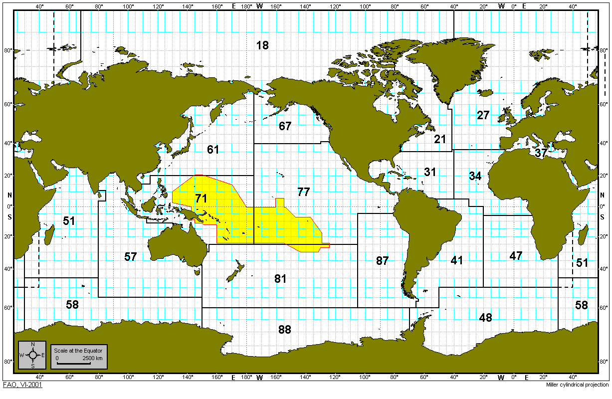
71 - PAcific, Western Central - (Yearbook of fishery statistics - up to volume 90/1(2000))
|
|
Proposed Fishing Area Maps |
|
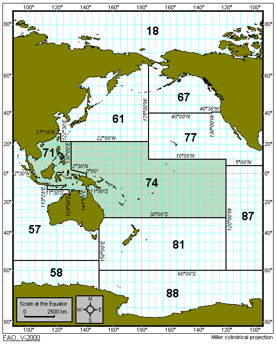
Pacific Ocean
|
|
Atlantic, Western Central. Possible subareas
and divisions of major fishing area 31.
|
|
Indian Ocean. Possible
modification to boundary between areas 47 and 51.
|
|
Indian Ocean, Eastern; Pacific, Western
Central. Possible modification to boundary between areas 57 and 71.
|
|
Indian Ocean, Eastern; Pacific, Southwest.
Possible modification to boundary between areas 57 and 81.
|
|
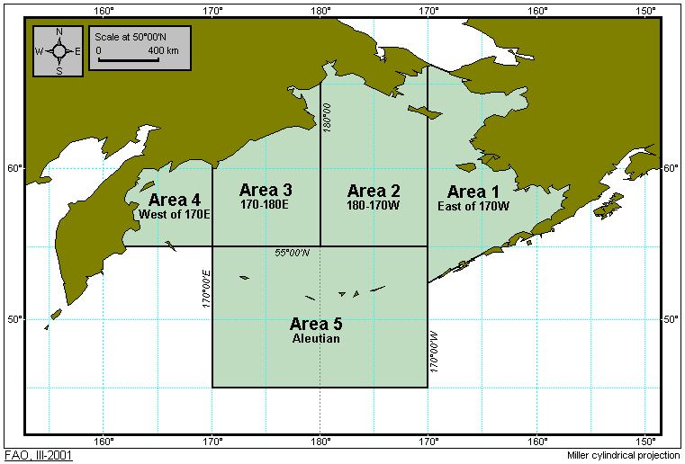
Statistical area/division of the Bering Sea Region used by the Pacific Commission.
|
|
Pacific Ocean proposed by Tuna Commissions
|
|
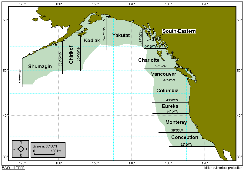
Statistical area/division of the North East Pacific Region
used by the North Pacific Commission.
|
|
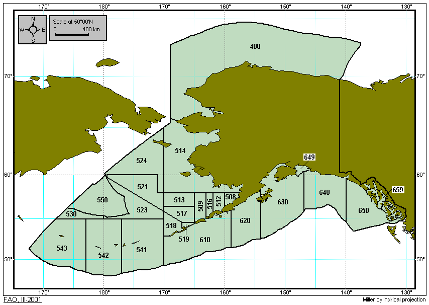
Statistical area/division of the
State of Alaska in use by USA.
|
|
Reporting Areas for the Pacific Halibut fisheries used
by the International Pacific Halibut Commission.
|
|
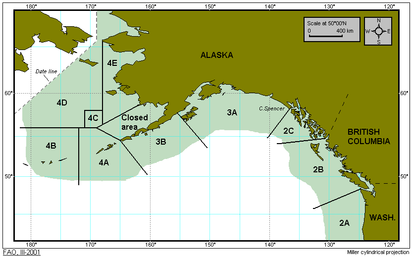
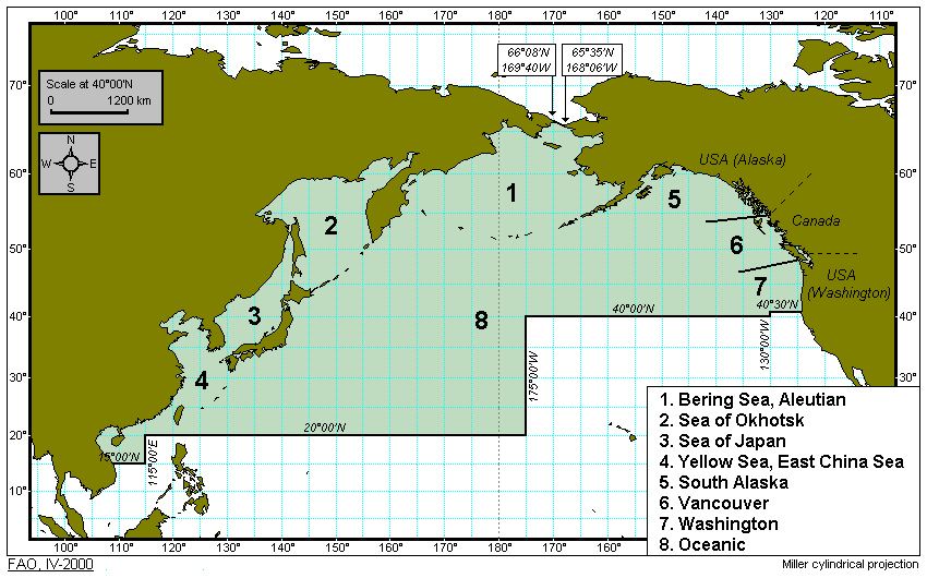
Reporting Areas around Alaska used by USA NMFS.
|
|
Pacific, North subareas proposed by FAO
in 1988 in respect fo major fishing area 61 amd 67.
|
|
Pacific, Western Central possible subareas
of major fishing area 71.
|
|
Possible modification to area 71 (Western Central Pacific)
to create new area (74) and reduce area 71.
|
|
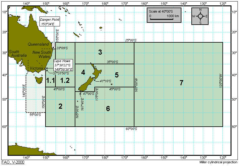
Pacific, Southwest; possible subareas of major fishing area 81.
|
|
Indian Ocean, Eastern; Pacific, Southwest; possible
modification to boundary between areas 57 and 81.
|
|
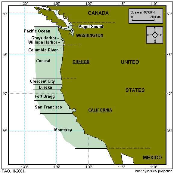
Statistical area/division of the state of Washington, Oregon
and California, used by the North Pacific Commission for Salmon Fisheries.
|
|
Pacific, Northwest; Pacific, Western Central;
possible modification to boundary between areas 71 and 61 and 74 (enlargement).
|