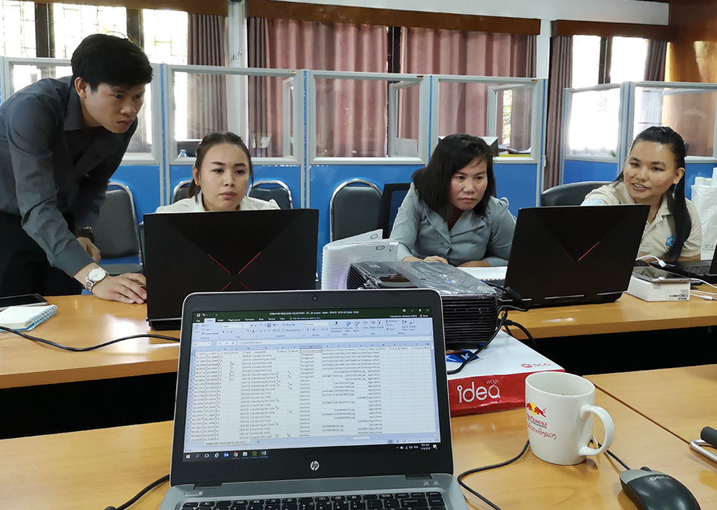
Ground-data collection training in Lao People's Democratic Republic

11-23 January 2019, FAO’s Senior Land Resource Information Management Expert, Gianluca Franceschini trained the ground-data collection team working under the Strengthening Agro-climatic Monitoring and Information System (SAMIS) project.
The team was made up of national consultants and experts from the Department of Agricultural Land Management (DALaM).
The main objective of the ground-data collection activity was to collect detailed geo-referenced information on the main agricultural patterns of the country (irrigated and rainfed paddy rice, upland rice, maize, sugarcane and cassava) to improve monitoring and analysis of agricultural production systems by strengthening land resources information management systems and Agro-Ecological Zoning.
 Agroecological zones (AEZs) are geographical areas exhibiting similar climatic conditions that determine their ability to support rainfed agriculture.
This information will support agricultural policies and climate change adaptation planning. It is important when designing scenarios where crop suitability will be evaluated under current conditions versus alternative, potentially more suitable land uses.
The interpretation of specific crop types from remote sensed imagery, requires detailed knowledge of different farming practises, crop calendars and the collection of ground observations on individual crops. The ground-truth data are then used to train statistical analysis via supervised classification models and artificial intelligence based on the input of multi-temporal and multi-sensor satellite images.
Districts in two provinces were selected for the data collection, Luang Namtha and Salavan, corresponding to the two main agroecological zones of the country: the upland region in the north and the lowland areas in the south.
The whole team was split into two groups working along different roads. They used the windshield technique and stopped the vehicle when agricultural land was encountered. The teams would then collect data on their mobile and tablet applications.
In total 680 individual valid data points were submitted into the server split by the following crops:
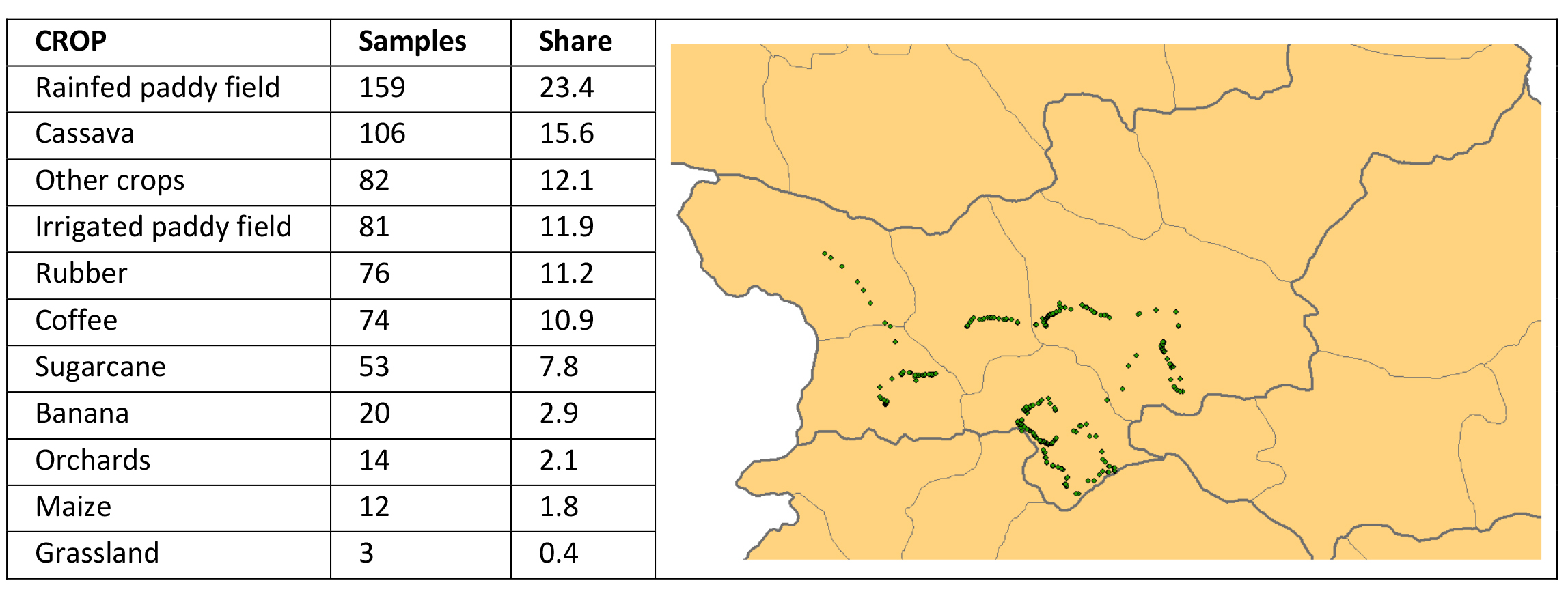
The category “Other crops” included orchards, vegetables and plantations that will not be mapped as individual crops in the final land cover dataset.