Actualités
Cette section présente des articles et des informations sur les activités réalisées par la FAO à l’aide de technologies et de méthodes géospatiales.
24 October 2023
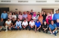
The National Consultative Workshop on implementation of the Soil Land and Water Information System (SoLaWISe) initiative was organized by the Food and Agriculture Organization of the United Nations in Tunis from October 24th to 27th, 2023. Tunisia serves as a...
18 October 2023
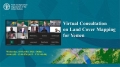
Land cover and land use information is a vital information for governments, agencies and institutions of a country to make informed decisions, promote sustainable development, protect the environment, food security biodiversity conservation, climate change and ensure the well-being of their...
18 October 2023

Join us for an exciting interactive experience and demo of AgroAdapt: Cultivate the Future! This simulation game, developed in collaboration with FAO Office Climate Change Biodiversity, FAO Land and Water Geospatial Unit, FAO Office of Innovation and FAO Regional Office...
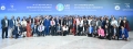
04 October 2023

The Geospatial Unit in Land and Water Division at the Food and Agriculture Organization of the United Nations organized a virtual event to collect the user experience using Land Characterization System Software on 4 October 2023. Total 39 participants from...
02 October 2023
In 2019, Baku, Azerbaijan was chosen as the host city for IAC 2022 by the IAF General Assembly, but due to the COVID-19 pandemic, the schedule was adjusted, and the 74th IAC will now take place from October 2-6, 2023....