新闻
本节介绍粮农组织利用地理空间技术和方法所开展活动的相关文章和新闻。
29 March 2024
The Italian Agency for Development Cooperation (AICS) and the Food and Agriculture Organization of the United Nations (FAO), in collaboration with the Ministry of Water Resources, the Ministry of Agriculture and Livestock and the Libyan Centre for Remote Sensing and...
22 March 2024

he collaboration between different international organizations has led to the launch of a groundbreaking certified eLearning course titled "Using land-cover information to monitor progress on Sustainable Development Goal 15." Developed jointly by the FAO Land and Water Division, FAO Forestry...
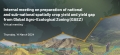
An internal meeting was held to demonstrate the practical advantages of utilizing the GAEZ dataset and remote sensing techniques for generating spatially aggregated crop yield and yield gap data at both national and sub-national levels. The aim was to showcase...
05 March 2024

AgroAdapt, the simulation game for anticipatory climate governance and resilient agrifood system transformation, took the spotlight at the Salon de l'Agriculture. Presented by AgroParisTech students Manon Roux-Dessarps and Adèle Chastanet, the game offers a unique perspective on navigating climate challenges...

An internal introduction and demonstration of the Land Cover Characterisation Software System (version 2) was given to FAO colleagues by Fatima Mushtaq, Victor Munene and Joe Njeru of the Geospatial Unit. The technical updates, user-friendly enhancements and benefits of the...