新闻
本节介绍粮农组织利用地理空间技术和方法所开展活动的相关文章和新闻。
25 September 2023
The 7th AfriGEO symposium held at the COSDEF Arts and Crafts Centre, in Swakopmund Namibia from 18-23 September, 2023 and Co-hosted by the Ministry of Higher Education, Technology and Innovation, and the National Commission on Research, Science and Technology.
There were...
04 September 2023

Geospatial Unit at Land and Water Division in the Food and Agriculture Organization of the United Nations (FAO) organizes the first 5 days training workshop in collaboration with FAO Somalia on 28th August to 1st September 2023 at FAO Somalia...
01 September 2023
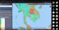
FAO provides techical assistance on Strengthening Agricultural Value Chain through Geospatial Value Chain Analysis (TCP/MYA/3806). On September 1, 2023, learn about "Crop Type Mapping," exploring remote sensing techniques for accurate land cover and crop identification. Then, on September 6, discover...

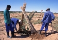
The National Centre for Vegetation Cover Development and Combating Desertification (NCVC) of Saudi Arabia recently visited the Food and Agriculture Organization of the United Nations (FAO) to discuss technical collaboration in achieving NCVC's objectives. The study tour mostly...
12 July 2023
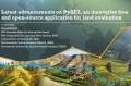
The Agro-Ecological Zoning (AEZ) methodology, developed by FAO and the International Institute for Ap-plied Systems Analysis (IIASA), is a well-established modelling system for land evaluation to support sus-tainable land-use planning, stimulate agricultural investments, monitor the status of agricultural resources, and...