


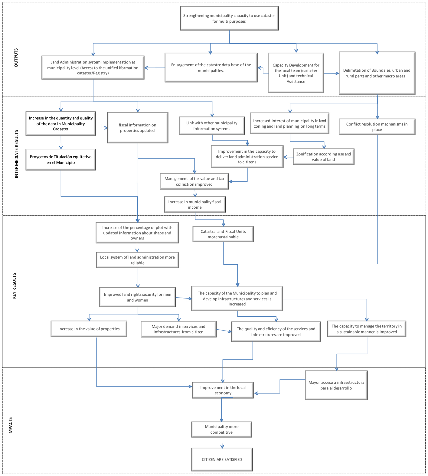
The results and impacts chain
LAP interventions to strengthen local governments are focused on the following:
- Cadastral mapping and updating
This activity is vital for land regularization and legalization processes. Cadastral mapping generally represents the highest budgetary item of LAPs. In Indigenous Communities and Territories (ICT), the total area is usually considered a single property in co-ownership or common use. In protected areas, in some cases only demarcation of the perimeter is carried out, while in others cadastral mapping of parcels located within these areas is also carried out. - Territorial planning and zoning
This consists of demarcating rural and urban areas, forest areas or natural reserves and in some cases risk areas. This includes support for dispute resolution over municipal boundaries, Indigenous Communities and Territories (ICT) or protected areas. In Honduras LAPs extend their activities to the development of Territorial Planning Schemes at municipal and ICT level in the titling process. - Linking cadastral information systems with taxation and receipts systems
Information on municipal districts, parcels and their occupants is updated based on cadastral mapping. Cadastral bases are often extended to the whole territory, not only urban areas. In parallel, LAPs support municipal governments to develop procedures and policies for improving taxation. - Training and educating staff in cadastral units and territorial management
LAPs seek to build capacity for municipal government staff in various fields related to cadastral administration, parcel measurement, knowledge of national land or property administration systems, management of the geographical information system, management of disputes and linking the cadastre with other areas of municipal management (zoning, tax collection, infrastructure, etc.). - Support for access to better cadastral unit and territorial management equipment
LAPs usually provide IT and measuring equipment for cadastral mapping work in the field and for digitization and data entry in the national system. Internet access and communication network quality in the municipal district are considered here.
In relation to these actions, the expected results and effects of LAPs can be viewed from a vertical cause-effect logic based on the results and impacts chain. This chain has identified four evaluation levels, corresponding to evaluation levels in the results framework. These levels correspond to:
- Key products derived directly from LAP actions in capacity building for subnational entities.
- Intermediate results of municipal capacity building and the generation of information on their territories.
- Key results related to how appropriate LAP intervention is for municipal governments.
- Impacts and effects at territory and citizen level.