![]()
![]()
![]()
Abstract
This paper examines the approaches of a rural Gambian community to forest fire management. Community forestry has given local communities the opportunities, but also the responsibility, of managing forests and protecting them from forest fires. The community described has been successful in implementing various fire prevention strategies. It has protected not only their forest, but also adjacent forestlands from ravaging fires. However, these achievements have been threatened by the lack of fire management in Kiang West National Park that borders the community forest of the village. The community’s Forest Committee has now approached villages surrounding the National Park and invited authorities of Forestry and the National Park to a round-table meeting with the objective of involving all concerned stakeholders in local forest fire management.
1. Introduction
The Gambia is the smallest country in continental Africa (Figure 1) with an area of approximately 11,000 km2, a population of more than 1.4 million and a population growth rate of about 3 percent per annum. With more than 120 inhabitants per km2, The Gambia is one of the most densely populated African countries. About 50 percent of the population above 15 years old are literate.
With an annual per capita income of about US$300, the country is one of the least developed in the world (FAO, 2000 estimates; CIA, 2001). The climate is of the Sudano-Sahelian type with a rainy season from June to October and a dry season from November to May. The average annual rainfall is between 800 and 1,000 mm. Situated in the dry savannah region of sub-tropical Africa, the country is prone to bushfires.
The most important causes of bush and forest fires in The Gambia are hunting, wild honey collection, land preparation, creation of new settlements and firewood collection. Other causes include oyster processing, palm wine tapping, and cooking in the open (Dampha et al., 2000).
2. The study area: Batelling in Kiang West District
Batelling is a comparatively small village of 27 compounds (households) with 366 inhabitants. It is located in Kiang West District in the Lower River Division, about 150 km from Banjul. Batelling’s traditional lands are bordered by the 11,000 ha Kiang West National Park (KWNP) to the north and west, and by the 360 ha Brikama Forest Park in the south (Figure 2).
Figure 1: Map of The Gambia and neighbouring countries
Source: www.lib.utexas.edu/Libs/PCL/Map_collection/africa.html
Most inhabitants of Batelling are Mandinka by ethnic origin. There is only one Fula compound with seven people. The Fulas are the herders of the community with about 70 cattle. The predominant economic activity in the village is growing groundnut as a cash crop. Sorghum, rice, maize and cassava cultivation is mainly for domestic consumption.[22]
In addition to farming, 14 villagers earn some income from crafts (carpentry, masonry) or employment in the public sector. In the 1990s, seven inhabitants worked in the KWNP and four in the Forest Station at Dumbutu. Roughly one-third - 9 women and 55 men between 15 and 60 years old - of Batelling’s population can be recruited for community activities.
Batelling’s origins can be traced back 650 years, when the ancestors of the present inhabitants came from the empire of Mali, the origin of all Mandinkas. Despite its small size, Batelling used to be the capital of the Lower River Division, hosting its colonial administrators, the commissioners and, up to The Gambia’s independence in 1965, the district heads (chiefs).
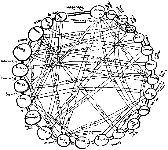
The traditional structure of the village has remained virtually unchanged to this day. The most important social units are the 4 kabilos (clans), which comprise families of the same lineage. The social structure is closely knit, with most compounds being interrelated by marriage or kinship (Figure 3). All the villagers are Muslims, guided by the Imam, a religious leader who plays an important role in the community.
The main decision-maker in the village is the kebba kafoo (Council of Elders with the Imam and the village head or alkalo). As in other Gambian communities in the last 20 years, the co-ordinating body for communal work and development activities is the Village Development Committee.[23]
Figure 2: Map of Batelling and surroundings
Figure 3: Sociogram of kinship in Batelling
Source: Bernecker and Fekade, 1994
3. Batelling’s involvement in community forestry
3.1. Concept of community forestry in The Gambia
In The Gambia, the Forestry Department with the assistance of several Gambian-German forestry projects developed and implemented a community forestry concept since 1991. The approach attempts to give the local population full responsibility in the management of their local forest by vesting them with legal ownership over land and trees. Up to the present, community forestry is implemented in an area of 25,000 ha and involves more than 500 communities throughout the country.
The transfer of ownership to the participating communities proceeds in three phases:
Start-up phase:
Communities that declare interest to the Forestry Department receive training in community forestry procedures. They identify a suitable forest area and form a Forest Committee representing the community.
Forestry staff and villagers develop a management plan under which the community is to demonstrate its ability to manage the forest and protect it from fire and illegal exploitation during a 3-year period with the advice and assistance of the local forestry staff.
If the preliminary phase is successfully concluded, full ownership is awarded for the sustainable and exclusive forest use according to yearly village planning.
3.2. Community forestry in Batelling
When community forestry was introduced to the Lower River Division communities in August 1994, Batelling was the first village to send a letter of interest to the forestry officers, indicating its willingness to participate in the programme. The villagers were keen to gain ownership of the local forest after encountering restrictions laid down by the Department of Parks and Wildlife outlined in the KWNP management plans. Similarly, in fencing off the Brikama Forest Park in 1983, the Gambian-German Forestry Project (GGFP), in co-operation with the Department of Forestry, effectively banned the neighbouring communities from collecting firewood and grazing cattle (Schindele, 1986). Project and forestry staff recorded the villagers’ point of view in the first village appraisal:
“After having explained that the KWNP [authorities] took their forest, they continued: ‘the GGFP ... came and took Brikama [Forest Park]. We are afraid that outsiders are taking our forest .... So we proposed the site for community forestry before it is taken away....’” (Bernecker and Fekade, 1994).
Just one month after the introduction of the concept, a Forest Committee of 20 village representatives was formed to co-ordinate the establishment and management of the community forest. The committee included youth and women representatives, with the alkalo and Imam as advisors. The structure of the committee has remained virtually unchanged to this day (Figure 4). The community selected a site of almost 500 ha adjacent to the farmland southeast of the village, extending up to the boundary of KWNP (see Figure 2). The community forest, named Nganing-Koi after a local tree species (Acacia seyal), was demarcated in November 1994.
The community obtained provisional ownership in January 1995. After a positive evaluation of the management of Nganing-Koi in December 1997, the Forestry Department awarded full ownership over the forest to Batelling in December 1999.
In May 1998, the community applied for an extension of more than 300 ha to the north. With this extension (Nganing-Koi II, see Figure 2),[24] Batelling now has the second largest community forest in the country and the largest managed by a single village. Compared to the country’s most extensive community forest (~ 1,300 ha), which is jointly managed by six villages, each similar in size to Batelling, the management capacity and aspirations of this small community are to be marvelled.
Forest fire prevention and suppression play an important role in the development and management of Batelling’s community forest. According to the villagers, “to stand against fires is the primary objective” of all their management activities in Nganing-Koi.[25] The ongoing forest fire protection programme has been a prerequisite for receiving full ownership to the community according to the 1998 community forest regulations. On the other hand, to be empowered as legal owners of “their” community forest and endowed with exclusive use rights are strong incentives for the community to protect and develop the Nganing-Koi in the long term.
4. Community-based fire management in Batelling
4.1. Traditional fire management
Attempts to minimise the adverse effects of forest and bush fires have had some tradition at the community level. “We have inherited protection from our forefathers” is a comment elicited during interviews with the Forest Committee. Even before their adoption of community forestry practices, the villagers of Batelling had relied on traditional fire management methods to protect the forest areas they were using. In particular, they maintained firebreaks around forest patches covered with elephant grass (Andropogon spp.) to stop fire intrusion. Villagers also scheduled prescribed burns at the beginning of the dry season, “early in the year when the grass was not very dry,” with some people to control the burn and others who followed to put out all unwanted fires.
Figure 4: Structure of Nganing-Koi Forest Committee
Still, fighting fires to save the forest was not a main objective of traditional fire management: “We used not to mind, we only put it out when it came close to the fields.”[26] Nevertheless, when given the responsibility for managing their community forest, the villagers could draw on their traditional knowledge and experience for fire suppression. Furthermore, fire management techniques developed by the Forestry Department and adapted for community forest management help to booster their capabilities.
4.2. Fire management of Nganing-Koi community forest
Fire management is an integral part of community forestry. Without protecting the forests from annual fires, the rural population would not be able to derive sustained environmental and economic services from these forests. Therefore, active participation in community fire management is one of the decisive criteria for awarding them full ownership of the forest.
Fire prevention starts during the provisional phase of the transfer of ownership with the establishment of firebreaks on fire-prone sites. Priorities and details of these measures, such as timing, preparation, site selection and allocation of responsibilities, are determined in the management plan that is prepared by the Forest Committee with the assistance of forestry extension staff.
After five years of continuous collective village work, Nganing-Koi is entirely protected against incoming fires on its eastern boundary, previously the most vulnerable location. Live firebreaks and belts are the most important forms of protection. Live firebreaks are established by line planting of fast-growing species such as gumbar trees (Gmelina arborea). During the rainy season, their dense foliage inhibits understorey growth and creates a corridor with minimal fuel loads, thereby reducing chances of fire outbreaks during the dry season. Meanwhile, fire belts can be created by clearing a 5-m strip along the periphery of the community forest followed by a second strip running parallel at a distance of about 100 m, and then burning the vegetation - mostly grasses - between the two strips. This process has to be repeated annually at the beginning of each fire season to maintain the belts. Since Nganing-Koi II was established in 1999, annual controlled burns have protected its eastern boundary (Figure 5).
Figure 5: Fire management in Nganing-Koi community forest
Apart from the technical approaches, by-laws enforced by the Forest Committee regulate community forest management and fire prevention. Participation of able men and women in forest management is mandatory. The use of fire in the community forest is prohibited, with the exception of controlled burning. Culprits are to be reported to the alkalo, who in turn is to inform the Forestry Department and the district chief. The latter will take punitive action according to the 1998 Forest Act. The by-laws also set out the procedures for punishment at the village level. The Forest Committee is authorised to fine each guilty offender 300 Dalasis (about US$20) and withdraw his or her use rights to the community forest. For offenders under 17 years old, the Forest Committee will determine non-monetary forms of punishment, but there is no precedent yet.
Fire fighting to protect the community forest is mandatory under the existing by-laws: “Residents of Batelling have to participate actively in fire fighting. Offenders will be reported to the alkalo to be fined by him.”[27] The villagers also maintain “prevention is better than cure. Before it comes, we already have the area controlled burned.”[28]
The by-laws sanction the Forest Committee to raise awareness about the causes and consequences of fires in local schools and among other communities along the River Gambia where fires are often started by fishermen. The Forest Committee is also responsible for enforcing the laws. Four volunteers patrol the area to detect fires and other illegal forest activities such as felling of live trees and poaching.
The success of Batelling’s forest management, particularly their fire prevention activities, clinched them two prestigious prizes: in 1997, the first divisional prize from the National Environment Agency, and in 1999, the national award of CILSS (Permanent Inter-State Committee for Drought Control in the Sahel[29]). The prize money amounted to 20,000 Dalasis (about US$1,300).
4.3. Achievements of fire management
Statistics of fire incidences in the Lower River Division, and the Kiang West District in particular, point out that up to 90 percent of the local forests burn annually. This applies even to managed forest parks (Herbort, 1989) and many of the community forests in the area (Dampha et al., 2000). In comparison, since the Batelling community assumed responsibility for the management of Nganing-Koi community forest, only three major fires broke out in the area, namely in 1997, 2000 and 2001, burning most of the community forest. These fires were related to the following incidents:
Three minor fires were detected early and suppressed through the spontaneous collective action of the villagers. Even the more severe fires were fought collectively by the villagers with the help of neighbouring communities and staff from the Departments of Parks and Wildlife, and Forestry.
5. Co-ordination of local stakeholders in fire management
The KWNP is far bigger than other forest parks of The Gambia (up to 2,600 ha). Public access and use of its natural resources are prohibited. The villagers of Batelling perceived this as a “breach of agreement” since the Park had been set up with the assistance of an internationally funded project with the promise that neighbouring villages could use its resources. Subsequently, the communities resorted to “mass illegal exploitation”[30] in the Park that once was accessible to them (Bernecker and Fekade, 1994).
The National Park, although a “protected area” according to the Wildlife Act 1977, is affected severely by annual forest fires (Gilbert et al., 1992). Except for Jarin Bolong, a tributary of the River Gambia, the Park lacks any natural and artificial firebreaks and its road system is underdeveloped, which makes it difficult to access many sites.
According to a project-planning document, the firebreak system of the National Park is concentrated in the south and southeast of its peripheries. In 1990, villagers from Batelling and neighbouring communities were contracted by “food-for-work” programmes to clear firebreaks near their villages. When funding for these programmes ended, villagers’ participation declined (Gilbert et al., 1992). However, in recent years, villagers from Batelling were again contracted to clear firebreaks to be used as access roads by the KWNP staff.
A firebreak on the border between the KWNP and Nganing-Koi community forest used to be cleared until 1999, when funds were no longer available. The severe fire of 2001 entered the Nganing-Koi community forest through this overgrown area and destroyed Nganing-Koi I and II almost completely despite the community’s fire fighting attempts. The villagers of Batelling were frustrated about their inability to protect their resources after having invested so much effort. The Imam, advisor to the Forest Committee, contended: “We inherited this forest from our ancestors. Now that we have attained ownership, there is a sabotaging factor that hinders the whole system. If the efforts we are doing are in vain, demotivation might be the result.”
Theoretically, mechanisms are in place to integrate the satellite villages of KWNP in its management, the most important being a Technical Advisory Committee (TAC) that was set up in 1992. The main purpose of the TAC is “to discuss the issues they see as critical to life in a rural community” (Gilbert et al., 1992). The influence of TAC on the management of the Park seems to be limited, as evident from the Imam’s statement.
In fact, some community members alleged that arson by people dissatisfied with the current set-up of KWNP could be the cause of some fires. In the meanwhile, according to the villagers interviewed in Batelling, the lack of trust between the communities and the management of KWNP makes it difficult to trace the culprit(s).
To end this stalemate, the Forest Committee of Batelling called a meeting of all concerned stakeholders in the area - the management of KWNP, Forestry Department and the villages around the Park “as far as where the fire came from” - to discuss a common approach in fire management. Meanwhile, the villagers wondered why it was up to them to take the initiative: “Why don’t the heads of Forestry and Wildlife come and sit together and discuss strategies before the communities initiate these things?”[31]
While the call for this meeting was well received by the other concerned villages “because this is a headache for everybody,” the people of Batelling were cautious in their expectations from the representatives of the Departments of Forestry, and Parks and Wildlife.
6. The local forum on the control of bushfires
The communities were determined to use the proposed meeting as an opportunity to communicate their concerns to the relevant government agencies. The organizers from the Nganing-Koi Forest Committee therefore did everything to ensure the participation of officers from the Departments of Parks and Wildlife, and Forestry. However, the scheduled meeting was cancelled when Department representatives were not going to be present. The forum was finally held two months after the initial invitation, with the participation of 33 members of five satellite villages and staff of the two departments. Unfortunately, the villagers were unable to meet the Directors of both departments.
At the forum, participants voiced their views on the causes of the forest fires and responsibilities for controlling them as well as suggested solutions. The devastating effects of the latest fires in the KWNP were also disclosed. New houses in the village could not be roofed since grasses in Nganing-Koi had been burned. Many speakers, on behalf of the TAC and Forest Committee from satellite villages, were convinced that Park personnel have the capacity to play a more significant role in fire management. The management was urged to identify the origins of fires in the Park as a basis for prevention plans.
Likewise, the manager of KWNP explained the difficulties faced by the Park administration since funding for community involvement and salaries had been phased out prematurely. He envisaged future projects and called upon the support of the communities.
TAC members stressed the need for “people to be aware that they have to carry on even without projects.” The villagers “should be encouraged to understand that the Park is theirs to take care of.”
Forestry extension staff conducted a participatory appraisal on the results of the meeting. The following actions and stakeholders who are to be responsible for these actions were identified (Table 1).
Table 1: Proposed actions and stakeholders to be responsible
|
Proposed action |
Stakeholders to be responsible |
|
Form a local association to combat fires |
Forest Committees, TACs |
|
Improve participation in fire fighting from the satellite villages and KWNP staff |
Forest Committees, KWNP |
|
Sensitise the fishermen from Kiang, Baddibu (North Bank Division), Senegal and Mali who operate around Tubabkollon Point from November to June |
KWNP environmental education group, forestry field staff, Forest Committees |
|
Maintain continuous patrolling |
Forest Committees, KWNP, Forestry Department |
|
Clear fire entry points at appropriate times to be determined jointly |
Forest Committees, TACs |
|
Determine place and time for controlled burns based on previous experiences |
Forest Committees, TACs, support of forestry field staff |
|
Improve reporting of culprits and violators of the by-laws |
Forest Committees, forestry field staff, communities |
|
Enforce the Forest Act |
District authorities and forestry field staff |
|
Establish effective collaboration between the Departments of Parks and Wildlife, and Forestry in terms of fire management at the directorate level |
Forestry Department, Parks and Wildlife Department |
7. Conclusions
The case of Nganing-Koi demonstrates both the potentials and the limitations of community-based fire management. While the community of Batelling had traditionally employed fire management measures such as early burning to protect their assets, community forestry has laid the basis for sustained and co-ordinated fire prevention measures. It has also incorporated the advice and assistance of forestry extension staff, such as the construction of an extensive firebreak system and early burning.
The success of fire protection in Nganing-Koi shows that community forestry can have a high impact when it draws on appropriate local organization and traditional knowledge. Forestry extension officials should give high priority to these aspects in their village appraisals and consider them in the work plans with the villagers.
Ownership over Nganing-Koi has created a strong incentive for the community of Batelling to protect and develop their forest. The relationship with the Forestry Department has improved to the extent that the community now even takes responsibility for fighting fires in forest areas beyond their own boundary. This change of attitude has overcome former pitfalls of forest management such as fencing off the adjacent National Park.
However, the example of KWNP also serves as a strong reminder that responsibilities for fire management cannot simply be passed down to communities. A single fire that had crossed into the National Park, burning uncontrolled for several days, had rapidly destroyed the achievements of years of fire prevention in Nganing-Koi.
The KWNP is a huge and in effect unmanaged zone in terms of fire control, lacking mechanisms to incorporate the stakes of neighbouring communities. The relationship of the park management with satellite villages has been limited to contract labour and paid employment. Envy among communities has been generated by the uneven and seemingly arbitrary recruitment of paid labourers from different satellite villages. This relationship deteriorated further when financial support for communal workers’ salaries was withdrawn without prior notification. Villagers felt they were cheated out of their payments. It is therefore not surprising that communal work for maintaining the firebreaks of KWNP came to a halt.
The villagers thought they should be paid for their work because of the lost rights over the Park and its natural resources. This is not entirely correct since they are allowed to collect grass for domestic purposes. However, as it was revealed during the local forum, satellite communities were not told of this right by the park management, which leads to further misunderstandings.
The KWNP is a case in point for other nature parks and reserves that have restricted access by the local population, offering (at best) financial compensation to them for being deprived of any benefits. This is especially grave in a case like Batelling where subsistence livelihoods depend on the supply of local natural products and where inefficient (yet exclusive) management of these “protected” areas by state agencies can lead to detrimental events - such as forest fires - and severe hardship for the community.
The constructive outcome of the stakeholders’ meeting should not obscure the difficulties facing communities like Batelling in holding the relevant administrations responsible. The Departments of Forestry, and Parks and Wildlife did not show enough interest in addressing the problem directly. To the villagers of Batelling, the stakeholders’ meeting was less a manifesto of self-empowerment or grassroots politics, but rather an act of despair to deal with the threat to their natural assets. Attending the meeting was more a goodwill gesture from the two departments with no commitment on their part to solve the problems.
On the other hand, for the forum to have taken place at all is remarkable. It has brought relevant stakeholders together, identified others such as seasonal fishermen, and developed key points of action. The proposal to commit the key groups in a regional association seems to be particularly promising, corresponding in fact with a revision currently being foreseen in the Gambian forest policy. The new approach calls for a broader perspective on fire management planning at the local level, rather than at the regional scale which necessitates new planning procedures and new models of collective action (The Republic of The Gambia, 2001; Schindele, 2001).
References
Bernecker, K. & Fekade, W. (1994). Grassroots/Target group approaches in community forestry. Gambian-German Forestry Project. Deutsche Gesellschaft für Technische Zusammenarbeit (GTZ), Eschborn, Germany.
CIA. (2001). The World Factbook: Gambia. Central Intelligence Agency, Washington, D.C. http://www.odei.gov/cia/publications/factbook/geos
Dampha, A., Camara, K. & Beck, C. (2000). Management of forest fires through the involvement of local communities. Case study: The Gambia. Food and Agriculture Organization of the United Nations, Rome (in press).
FAO. (2000). Annual report 1999, by Heimo Mikkola, The Food and Agriculture Organization of the United Nations Representative in The Gambia. Banjul.
Gilbert, V.C., Camara, A. & Wilkie, D.S. (1992). Kiang West National Park Integrated Conservation and Development Project. Ministry of Natural Resources and the Environment (of The Gambia). Banjul, The Gambia.
Herbort, H. (1989). Savannenbrände in Westafrika: Ihre Auswirkungen und mögliche Gegenmaßnahmen, dargestellt am Beispiel Gambias. Thesis, University of Kassel. Kassel, Germany.
Schindele, W. (1986). Survey and demarcation of forest parks in The Gambia. Deutsche Forstinventur-Service for Deutsche Gesellschaft für Technische Zusammenarbeit (GTZ). Eschborn, Germany.
Schindele, W. (2001). Revision of the Gambian forest management concept. Some ideas and recommendations. Mission Report, Department of State for Fisheries, Natural Resources and the Environment/Deutsche Gesellschaft für Technische Zusammenarbeit/Deutsche Forstservice GmbH. Eschborn, Germany.
The Republic of The Gambia. (2001). The Gambian forest management concept. Final draft. Forestry Department, Department of State for Fisheries, Natural Resources and the Environment. Banjul, The Gambia.
Acknowledgements
First-hand information for this study was gained from group interviews with the Forest Committee of Nganing-Koi and from the documentation of village meetings. The authors are grateful to Sisawo Sabally of Dumbutu Forest Station for assisting in the organization and the documentation of the relevant statements and visualisations. We furthermore appreciate the assistance of the Directorate of the Department of Parks and Wildlife in Abuko, which generously supplied us with background information. Finally, we are profusely thankful to the villagers of Batelling, especially the Forest Committee, for their motivation and openness, without which this documentation could not have been compiled.
|
[21] Kebba Sonko, Department
of Forestry, 5 Muammar Al-Ghadafi Avenue, Banjul, The Gambia, email:
[email protected] Saikou Samateh Department of Forestry, 5 Muammar Al-Ghadafi Avenue, Banjul, The Gambia, email: [email protected] Kanimang Camara, National Consultancy on Forestry Extension Services and Training, P.O. Box 504, Banjul, The Gambia, email: nacogambia95@hotmail Clemens Beck, Gambian-German Forestry Project (GGFP), P.O. Box 504, Banjul, The Gambia, email: [email protected] [22] Village-related information comes from the Community Forest files at the Dumbutu Forest Station. [23] Village history of Batelling, Community Forest files, Dumbutu Forest Station (undated). [24] The area first demarcated in 1994 is now referred to as Nganing-Koi I. [25] Comment from a Forest Committee member during an interview. [26] Comment from villagers during interviews. [27] Nganing-Koi by-laws of 1995, Community Forestry files, Dumbutu Station. [28] Comment from a Forest Committee member in an interview. [29] The CILSS comprises member countries Senegal, The Gambia, Mali, Niger, Chad, Burkina Faso, Guinea-Bissau, Mauritania and Cape Verde. [30] Quoted from a forest committee member. [31] Comment from a forest committee member. |
![]()
![]()
![]()