


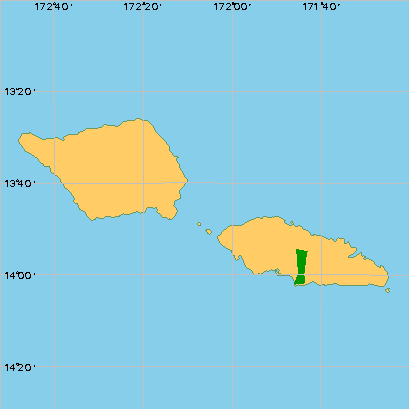
The Independent State of Samoa is located in the southern Pacific Ocean about 2 900 km northeast of New Zealand. It occupies the larger western portion of the Samoan archipelago that is divided at longitude 171° west between the country of Samoa to the west and American Samoa, a United States territory, to the east.
Samoa is made up of nine islands with a total land area of 2 831 km2, but the two largest islands, Savai'i and Upolu make up more than 99 percent of the land. They are of volcanic origin and their mountainous interiors are covered with dense rain forests. The surrounding landscape consists of fertile plateaux and coastal plains with numerous rivers and streams. Samoa's seven smaller islands are Apolima, Manono, Fanuatapu, Nu'ulopa, Nu'utele, Nu'ulua, and Nu'usafee, of which only Apolima and Manono are inhabited. Mount Silisili, on Savai'i, is the country's highest peak with an elevation of 1858 m.
The climate is oceanic tropical with high temperatures and humidity. Apia, which lies on the northern coast of Upolu, has an average daily temperature range of 21° to 31° C, with little seasonal variation, and an average annual precipitation of 2 850 mm. Most rainfall occurs on the windward southern sides of the islands, however, where the annual precipitation can range from 5 080 mm to 7 110 mm. The heaviest rainfall occurs between the months of November and April, and cyclones, which are relatively frequent, are most likely to occur during these same months.
Part of the Samoan archipelago, the Independent State of Samoa is comprised politically of the largest two islands in the group (which also includes six islands that comprise American Samoa): Savaii is 1 820 km2 and 1 860 m high; Upolu is 1 110 km2, 1 100 m high. The islands are in the southeast tradewind belt and receive much rainfall. Savaii is still active volcanically, while Upolu is extinct or at least dormant. Vegetation types include littoral, mangrove, and swamp forests, and a range of rain forest types. The following description of vegetation types is derived from Mueller-Dombois and Fosberg (1998).
This forest type grows on sandy or rocky substrates in the narrow zone between low-growing littoral vegetation on the seaward side and lowland forest inland. The most extensive of the littoral communities, it is often dominated by a single tree species, especially Barringtonia asiatica, Calophyllum inophyllum, Hernandia nymphaeifolia, Pisonia grandis or Terminalia catappa. Other characteristic trees include Cerbera manghas, Cocos nucifera, Cordia subcordata, Guettarda speciosa, Neisosperma oppositifolia, Thespesia populnea and Tournefortia argentea. The forest floor is only sparsely covered. Curiously, Casuarina equisetifolia is not naturalized in Samoa (or American Samoa).
In some areas just seaward of the littoral forest, mono-dominant thickets of Pandanus tectorius 1 to 6 m high can be found (e.g., cliffed coasts of Savaii and Upolu).
Mangrove forests dominated by stands of Bruguiera gymnorrhiza typically occur in protected coastal bays and estuaries where fresh water enters the ocean. These habitats are inundated by saline or brackish water at high tide and often flooded by fresh water. The closed canopy allows only Bruguiera seedlings in the understory, but the swamp fern Acrostichum aureum and Rhizophora samoensis occupy openings. In one locality on the southern coast of Savaii, Xylocarpus moluccensis, rare in Samoa, is associated with Bruguiera.
Often fronting mangrove forest is a mangrove scrub community dominated by small to medium-sized trees of Rhizophora samoensis. Where Rhizophora samoensis competes with the larger Bruguiera gymnorrhiza, the former is shaded out by the latter. Mangrove scrub can be seen in the Apia area of Upolu.
These forests are unified by their substrate of freshwater-saturated soil. In Western Samoa these occur in coastal and inland habitats. One coastal example along the south side of Upolu is dominated by Inocarpus fagifer; another on the west side reportedly includes scattered trees of Erythrina fusca. Inland basins and craters with poor drainage also provide swamp forest habitat. The crater at Fogalepolo in eastern Upolu contains a swamp, the central part dominated by Pandanus tectorius, with an outer margin of Barringtonia samoensis. Other large tracts of swamp forest on eastern Upolu contain a mix of species but have not yet been studied.
The most wide-ranging and complex forest type in Western Samoa, the following four lowland rain forest types are distinguished by their assemblage of species and by substrate and moisture characters.
Diospyros Forest: A medium-statured forest on well-drained soil inland of littoral forest, this zone is dominated by Diospyros elliptica and D. samoensis in association with Syzygium clusiifolium and S. dealatum. Ficus obliqua is an important component, and littoral species such as Pisonia grandis are occasionally seen. Examples can be seen on the Aleipata Islands east of Upolu, and on Apolima Island between Savaii and Upolu.
Pometia Forest: This forest is one of the tallest of Samoan rain forests, distinguished by its massive canopy emergents of Pometia pinnata; associated canopy elements include Dysoxylum mollissimum ssp. molle, Ficus prolixa, Myristica fatua, Neonauclea forsteri, and Planchonella samoense. It represents a mature Samoan rain forest on volcanically young soils. Once widespread in the lowlands of Savaii and Upolu on rocky soils up to 450 m elevation, patches of Pometia forest can still be seen along their southern coasts.
Syzygium Forest: Representing a mature rain forest on ancient, deeply weathered volcanic soils, Syzygium forest can be found on lowland ridges and steep interior slopes. It is dominated by S. inophylloides; associated canopy trees include Alphitonia zizyphoides, Calophyllum neo-ebudicum, Canarium vitiense, Fagraea berteroana, Intsia bijuga, Myristica hypargyraea, Planchonella garberi and Syzygium samoense.
Planchonella Forest: Now of restricted distribution, this forest type represents a mature rain forest on moderately weathered volcanic soils. Dominated by Planchonella samoensis, associated trees include Calophyllum neo-ebudicum, Canarium vitiense, Dysoxylum gaudichaudianum, D. mollissimum spp. molle, Myristica fatua, and Syzygium inophylloides. Planchonella forest once formed much of the lowland cover on Upolu and significant areas on Savaii.
Above 500 m elevation conditions become wetter (5 000 mm rainfall at 600 m elevation), and Planchonella forest gradually gives way to a montane forest dominated by Dysoxylum huntii. Two other species of Dysoxylum (D. gaudichaudianum, D. mollissimum spp. molle) common in the lowland forests thin out at these elevations. Associated canopy species include Astronidium spp., Bischofia javanica, Fagraea berteroana, Hernandia moerenhoutiana, Reynoldsia spp., Spiraeanthemum samoense, Syzygium spp., Trichospermum richii, and Weinmannia spp.
This forest occurs at the highest elevations on Savaii and Upolu. These habitats are typified by constant cloud cover, dripping wet conditions, and a clothing of epiphytes on tree trunks and branches. On Savaii, a medium-statured cloud forest occurs above 1 200 m elevation on the volcanically young and permeable substrate of Mount Silisili, unlike the gnarled, low forests seen on more poorly drained substrates (e.g. Tau in American Samoa). The Savaii forest is dominated by a 15 to 20 m high canopy of Dysoxylum huntii, Omalanthus acuminatus, Reynoldsia pleiosperma and Weinmannia samoense. Other common trees include Coprosma savaiiense, Psychotria xanthochlora, Spiraeanthemum samoense and Streblus anthropophagorum.
Typically dominated by Scaevola taccada and/or Wollastonia biflora on both sandy and rocky substrates, this vegetation type grows between the herbaceous strand zone and littoral forest or Pandanus scrub. Other characteristic species include Clerodendrum inerme, Colubrina asiatica, Ficus scabra and Premna serratifolia.
On historically recent (ca. 1750 to 1911) volcanic surfaces on Savaii can be found scrubby vegetation zones that represent young pioneer rain forest. Both lowland and montane subtypes can be distinguished. The lowland (ca. 200 m elevation) scrub is characterized by emerging trees of Fagraea berteroana and Glochidion ramiflorum, the shrub Morinda citrifolia and the ferns Davallia solida and Nephrolepis hirsutula.
The montane scrub at 700 m elevation has, in addition to Fagraea and Glochidion, the trees Metrosideros collina and Weinmannia samoensis. At 1 500 m, an additional volcanic scrub zone is dominated by Coprosma strigulosa, Spiraeanthemum samoense, and Vaccinium whitmeei. In at least one place at this elevation is an ash plain devoid of shrubs and dominated by the grass Imperata conferta and lichens.
This is the community that develops on recently abandoned lands, which are quickly inhabited by fast-growing species that are effectively dispersed and often heliophytic. Many of the latter disappear as scrub is eventually replaced by secondary forest that shades out the understory plants. Characteristic trees include Hibiscus tiliaceus, Macaranga harveyana, Omalanthus nutans, Pipturus argenteus and Trema cannabina. Cleared montane areas on Savaii and Upolu are sometimes dominated by the seeded banana Musa x paradisiaca var. seminifera.
This high forest is dominated by shade-intolerant trees that replaces secondary scrub. The dominant overstory tree species are Alphitonia zizyphoides, Elattostachys falcata and Rhus taitensis; they are rare in the understory, however, suggesting that unless a future disturbance event takes place, they will eventually be replaced in the forest by other species. Other common secondary forest species include Adenanthera pavonina, Bischofia javanica, Cananga odorata, Dendrocnide harveyi, Dysoxylum spp., Hibiscus tiliaceus, Kleinhovia hospita, Macaranga stipulosa and Neonauclea forsteri. On Upolu, Funtumia elastica, a weedy African rubber tree, has become a dominant subcanopy tree on the western half of the island.
Mueller-Dombois, D. and F. R. Fosberg 1998. Vegetation of the tropical Pacific islands. Springer-Verlag, New York. 733 pp.
Whistler, W. A. 1992. Vegetation of Samoa and Tonga. Pac. Sci. 46(2):159178.
Whistler, W. A. 1984. Annotated list of Samoan plant names. Econ. Bot. 38(4):464489.
Country |
Samoa |
Title |
Annual Report for Samoa |
Author |
Vili A. Fuavao, FAO Representative for Samoa |
Year |
1999 |
Source |
FAO Internal Document |
Date of consult. |
25/6/00 |
Location (of publication) |
In FRA Pacific Islands box |
Description of source
(including type of source, overall quality assessment and utility for FRA 2000)
Annual report gives merchantable and non-merchantable forest areas for the two major Samoan islands, Savali'i and Upolu. Estimate of merchantable volume given. Also has plantation data. |
Information content (check one or more topics as appropriate)
Natural Forest |
X |
Protected areas |
||
Plantations |
X |
Biodiversity |
||
Other wooded land |
X |
Forest ownership |
||
Forest area change |
Wood supply potential |
|||
Total volume |
Non-wood forest products |
|||
Total biomass |
Trees outside forest |
|||
Commercial volume |
X |
Forest fires |
Name of reviewer: Jim Space
|
Country |
Samoa |
|
Title |
The Forest Resources of Western Samoa |
|
Author |
P. F. Olsen & Co. Ltd. |
|
Year |
1978 |
|
Source |
Forest inventory report |
|
Date of consult. |
25/6/00 |
|
Location (of publication) |
In FRA library, Western Samoa box |
Description of source
(including type of source, overall quality assessment and utility for FRA 2000)
|
Good quality inventory for the times; gives area and volumes but focuses on timber production. |
Information content (check one or more topics as appropriate)
|
Natural Forest |
X |
Protected areas |
||
|
Plantations |
X |
Biodiversity |
||
|
Other wooded land |
Forest ownership |
|||
|
Forest area change |
Wood supply potential |
|||
|
Total volume |
Non-wood forest products |
|||
|
Total biomass |
Trees outside forest |
|||
|
Commercial volume |
X |
Forest fires |
Name of reviewer: Jim Space
Table 2 - Description of forest inventories/surveys
|
Country |
Samoa |
Reference year |
|
Title of inventory |
|
Type of inventory |
Field / aerial photos / satellite images / ...
Brief summary of methodologies used
|
Reporting level |
Country coverage |
||
|
National / sub-national |
Complete / partial | ||
|
Map output |
Scale of the map |
||
|
yes / no (also indicate format: analogue / digital) |
|
Vegetation types included |
yes/no |
Additional information included |
yes/no | |
|
Natural forests |
Area by forest formation |
|||
|
Plantations |
Volume |
|||
|
All forests |
Biomass |
|||
|
Other wooded land |
Forest naturalness |
|||
|
Forest biodiversity |
||||
|
Forest ownership |
||||
|
Wood supply potential |
Remarks
|
Area and volume statistics in FAO annual report for Samoa, 1999. |
|
Reliability class |
3 |
1=high 2=medium 3=low |
|
Country |
Samoa |
Reference year |
1977 |
|
Title of inventory |
The Forest Resources of Western Samoa |
|
Type of inventory |
Aerial photos with ground sampling |
Field / aerial photos / satellite images / ...
Brief summary of methodologies used
|
Forest areas and types delineated on aerial photos, rectangular half-acre plots on lines. |
|
Reporting level |
National |
Country coverage |
Complete |
|
National / sub-national |
Complete / partial | ||
|
Map output |
Probably, but dont have |
Scale of the map |
|
|
yes / no (also indicate format: analogue / digital) |
|
Vegetation types included |
yes/no |
Additional information included |
yes/no | |
|
Natural forests |
yes |
Area by forest formation |
yes | |
|
Plantations |
yes |
Volume |
yes | |
|
All forests |
yes |
Biomass |
||
|
Other wooded land |
Forest naturalness |
|||
|
Forest biodiversity |
||||
|
Forest ownership |
||||
|
Wood supply potential |
yes |
Remarks
|
Reliability class |
2 |
1=high 2=medium 3=low |
Table 3 - Area of woody vegetation according to national classification
Reference year: Unknown Geographic Unit: Savalii and Upolu, Samoa
|
Forest and other woody vegetation types (country classification) |
Area (000 ha) |
|
1. Closed forest Merchantable forest (Savalii) |
15.135 |
|
2. Closed forest Merchantable forest (Upolu) |
0.789 |
|
3. Closed forest Non-merchantable forest (Savalii) |
62.874 |
|
4. Closed forest Non-merchantable forest (Upolu) |
24.522 |
|
Subtotal of country classes corresponding with FRA 2000 forest and other wooded land |
103.320 |
|
Subtotal other land |
179.780* |
|
Total land area |
283.100** |
Comments: *Includes an estimated 3.205 ha of plantations per FAO annual report for 1999.
**From geographic description, above.
---------------------------------------------------------------------------------------------------------------------------------------
Reference year: 1976 Geographic Unit: Savalii and Upolu, Samoa
|
Forest and other woody vegetation types (country classification) |
Area (000 ha) |
|
1. Closed forest Productive forest (Savalii) |
79.004 |
|
2. Closed forest Productive forest (Upolu) |
24.651 |
|
3. Closed forest Non- productive forest (Savalii) |
25.321 |
|
4. Closed forest Non- productive forest (Upolu) |
25.239 |
|
Subtotal of country classes corresponding with FRA 2000 forest and other wooded land |
154.215 |
|
Subtotal other land |
128.885* |
|
Total land area |
283.100** |
Comments: *Derived by subtraction
**From geographic description, above.
Table 4 - Comparability between country classification and FRA 2000 classification
Reference year: Unknown
Geographic Unit: Savalii and Upolu, Samoa
Title of the inventory/survey: From FAO annual report for Samoa, 1999
|
Forest and other woody vegetation types (country classification) |
Corresponding FRA 2000 classes |
|
Merchantable forest Non-merchantable forest |
Closed Forest |
|
Open Forest | |
|
Shrub | |
|
Forest fallow system |
Note: Open and closed forest make up natural forest; shrub and forest fallow make up other wooded land
Comments:
----------------------------------------------------------------------------------------------------------------
Reference year: 1976
Geographic Unit: Savalii and Upolu, Samoa
Title of the inventory/survey: The Forest Resources of Western Samoa
|
Forest and other woody vegetation types (country classification) |
Corresponding FRA 2000 classes |
|
Productive forest Non-productive forest |
Closed Forest |
|
Open Forest | |
|
Shrub | |
|
Forest fallow system |
Note: Open and closed forest make up natural forest; shrub and forest fallow make up other wooded land
Comments:
|
Non-forest Species |
Age |
Gross estimated area |
Ownership (%) | ||
|
(ha) |
Public |
Private |
Others | ||
|
Coconut, tall |
1-29 |
||||
|
30-59 |
|||||
|
60+ |
|||||
|
Total |
75 000* |
||||
|
Coconut, hybrid |
|||||
|
Oil palm |
|||||
|
Rattan* |
|||||
*Asian and Pacific Coconut Community. 1998. Coconut Statistical Yearbook 1997. Jakarta.
|
Explanatory note on 2000 estimates Oliver (1999) gives the total plantation area as of June 1999 to be 4,001 ha; breakdown by species and age classes are available. Most of plantations are established during last 5 years, the average established area per year could be used as annual planting rate, approximately 540 ha. Applying this to the total of June 1999, the total of the year 2000 is estimated to be approximately 4,540 ha. Oliver (1992) presents areas by purposes and species, on the assumption that purposes mentioned by species are valid up to the year 2000, but the rate should be adjusted to the year 2000. Thus industrial plantation is estimated to be about 93 percent of the whole plantation. |
Oliver, W. 1992: Plantation forestry in the South Pacific: A compilation and assessment of practices: Project RAS/86/036: UNDP-FAO. 121 pp.
Table 12.1; Forest plantation areas by purpose and species in Western Samoa as of Aug.1991 (Page 112)
Oliver, W. 1999. An Update of Plantation Forestry in the South Pacific, RAS/97/330 Working Paper No.7, Pacific Islands Forests & Trees Support Programme
Table9.1; Plantation area by species and administrative unit in Samoa as of June 1999 (page 76) (Division's plantation area = public)
Table9.2; Age classes of forest plantations on Samoa as of June 1999 (page 77)
Table 6 - Volume data (of natural forests)
Reference year: 1976
Part 1 : Forest Inventory Description
Name of the Inventory: The Forest Resources of Western Samoa
National Forest Inventory (Yes or No): Yes
Geographic location: Savaii and Upolu Islands, Samoa
Total inventoried area (000 ha): 154.215
Sketch map attached (Yes or No): No
Part 2: Inventory methodology
Stratification criteria: Major stratification is by productive and non-productive forest.
Sampling design: Type mapping based on aerial photos with half-acre ground plots laid out along lines.
Sampling intensity (%):
Species coverage: Merchantable trees
Minimum diameter: 15 inches DBH
Type of volume measured: Overbark converted to underbark using volume tables derived through mill studies.
(including or excluding branches, underbark or overbark, etc.)
Part 3: Inventory results (by reporting unit)
Reporting Unit name: Savaii and Upolu Islands
Area : 230,128 acres
Average volume per acre: 278,800,000 cu ft./230,128 acres = 1211 cu. ft./acre = ? cu m/ha
Sampling error for average volume per hectare at 95% probability (%): Not given
Stand and stock tables attached (Yes or No): Available
Comments:
Table 6A - Volume of woody vegetation according to national classification
Reference year: 1998* Geographic Unit: Samoa
|
Forest and other woody vegetation types (country classification) |
Volume (1 000 m3) |
Biomass (1 000 m3) |
|
1.Merchantable forest |
390.636 |
|
|
Subtotal of country classes corresponding with FRA 2000 forest and other wooded land |
390.636 |
Definitions:
Comments: *Forestry Division estimate contained in FAO Annual Report for Samoa, 1999.
---------------------------------------------------------------------------------------------------------------------------------------
Reference year: 1976 Geographic Unit: Savaii and Upolu Islands
|
Forest and other woody vegetation types (country classification) |
Volume (1 000 m3) |
Biomass (1 000 m3) |
|
1.Upolu (53,828 acres) 47.4 million cu. ft. |
||
|
2.Western Savaii (75,538 acres) 132.6 million cu. ft. |
||
|
3. Eastern Savaii (100,872 acres) 98.8 million cu. ft. |
||
|
Subtotal of country classes corresponding with FRA 2000 forest and other wooded land |
Definitions:
Comments: Area and volume in Imperial measurements, not converted to metric.
|
Ha |
Year |
Source |
Remarks |
|
2000 |
|||
|
700 |
1995 |
Ellison, J.C. (1995) Status report on Pacific Island Mangroves. In: Marine and Coastal Biodiversity in the Tropical Island Pacific Region. Volume 1: Population Development and Conservation Priorities. Maragos, J.E.., Peterson, M.N.A., Eldredge, L.G., Bardach, J.E. and Takeuchi, H.F. (Eds.). East-West Center, Honolulu, USA. |
Mangrove forests dominated by stands of Bruguiera gymnorrhiza typically occur in protected coastal bays and estuaries where fresh water enters the ocean. These habitats are inundated by saline or brackish water at high tide and often flooded by fresh water. The closed canopy allows only Bruguiera seedlings in the understory, but the swamp fern Acrostichum aureum and Rhizophora samoensis occupy openings. In one locality on the southern coast of Savaii, Xylocarpus moluccensis, rare in Samoa, is associated with Bruguiera.
Often fronting mangrove forest is a mangrove scrub community dominated by small to medium-sized trees of Rhizophora samoensis. Where Rhizophora samoensis competes with the larger Bruguiera gymnorrhiza, the former is shaded out by the latter. Mangrove scrub can be seen in the Apia area of Upolu.
Mueller-Dombois, D. and F. R. Fosberg 1998. Vegetation of the tropical Pacific islands. Springer-Verlag, New York. 733 pp.
Whistler, W. A. 1992. Vegetation of Samoa and Tonga. Pac. Sci. 46(2):159178.
Whistler, W. A. 1984. Annotated list of Samoan plant names. Econ. Bot. 38(4):464489.
Forest policy in Samoa is centred on sustainable management of remaining forest resources and maintenance of domestic supplies of industrial and fuel wood. In 1991 the Government set an annual allowable cut of 29 000 cubic metres to facilitate sustainable management. Maintaining a viable forestry industry in Samoa requires an expansion of the current forest estate and policy over the coming 15 years is likely to be directed toward encouraging plantation and small woodlot development.
Brown, C. 1997. Regional study the South Pacific. Asia-pacific Forestry Sector Outlook Study, Working Paper No. APFSOS/WP/01. FAO, Rome.
Samoa is the only Polynesian country with a timber export industry. Deforestation is a serious problem in Samoa. Heavy exploitation of the indigenous forests did not really begin until 1974. However, in a 15-year period from 1978 it is estimated that 50 percent of the merchantable forest and 30 percent of the non-merchantable forest has been cleared. Much of the remaining merchantable forest has suffered from severe cyclone damage. Annual forest clearance is presently estimated at around 4000 hectares per annum. This is primarily clearance for agriculture. Commercial logging has been halted on Upolu since 1989 since less than 800 hectares of merchantable forest remain. At present extraction rates Savai'i's forests will also be logged out shortly after the turn of the century. The 1993 Forestry Review Team noted:
On a global scale this is a dramatic rate of rainforest clearance. Proportionately a far greater loss for Samoa than is rainforest clearance in Indonesia. For Western Samoa this loss of indigenous forest is a tragedy, representing the loss not only of natural ecosystems, plants and animals that are found nowhere else, but also a dramatic loss of water catchment areas, forests that maintain soil stability and long term sources of food, cultural materials and timber products from the forest ecosystems.
Effective plantation establishment in Samoa began only in 1974 with the planting of Mahogany and Australian Red Cedar. In November 1991 the total plantation area managed by the Samoan Forestry division was 3 522 hectares after significant losses to cyclone Ofa. More than 90 percent of the remainder was damaged by tropical cyclone Val with 45 percent written off initially and a further 45 percent later abandoned. Mahogany is the predominant species particularly given its superior resilience to wind damage. Teak and Eucalypt species are also important.
...since 1990 2 100 hectares of new planting has occurred leaving Western Samoa with a plantation estate of 2453 hectares in September 1995, 70 percent of which is Mahogany (Swietenia macrophylla).
Brown, C. 1997. Regional study the South Pacific. Asia-pacific Forestry Sector Outlook Study, Working Paper No. APFSOS/WP/01. FAO, Rome.
Western Samoan production is in decline as the remaining natural forest is cut over. In 1992 Government restricted the allowable cut from the natural forest to 30 000 m3. However, by 1995 Thaman and Whistler note Western Samoa is producing only 85 percent of its annual domestic demand for sawn timber (13,000 m3), which suggest harvest levels have fallen below the restricted level. Western Samoa's merchantable natural forest and plantation forest have been subject to significant cyclone damage in the 1990's. As a consequence, there is reduced capacity and a large gap in plantation age-class structures. Oliver (1992) reports an average age of only 3 years for Western Samoa's remaining plantations in the wake of Cyclone Val.
It seems likely that Samoa will continue to be at least partially dependent on imports of timber for the foreseeable future. If strategies alter, to manage the remaining indigenous forest sustainably, then Samoa will continue to supply a good proportion of its own timber needs. If harvesting continues at the present rate then by 2010 most of Samoa's timber needs will, of necessity, be imported.
Brown, C. 1997. Regional study the South Pacific. Asia-pacific Forestry Sector Outlook Study, Working Paper No. APFSOS/WP/01. FAO, Rome.
Oliver, W. W. 1992. Plantation Forestry in the South Pacific: A Compilation and Assessment of Practices; Project RAS/86/036, FAO/UNDP.
Thaman, R. R. and Whistler, W. A. 1995. Samoa, Tonga, Kiribati and Tuvalu: A Review of Uses and Status of Trees and Forests in Landuse Systems with Recommendations for Future Actions; Project RAS/92/T04; FAO.
|
Area Name |
Subclass |
Type of area |
IUCN Cat. |
Size (ha) |
|
O Le Pupu Pu'e |
NATIONAL |
National Park |
II |
2857 |
|
Falealupo Rainforest Reser |
NATIONAL |
Other area |
IV |
1215 |
|
Tafua Rainforest Reserve |
NATIONAL |
Other area |
IV |
6000 |
|
Palolo Deep Marine |
NATIONAL |
Reserve |
IV |
22 |
|
Tusitala Historic and Natu |
NATIONAL |
Nature Reserve |
IV |
64 |
|
Togitogiga Recreation |
NATIONAL |
Reserve |
V |
3 |
|
Uafato Conservation Area |
NATIONAL |
Other area |
VI |
1400 |
|
IUCN categories I and II ( Strict Nature Reserve / Wilderness Area, National Park) | |
|
IUCN categories III to VI (Natural monument, Habitat/Species Management Area, Protected Landscape/Seascape, Managed Resource) | |
|
Not classified according to the IUCN system |
|
Units |
1991 |
1992 |
1993 |
1994 |
1995 |
1996 |
1997 |
1998 |
1999 | |
|
Roundwood |
Cum |
131 |
131 |
131 |
131 |
131 |
131 |
131 |
131 |
|
|
Industrial Roundwood |
Cum |
61 |
61 |
61 |
61 |
61 |
61 |
61 |
61 |
|
|
Sawlogs+Veneer Logs |
Cum |
58 |
58 |
58 |
58 |
58 |
58 |
58 |
58 |
|
|
Other Indust Roundwd |
Cum |
3 |
3 |
3 |
3 |
3 |
3 |
3 |
3 |
|
|
Wood Fuel |
Cum |
70 |
70 |
70 |
70 |
70 |
70 |
70 |
70 |
|
|
Sawnwood |
Cum |
21 |
21 |
21 |
21 |
21 |
21 |
21 |
21 |
|
|
Sawnwood (C) |
Cum |
0 |
0 |
0 |
0 |
0 |
0 |
0 |
0 |
|
|
Sawnwood (NC) |
Cum |
21 |
21 |
21 |
21 |
21 |
21 |
21 |
21 |
|
|
Wood-Based Panels |
Cum |
0 |
0 |
0 |
0 |
0 |
0 |
0 |
0 |
|
|
Veneer Sheets |
Cum |
0 |
0 |
0 |
0 |
0 |
0 |
0 |
0 |
|
Import |
Export |
Production |
Consumption | ||||
|
Units |
Quantity |
$US |
Quantity |
$US |
Quantity |
Quantity | |
|
Sawnwood |
Cum |
2534 |
705 |
208 |
159 |
21000 |
23326 |
|
Sawnwood (C) |
Cum |
2289 |
628 |
0 |
0 |
0 |
2289 |
|
Sawnwood (NC) |
Cum |
245 |
77 |
208 |
159 |
21000 |
21037 |
|
Wood-Based Panels |
Cum |
1462 |
593 |
616 |
236 |
0 |
846 |
|
Veneer Sheets |
Cum |
313 |
138 |
616 |
236 |
0 |
-303 |
|
Plywood |
Cum |
495 |
243 |
0 |
0 |
0 |
495 |
|
Particle Board |
Cum |
31 |
8 |
0 |
0 |
0 |
31 |
|
Fibreboard |
Cum |
623 |
204 |
0 |
0 |
0 |
623 |
|
Wood Pulp |
Mt |
0 |
0 |
0 |
0 |
0 |
0 |
|
Chemical Wood Pulp |
Mt |
0 |
0 |
0 |
0 |
0 |
0 |
|
Paper+Paperboard |
Mt |
351 |
452 |
0 |
0 |
0 |
351 |
|
Newsprint |
Mt |
81 |
42 |
0 |
0 |
0 |
81 |
|
Printing+Writing Paper |
Mt |
148 |
217 |
0 |
0 |
0 |
148 |
|
Other Paper+Paperboard |
Mt |
122 |
193 |
0 |
0 |
0 |
122 |
|
Roundwood |
Cum |
74 |
34 |
107 |
72 |
131000 |
130967 |
|
Industrial Roundwood |
Cum |
60 |
33 |
107 |
72 |
61000 |
60953 |
|
Sawlogs+Veneer Logs |
Cum |
0 |
0 |
0 |
0 |
58000 |
58000 |
|
Other Indust Roundwd |
Cum |
0 |
0 |
0 |
0 |
3000 |
3000 |
|
Wood Fuel |
Cum |
14 |
1 |
0 |
0 |
70000 |
70014 |
|
Wood Residues |
Cum |
1 |
0 |
0 |
0 |
0 |
1 |
|
Recovered Paper |
Mt |
39 |
6 |
0 |
0 |
0 |
39 |
|
Year |
Fuelwood Production |
Charcoal Production |
Charcoal Imports |
Charcoal Exports |
|
m3 |
metric t |
metric t |
metric t | |
|
1991 |
70 000 |
|||
|
1992 |
70 000 |
|||
|
1993 |
70 000 |
|||
|
1994 |
70 000 |
|||
|
1995 |
70 000 |
|||
|
1996 |
70 000 |
|||
|
1997 |
70 000 |
|||
|
1998 |
70 000 |
|||
|
1999 |
Information notes:
