![]()
![]()
![]()
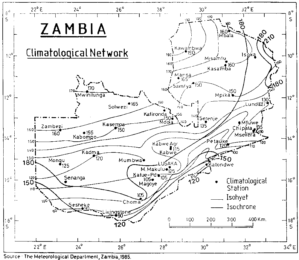
According to the LGP isolines published by FAO (1982), eastern Zambia (the Luangwa Rift Valley and eastern borderlands), and southern Zambia (the Zambezi Valley) have less than 180 days' LGP.
According to an independent country study (Muchinda, 1985), the entire country, with the exception of a small area in the north, falls below the 180-day isoline.
The two versions are reproduced in the accompanying Figure.
Muchinda defined the beginning of the growing period as the first decade during which rainfall (P) is equal to or exceeds half potential evapotranspiration (PET), and the end of the growing season as the last decade so described; and he took account of other calculations which included 10-day periods of soil moisture storage, though the method is not explained.
Differences in method between Muchinda's computations and FAO isolines may account for the divergences shown, but do not reassure the reader who may doubt the reliability of LGP isolines as objective indicators of agroclimatic and ecological conditions. The Zambian example is probably an extreme one, owing to the country's altitude, southerly latitude and generally level topography which offers few barriers to rain formations and rather homogeneous conditions for convectional instability over wide areas.
Mean annual rainfall is 900-1000 mm in the Luangwa Valley but falls below 800 mm in the Zambezi lowlands between Sesheke and Katondwe. Generally, mean annual rainfall is higher than would be expected from Muchinda's calculations of LGPs, going on experience elsewhere in the SAZ. This suggests different properties in Zambian rainfall and supports the proposition that, with the exception of the bottom of the Zambezi trough, the country is not truly semi-arid.
![]()
![]()
![]()