![]()
![]()
![]()
A record of all fishing stations with total catch and main species composition is shown in Appendix II.
A total of 155 hauls were made. Their distribution on areas and the range and mean value of the five highest catches in the bottom trawl were (in tonnes per hour):
|
|
Number of hauls |
Catch 5 highest demersal |
||
|
Area |
Pelagic |
Demersal |
Range |
Mean |
|
Cumene - Porto Alexandre |
19 |
10 |
0.9 - 8.0 |
3.5 |
|
Porto Alexandre - Benguela |
2 |
2 |
0.2 - 1.4 |
0.8 |
|
Benguela - Luanda |
19 |
23 |
1.0 - 1.7 |
1.3 |
|
Luanda - Cabinda |
30 |
50 |
1.2 - 2.0 |
1.6 |
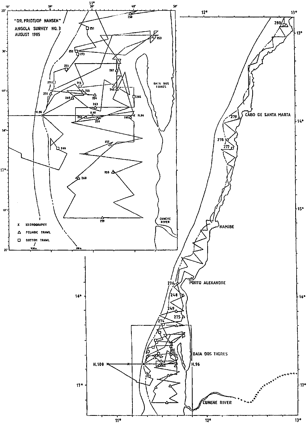
Figure 1. Cruise track, hydrography and fishing stations south of 13°LS.
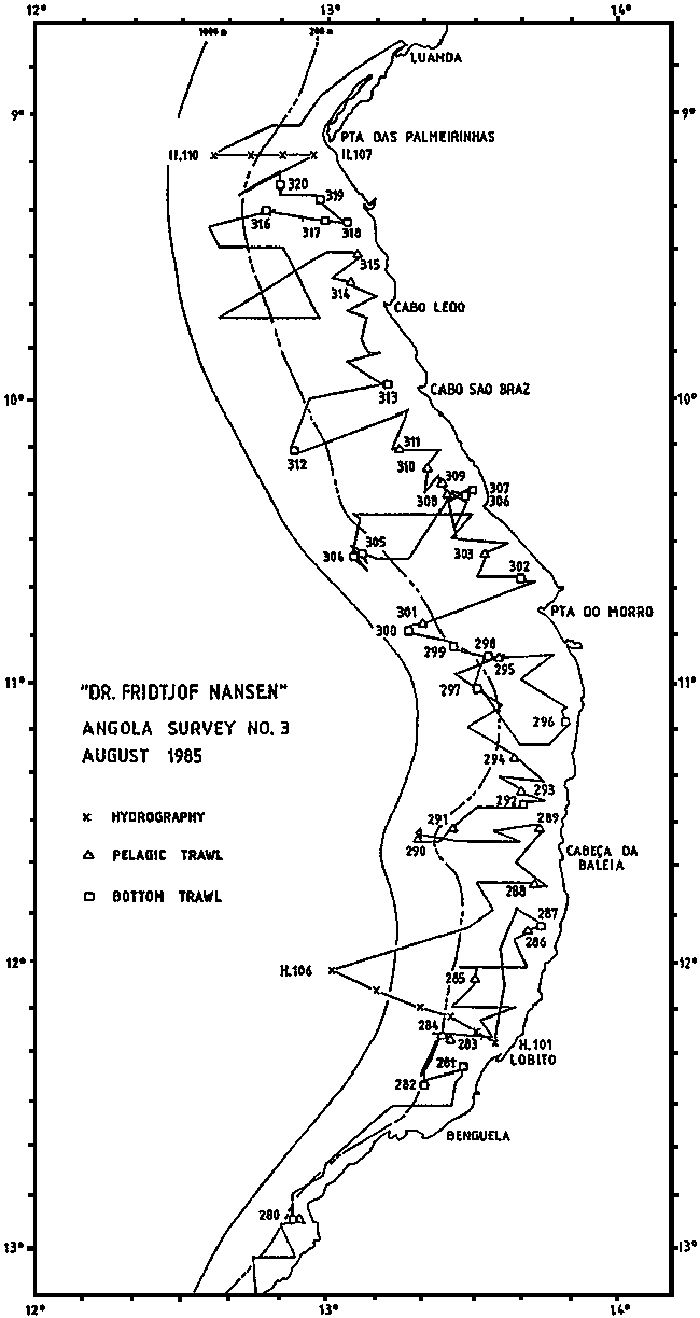
Figure 2. Cruise track, hydrography and fishing stations, Benguela to Luanda.
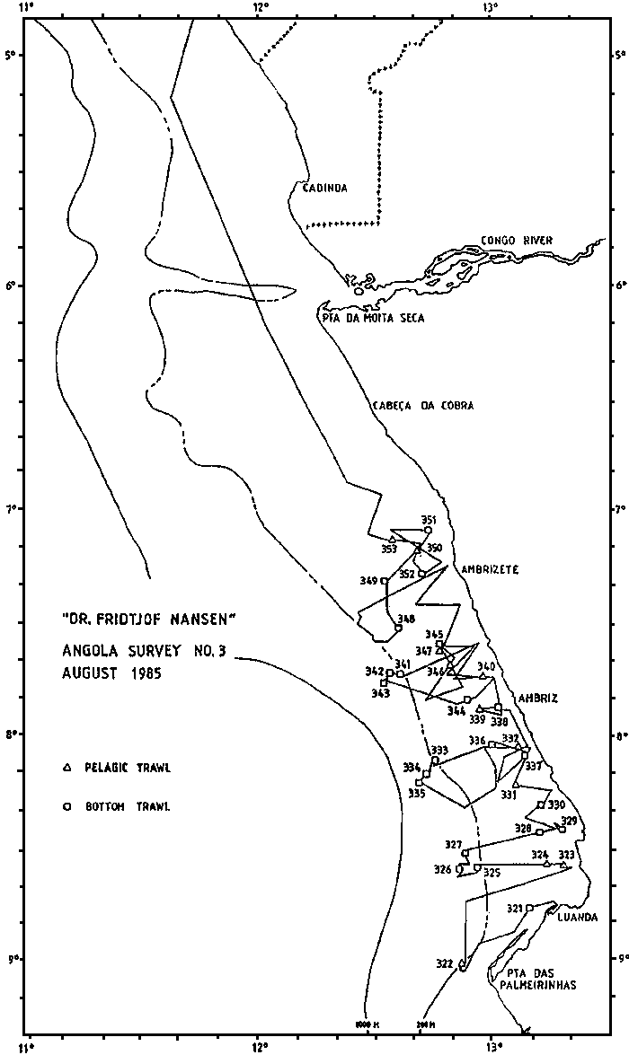
Figure 3. Cruise track and fishing stations, Luanda to Cabinda.
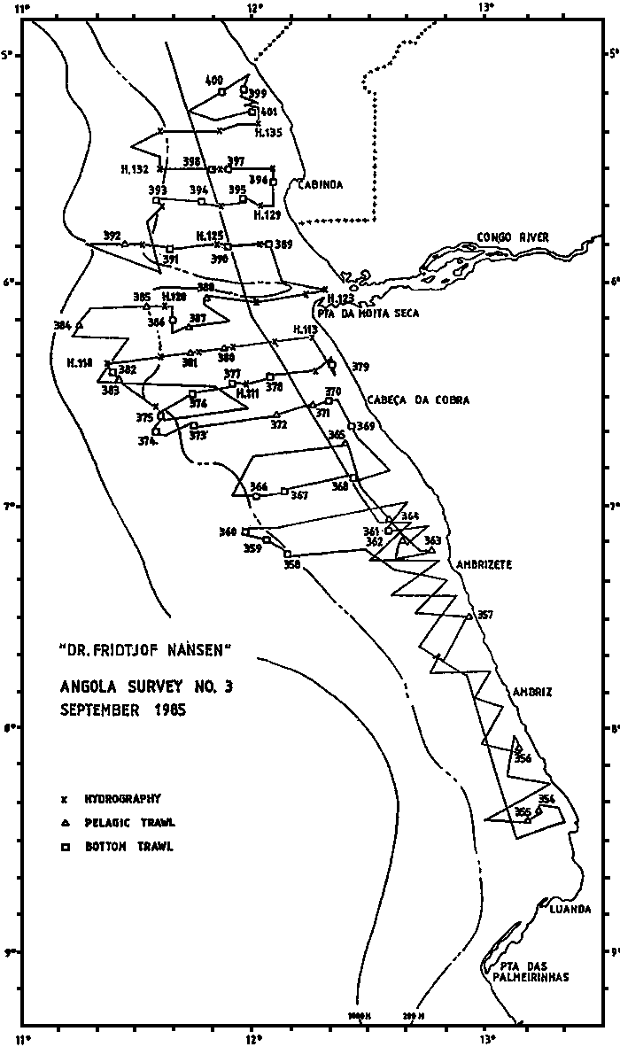
Figure 4. Cruise track, hydrography and fishing stations, Luanda to Cabinda.
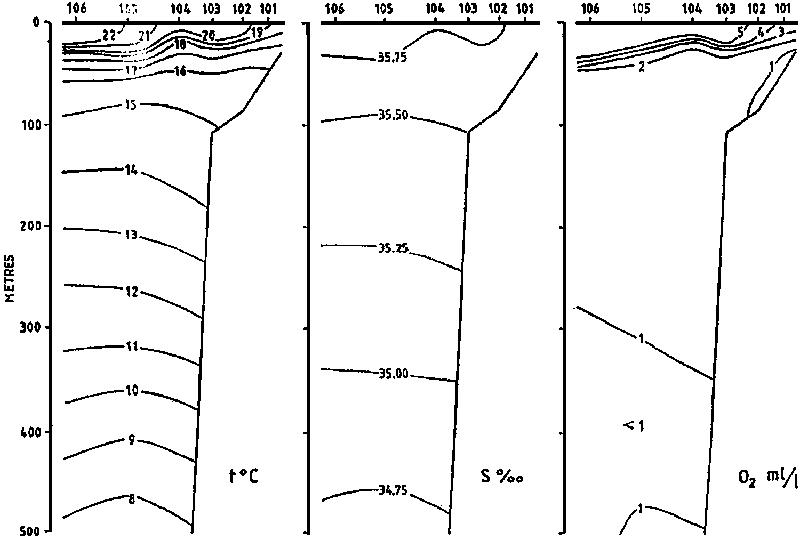
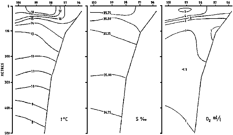
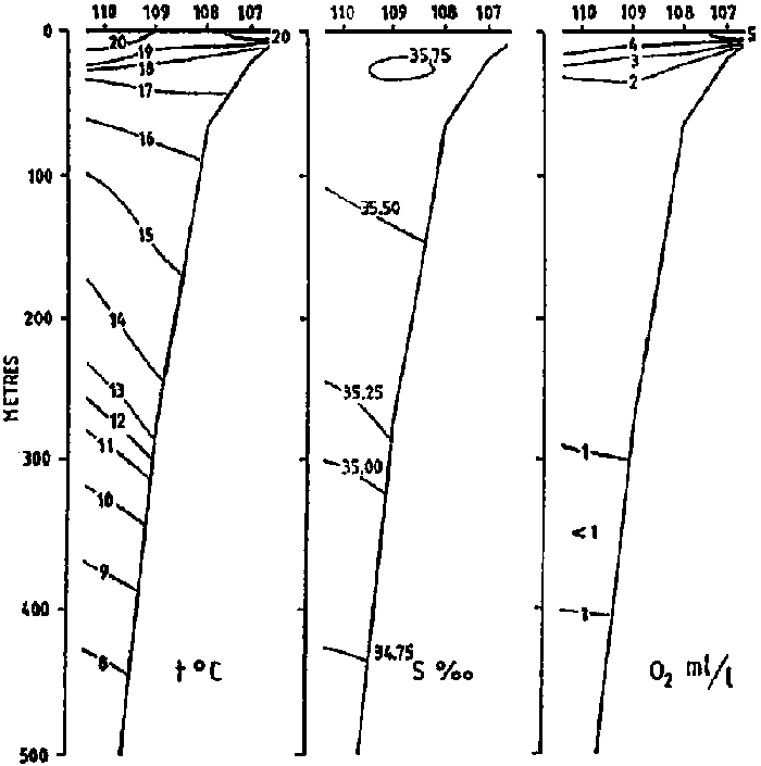
Figure 5. Distribution of temperature, salinity and oxygen in hydrographical sections off Baia dos Tigres and Lobito.
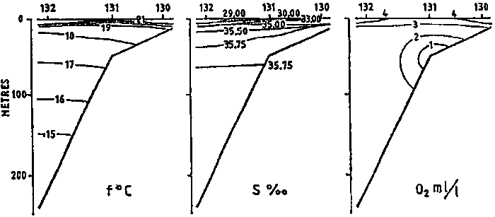
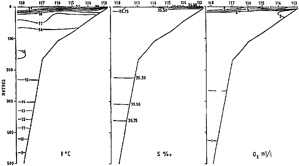
Figure 6. Distribution of temperature, salinity and oxygen in hydrographical sections off Pta das Palmeirinhas, Pta da Moita Seca and Cabinda.
PTA DA MOITA SECA - 5 SEP 1985
PTA DAS PALMEIRINHAS - 23-24 AUG 1985
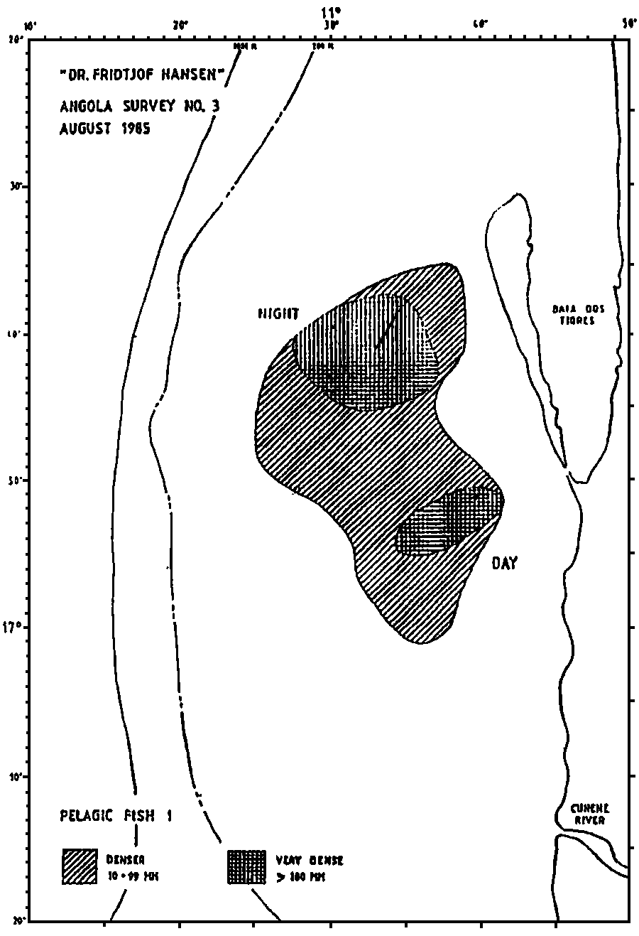
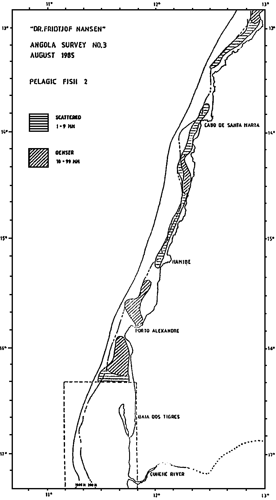
Figure 7. Distribution of three categories of fish in the Baia dos Tigres area.
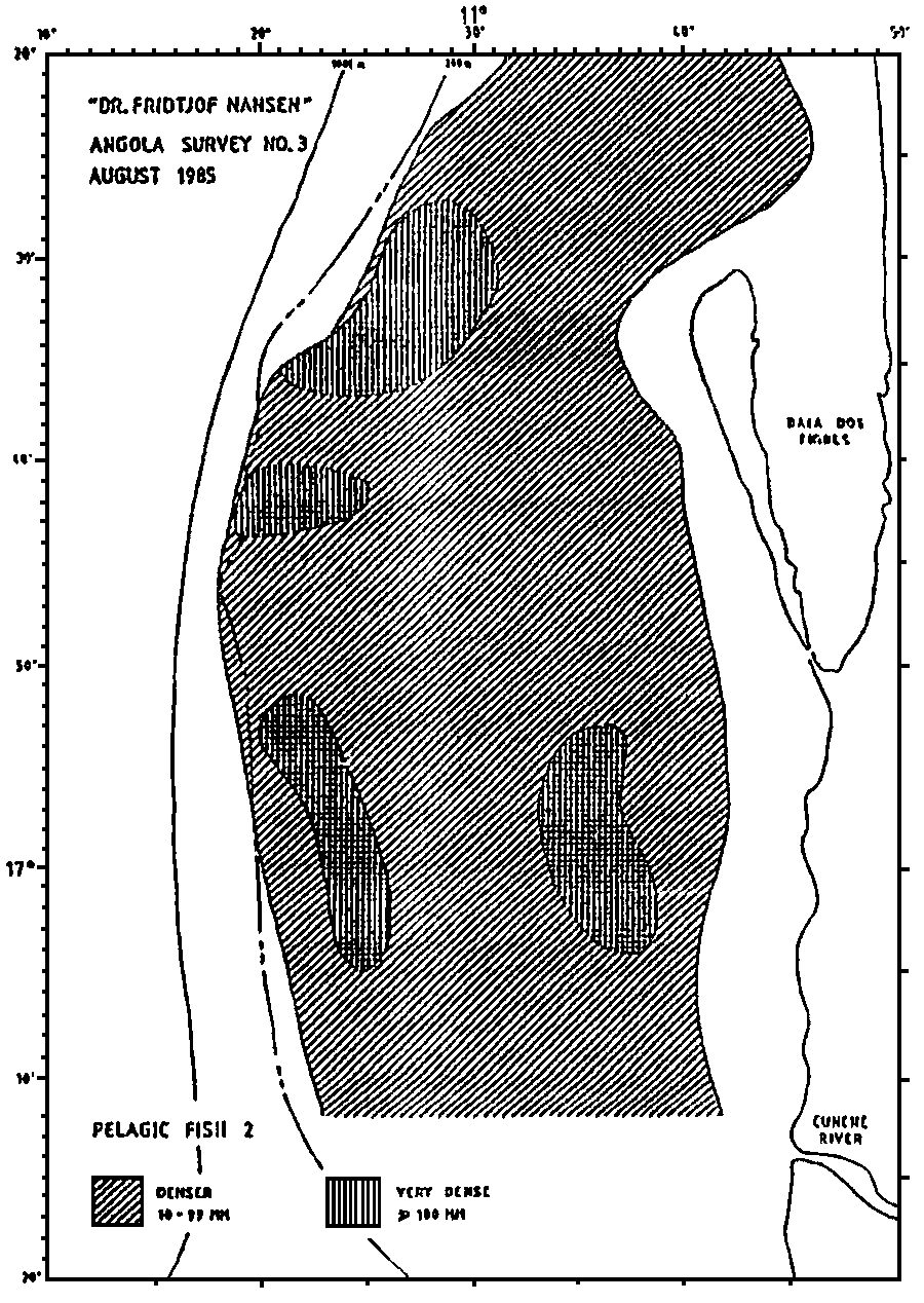
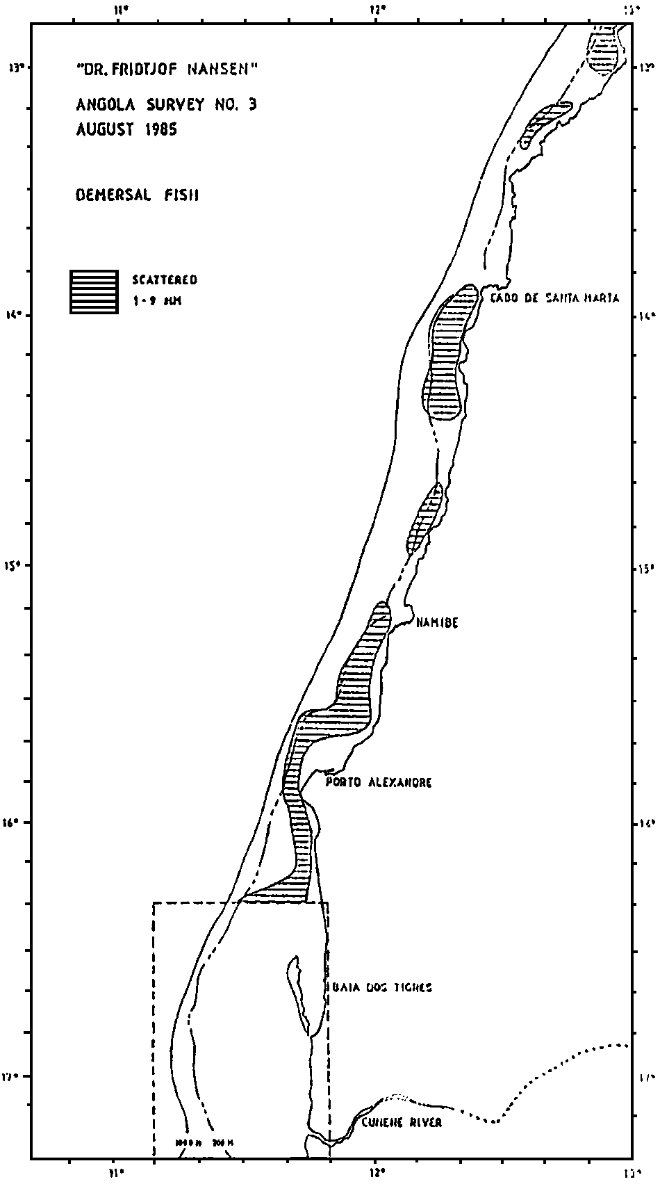
Figure 8. Distribution of two categories of fish in the area between Baia dos Tigres and Benguela.
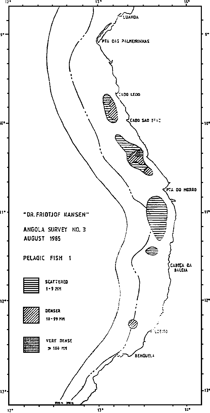
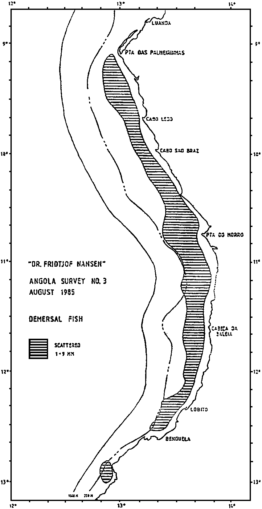
Figure 9. Distribution of three categories of fish in the area between Benguela and Luanda.
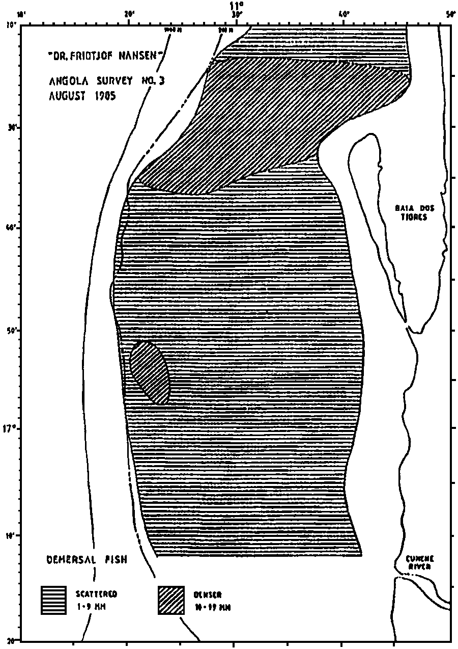
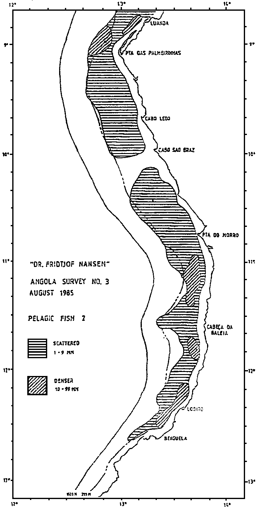
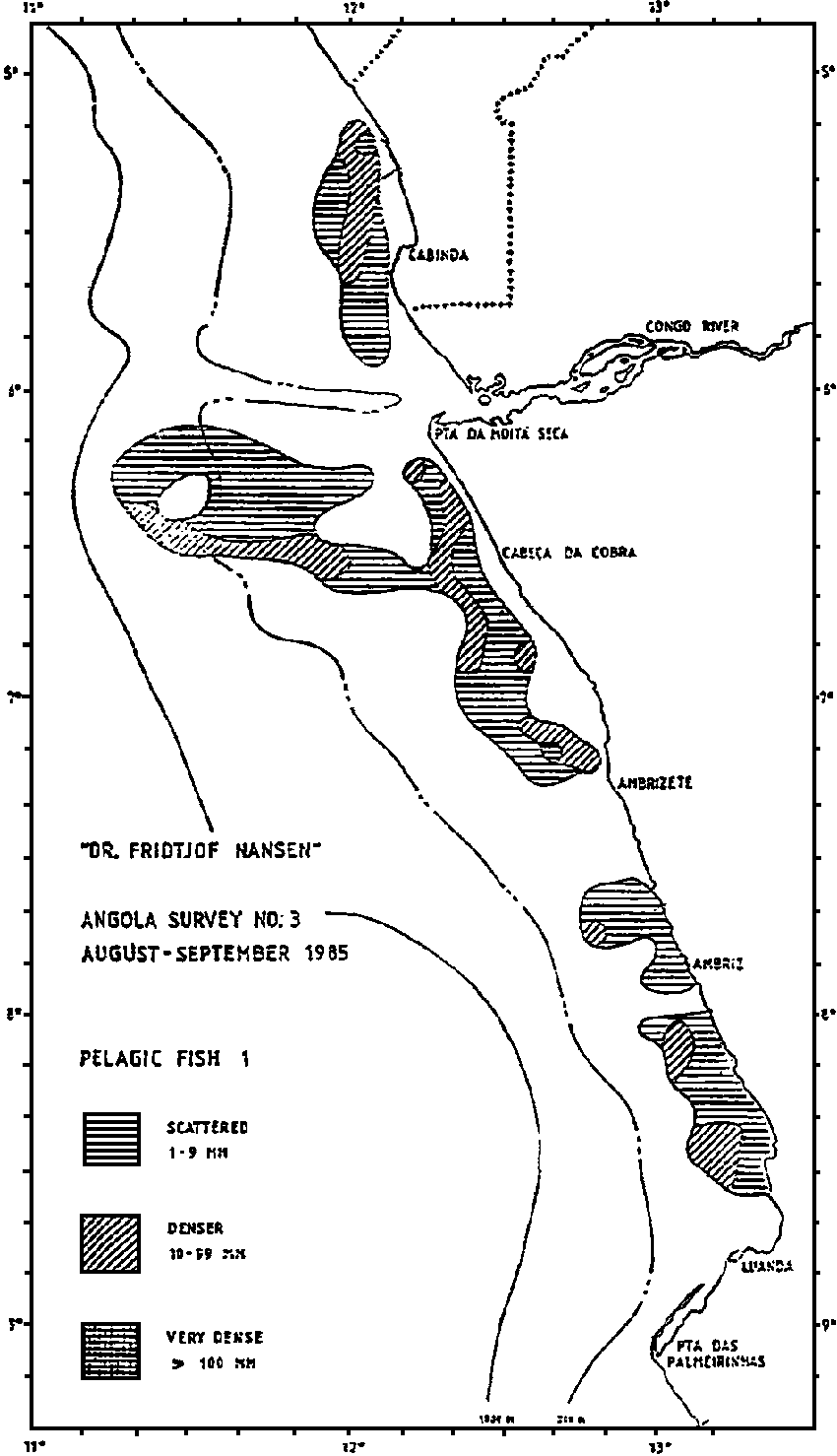
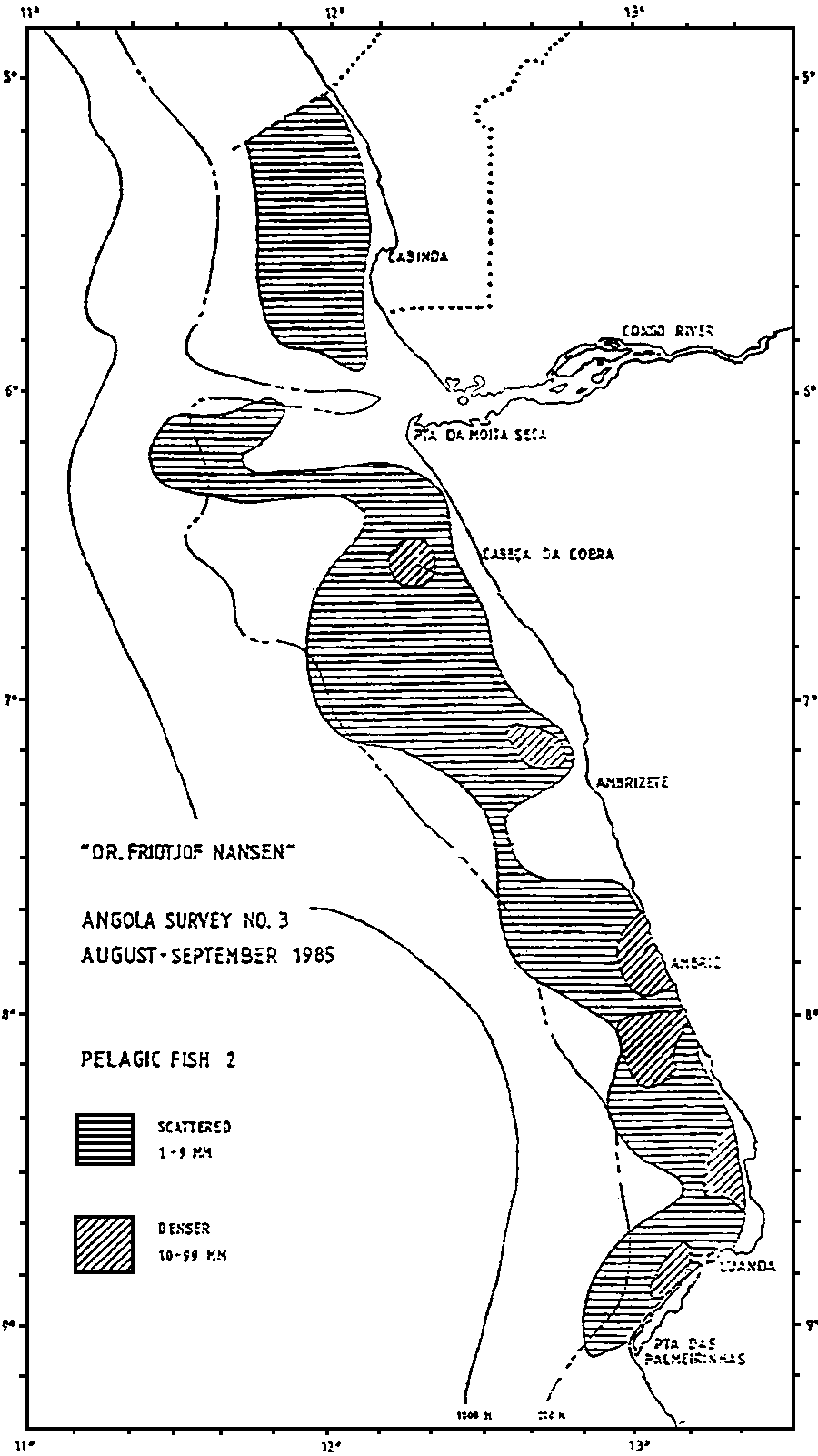
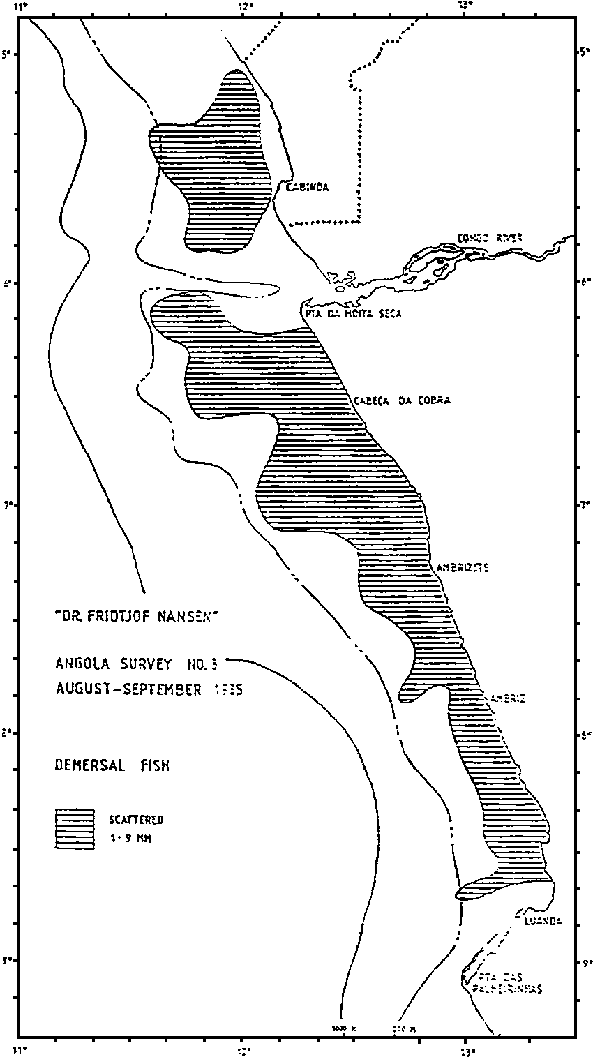
Figure 10. Distribution of three categories of fish in the area between Luanda and Cabinda.
![]()
![]()
![]()