![]()
![]()
The primary objectives of this data summary are to display some features of the distribution of hydrographic and chemical parameters in the Mozambique Channel in a form which, hopefully, will be useful for oceanographers. Additionally, it will serve as a basis for the processing of the more recent data obtained after 1977 from the Mozambican waters.
Table 1 summarizes the oceanographic cruises carried out in the Mozambique Channel. The information on cruises up to 1970 is from the comprehensive work of LUTJEHARMS (1972) and covers all oceanographic work carried out in the area. After 1970 some of the VAUBAN cruises have been deleted from the table as they were carried out in very near shore and shallow areas along the Madagascan coast.
Cruises from which data are included in the present report are marked with an asterisk in Table 1. The criterions for the selection of the data to be included have been:
- The data should not previously been published in a compressed form.The National Oceanographic Data Center (NODC) in Washington, D.C. supplied the data for the following cruises: COMMANDANT ROBERT GIRAUD - 1960 and 1962, ATLANTIS II - 1965, ARIEL - 1968, and the VAUBAN cruises of 1973 and 1975. The data for the ALIDADE - 1952 cruise were obtained from Centre National pour l’Exploitation des Océans (CNEXO) in Brest. The ERNST HAECKEL 1979-1980 data were supplied by the originator and the rest from one of the publications listed under references for each cruise. The results from the three last cruises in Table 1 will be reported separately. The list of references for the cruises up to 1970 is not complete. Additional references can be found in LUTJEHARMS (1972).- The data should contribute in elucidating the general oceanographic circulation or conspicuous oceanographic features in the area.
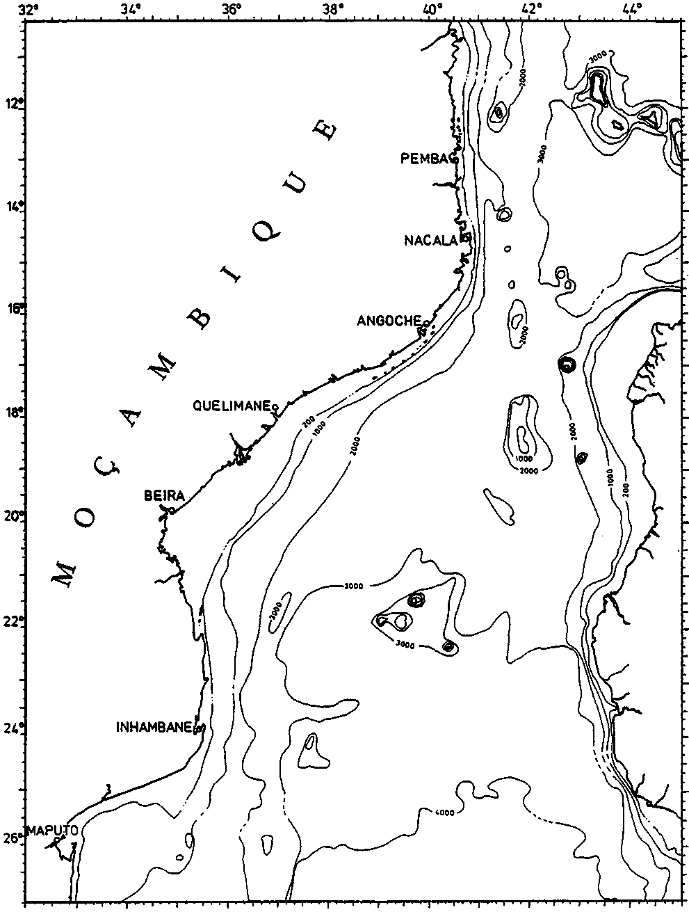
The data are presented in the form of vertical sections and horizontal maps. For the sections deeper than 1200 m there is a change in the vertical scale at 500 m. Table 1 contains all the hydrographic stations within the Mozambique Channel, while the sections contain only those positioned within the frame of the bathymetric map in Fig. 1.
The horizontal maps consist of the following types:
A. Station gridFig. 2 shows a typical and simplified T-S and T-O2 diagram from the central Mozambique Channel where the different core layers are indicated:
B. Surface distribution (T° C and S‰)
C. Core layers.
1. The shallow salinity minimumCore layer maps are included for those cruises which covered more or less the whole Mozambique Channel, of which only the ALMIRANTE LACERDA cruises of 1964 took oxygen measurements.
2. Subsurface oxygen minimum
3. Subsurface salinity maximum
4. Intermediate oxygen maximum
5. Intermediate salinity minimum
6. Intermediate salinity maximum
7. Deep oxygen minimum.
Fig. 1. Bathymetric map of the Mozambique Channel. Depth in meters.
![]()
![]()