Geospatial tools
On 5 March 2018, FRA launched a new online platform for reporting on the status and trends of the world's forest resources. The online platform was developed by FAO with financial support from the European Union and the Government of Finland.
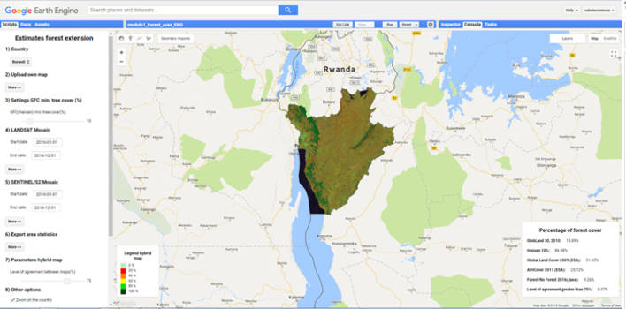
The platform was used for the FRA 2020 report. It contains several new features, including improved data entry, data visualization, review and analysis functions. To further facilitate the reporting process, especially for countries where forest information is limited or not available, the platform provides geospatial modules to access related external information as well as geospatial data from global remote sensing products.
The modules operate in the Google Earth Engine interface and for the first time will provide free access to vast global data repositories and analytical tools using the computing power of Google. The modules make it easy for people without prior remote-sensing experience to access satellite imagery and other geospatial data to monitor national forest cover and land use changes over time. The scope of the new platform is not limited to forest assessments only. It serves other reporting needs as well, including its significant contribution to the implementation of 2030 Agenda and to the forest related indicators of the Sustainable Development Goals (SDG).