Actos
Aquí encontrará información sobre los próximos actos, seminarios, reuniones y conferencias sobre cuestiones geoespaciales organizados por la FAO o en los que la FAO toma parte activa.
From 19 March 2023 to 21 March 2023
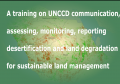
A training on UNCCD communication, assessing, monitoring, reporting desertification and land degradation for sustainable land management will take place in Al Dammam, Saudi Arabia between 19-21 of March 2023. The Geospatial Unit will lead a practical training session on employing Remote...
From 16 March 2023 to 16 March 2023

On March 16th 2023, a training on GIS and Remote Sensing for Early Warning System in Central African Republic was organised in the context of the Central African Republic Emergency Food Crisis Response Project (PRUCAC). The training was dedicated to technical...
From 15 March 2023 to 15 March 2023

On 15th March 2023, an internal consultation was organised to review sampling design, field forms and code lists used in assessing land degradation in support of integrating field and remote sensing.
From 14 March 2023 to 16 March 2023

The Geospatial Unit of the Food and Agriculture Organization of the United Nations (FAO) and the Arab Organization for Agricultural Development (AOAD) are organizing a virtual technical workshop from 14 to 16 March 2023 on the use of SEPAL...
From 14 March 2023 to 16 March 2023

FAO provides techical assistance on land cover, crop and water productivity monitoring in Libya (Projects OSRO/LIB/002/ITA, OSRO/LIB/100/AFB). INtegrating satellite imagery and field data...