Actos
Aquí encontrará información sobre los próximos actos, seminarios, reuniones y conferencias sobre cuestiones geoespaciales organizados por la FAO o en los que la FAO toma parte activa.
From 22 February 2023 to 22 February 2023

To make the benefits of a national LiDAR dataset a reality in Bangladesh, multiple users and donors will need to come forward for financial and technical support. Data and knowledge sharing among national institutions...
From 16 February 2023 to 16 February 2023

A technical meeting has been held on 16 February 2023 in Saudi Arabia. The objective of this meeting is to discuss the need of harmonized land cover representation system...
From 06 February 2023 to 09 February 2023

The FAO Geospatial Unit is providing technical assistance to the project “Gums for Adaptation and Mitigation in Sudan (GAMS): Enhancing adaptive capacity of local communities and restoring carbon sink potential of the Gum Arabic belt, expanding Africa’s Great Green Wall...
From 30 January 2023 to 30 January 2023

Registration link available here
Interested in digital platforms and tools for more effective forest and land monitoring?
Learn how to use SEPAL.
To support knowledge and skills development to operationally apply high-resolution satellite imagery to critical forest and land monitoring in tropical...
From 24 January 2023 to 25 January 2023
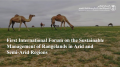
The international forum will be held under the title "Sustainable Management of Rangelands in Arid and Semi-Arid Regions" to introduce the importance of rangelands, their current status, the challenges they face and ways to overcome them. In addition to...