الأخبار
يقدّم هذا القسم مقالات وأخبارا عن الأنشطة التي تجريها المنظمة بالاستعانة بالتكنولوجيا والمنهجيات الجغرافية المكانية.
07 July 2023
The FAO Geospatial Unit is actively providing technical assistance to the "Sustainable Land Management in target landscapes of Central Angola (GCP/ANG/055/GFF)" project. This support aims to facilitate the development of historical land cover maps, conduct land degradation assessments, and promote...
29 June 2023

FAO, in collaboration with the government and with support from different donors initiated the update of the South Sudan land cover database, making use of FAO Geospatial Unit’s technical know-how, more updated geospatial methodologies and using high resolution satellite images....

As the world population is expected to reach 9.7 billion by 2050 (UN DESA Population Division, 2022), the degradation of land and water resources and the potential for sustainable and resilient agriculture is the centre of much attention as global...
On 27 June 2023, the hybrid event "Enhanced global land and water resources assessment for sustainable agriculture in a high-performing on-demand computing environment" was jointly organized by the Food and Agriculture Organization of the United Nations (FAO) and Mississippi State...
09 June 2023

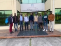
The Ministry of Agriculture and Environmental Protection (MAEP) of Turkmenistan has requested that FAO support the continued development and consolidation of its land administration system.
FAO has been providing support to MAEP and its Land Resources Service (LRS) under the TCP...