News
A new framework designed to monitor and report on the progress of restoration efforts throughout the duration of the UN Decade on Ecosystem Restoration has been launched by the Food and Agriculture Organization of the United Nations (FAO).
The Framework for...
Land cover is critical for various Sustainable Development Goals, for planning and monitoring sustainable land and water management, including for food security and resilient agriculture. With the recent technological progress and access to information, land cover information is becoming increasingly...

A virtual consultation on the update of the methodology for the new Global Agro-Ecological Zoning was organized by the Food and Agriculture Organization of the United Nations (FAO) and the International Institute for Applied Systems Analysis (IIASA), in collaboration with...
04 March 2022

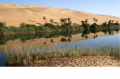
The Guyanese natural resources endowment is threatened by a progressive pattern of land degradation through inappropriate land use and management practices and lack of reclamation efforts that are making land unproductive, affecting biodiversity and ecosystem services, and exacerbating risks of...
On 31st of January and 1st of February 2022, two projects (Evaluation of irrigation, infrastructure crop mapping and estimation of agricultural water use (OSRO/LIB/100/AFB) and Monitoring, evaluation and rationalization of water use for Agriculture Sector (OSRO/LIB/002/ITA)) were launched by...