News

An internal introduction and demonstration of the Land Cover Characterisation Software System (version 2) was given to FAO colleagues by Fatima Mushtaq, Victor Munene and Joe Njeru of the Geospatial Unit. The technical updates, user-friendly enhancements and benefits of the...
14 February 2024

The Geospatial Unit at the Food and Agriculture Organization (FAO) is making significant strides in international collaboration, particularly in the outer space affairs field. Recently, technical officer Matieu Henry represented FAO's Geospatial Unit during a mission contributing to the United...
25 January 2024
In recent years, the importance of accurate and up-to-date land cover information has become increasingly evident, especially in countries like Somalia that are grappling with environmental challenges, resource management, and sustainable development. Recognizing the critical role of geospatial technology in...
24 January 2024

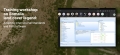
The training workshop conducted in Banjul on January 16 and 17, 2024, was designed as an interactive platform to enhance the capacity of national stakeholders in employing geospatial solutions for agricultural development. It centered around the methodologies and standards promoted by the...
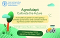
The FAO and Business Finland are organizing a hybrid event at COP28 on December 11, 2023, titled "AgroAdapt: Cultivate the Future." The event, held at the Finland Pavilion, showcases a serious game, AgroAdapt, designed to address climate change challenges in...