Noticias
En esta sección se presentan artículos y noticias sobre las actividades que lleva a cabo la FAO con apoyo de tecnología y métodos geoespaciales.

A virtual consultation was organized by the Food and Agriculture Organization of the United Nations (FAO) and the International Institute for Applied Systems Analysis (IIASA), in collaboration with the Environmental System Research Institute (ESRI) and the Asian Institute of Technology...
03 December 2021

Land Degradation Neutrality (LDN) is “a state whereby the amount and quality of land resources, necessary to support ecosystem functions and services and enhance food security, remains stable or increases within specified temporal and spatial scales and ecosystems”. Restoring degraded...
21 October 2021

Land cover is one of the 14th essential geospatial data layers recognized by the United Nations Committee of Experts on Global Geospatial Information Management (UN-GGIM). It is essential for achieving most of the Sustainable Development Goals. Despite this recognized need,...
18 October 2021
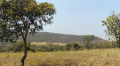
Due to high population growth, unsustainable natural resources management, landscapes in Central Angola are degraded. The Centre of Tropical Ecology and Climate Change (CETAC), under the Ministry of Culture, Tourism and Environment (MCTA), and other relevant departments, receive technical and...
15 October 2021

Productive land is a foundation to global food security and environmental health, zero hunger, poverty eradication, and energy for all yet this natural resource is under pragmatic threat. Human activities and climate change directly pose negative effects on the environment....