
Key achievements
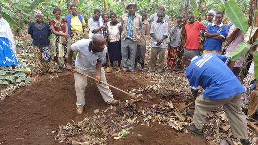
Capacity building on FFS facilitation by training watershed based Facilitators. The participatory watershed management workshop was held from December 4th – 9th 2013 at Hotel Kash, Mbarara and was organized for 39 participants including the selected community leaders and active members of FFS members from the 6 districts of Kagera TAMP in Uganda namely, Kabale, Ntungamo, Isingiro, Mbarara, Kiruhura and Rakai. The workshop objectives were:
- To understand the community context and process of participatory watershed management
- To demonstrate the Farmer Field School methodology in participatory watershed management
- To review the process of activity planning and record keeping in watershed management
Districts
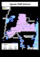
Kagera basin includes parts of the districts of Kabale, Ntungamo, Mbarara. Rakai. Isingiro and Kiruhura. The last two were not preciously included in the PDFB. There are 12 watersheds and 12 service providers who have managed to establish over 1 600 000 trees.
District | Catchment | Service Provider | Number of FFS | Number of trees planted |
|---|---|---|---|---|
Isingiro | Rurongo | Rurongo | 3 | 14600 |
Kikagati | Nyakayojo Tweyombekye | 4 | 360000 | |
Kabale | Rwamate | Mukirwa Community Agroforesty | 3 | 60000 |
Kanayankwanzi | Bukora Environment Group | 3 | 100000 | |
Kiruhura | Sanga | Sanga Bee keepers | 2 | 14000 |
Nyakigando | Nyakigando Farmer s Group | 2 | 730000 | |
Mbarara | Kabingo | Kabingo Environmental Conservation Group | 3 | 500 |
Kabaya | Rubagano Tutungukye Group | 4 | 30600 | |
Ntungamo | Rwerazi | Rwerazi Tweyambe Group | 3 | 11500 |
Nshenyi | Nshenyi Barisa Bahingye | 3 | 50500 | |
Rakai | Katongero | Kakuto community development project | 6 | 114500 |
Kakuto | 5 | 120000 |
SLM specific activities
In Uganda the Fanya Juu and fanya chini trenches were dug to overcome the problem of soil erosion in banana plantations mainly in Mbarara, Ntungamo, Isingiro and Rakai districts. Over 120m of Fanya Chini and cut off drains were dug to check the heavy runoffs. In Kiruhura the continuous runoff had along steep slopes had resulted into deep gullies. However, farmers had made use of these gullies by planting sugarcane that slowly minimizes the speed of runoof.
Napier grass was planted during December rains. In Kabale district napier grass is planted along contours. Over 1200 metres of Napier have been planted along contour lines to stop runoff. Napier has become a popular among farmers with soil fertility problem because it is a precondition to getting goats to generate manure that is applied on degraded soil for fertility improvement.
Activity | Kabale | Mbarara | Ntungamo | Isingiro | Kiruhura | Rakai |
|---|---|---|---|---|---|---|
Fanya juu/chini | 1300 | 1700 | 700 | 500 | 1400 | 1450 |
Stone lines | 0 | 0 | 0 | 0 | 0 | 200 |
Napier grass | 1200 | 750 | 0 | 0 | 0 | 0 |
Nursery beds | 1000 | 15000 | 5000 | 5000 | 4000 | 1200 |
Stoves | 70 | 0 | 0 | 0 | 0 | 120 |
Tree seedlings are planted on highly degraded steep slopes as well as croplands. The trees which are planted steep slopes include Pinus patula, Pinus caribea and Pinus oocarpa. The trees on steep slopes are mainly for both fuelwood and pole production and also protecting the landscape. The formerly bare hills are now covered with vegetation. Raising tree seedlings was also a big activity for most watersheds.
There is a huge demand for tree seedlings in Kiruhura due to previous dependence on the national park. In Mbarara, over 230,000 pine trees and coffee seedlings were planted to improve the vegetation cover and provide poles and fuelwood. Furthermore, farmer field schools conducted meetings where trainings were made for making fuel saving cooking stove in Mbarara, Kabale and Kiruhura districts