Connecting the dots in forest monitoring in Paraguay
Equipped with FAO remote sensing tools, local experts are studying deforestation dynamics
The Global Remote Sensing Survey of the Food and Agriculture Organization of the United Nations (FAO) worked with local forest conservation experts to interpret satellite imagery and understand changes in forests and forest use in Paraguay. ©FAO/Katherin Patricia Insfrán Chena.
29/05/2023
The fight against deforestation in Paraguay is getting a boost from an unlikely source: cutting-edge technology and data from space, coupled with the expertise of local forest conservationists.
In 2019, the Food and Agriculture Organization of the United Nations (FAO) organized a one-week training in Paraguay’s capital, Asunción, for twenty international and local experts, like Katherin Patricia Insfrán Chena.
The workshop was part of the Global Remote Sensing Survey, a ground-breaking study developed by FAO in collaboration with the Joint Research Centre of the European Commission and funded by the European Union and Norway's International Climate and Forest Initiative. The Global Survey’s aim was to improve the understanding of forest area trends and drivers of deforestation by combining local expertise with the latest satellite data.
Part of the work of the survey entailed leveraging cutting-edge tools like Collect Earth Online, an open-source software for viewing and interpreting high-resolution satellite imagery developed by FAO together with Google, National Aeronautics and Space Administration (NASA), the Spatial Informatics Group of the University of San Francisco, SilvaCarbon and the United States Forest Service. With this and other tools, FAO and more than 800 local experts from 126 countries and territories analysed 400 000 global satellite data samples.
Despite major advances in satellite images and their analytics, field knowledge of local land uses remains essential to correctly identify changes using remote sensing products. This is where Patricia’s deep understanding of her country’s landscapes really shines.


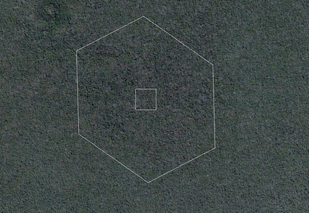
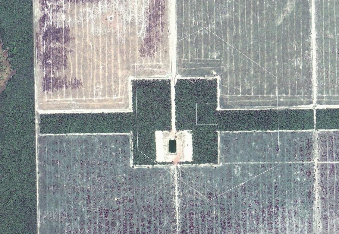
Remote sensing images show the changes in forest and land use between 2002 and 2008 in one part of El Chaco, Paraguay. ©2023 Maxar Technologie, Google Earth
As a participant in the Global Survey, Patricia who was working for the National Forestry Institute’s Remote Sensing Team at the time, helped interpret survey samples for Paraguay, a country grappling with a history of deforestation and land use change for activities related to livestock and agriculture.
To gain a better understanding of these changes, Patricia and the other participants visited specific plots in El Chaco, a region comprised of dry forests, savannahs, shrublands, grasslands and wetlands, accounting for approximately 60 percent of Paraguay’s surface. The region is also considered a hub of economic development driven mainly by raising livestock for meat production.
During their visit, Patricia and her team uncovered the impact of cattle ranching on forests and grasslands. Vegetation peculiarities and tree density, which impact the reflectance captured in satellite images, make it difficult to correctly interpret satellite data and identify changes in land use. However, Patricia and five other experts from Paraguay used the tools and methodologies delivered by FAO in the workshop to overcome these technical problems.
“We learned how to use time series and spatial patterns to analyse land uses when it is difficult to see from the satellite image,” said Patricia.
Science-based decisions
The Global Remote Sensing Survey was conducted in the context of FAO's broader Global Forest Resources Assessment (FRA) carried out in 2020. This new Global Remote Sensing Survey showed that agricultural expansion, including cropland and livestock grazing, is direct driver of almost 90 percent of deforestation worldwide, underscoring the need for science and networks of experts to inform and shape future changes in forest conservation and land use. It also highlighted that further attention should be placed on supporting sustainable agricultural practices to avoid deforestation.

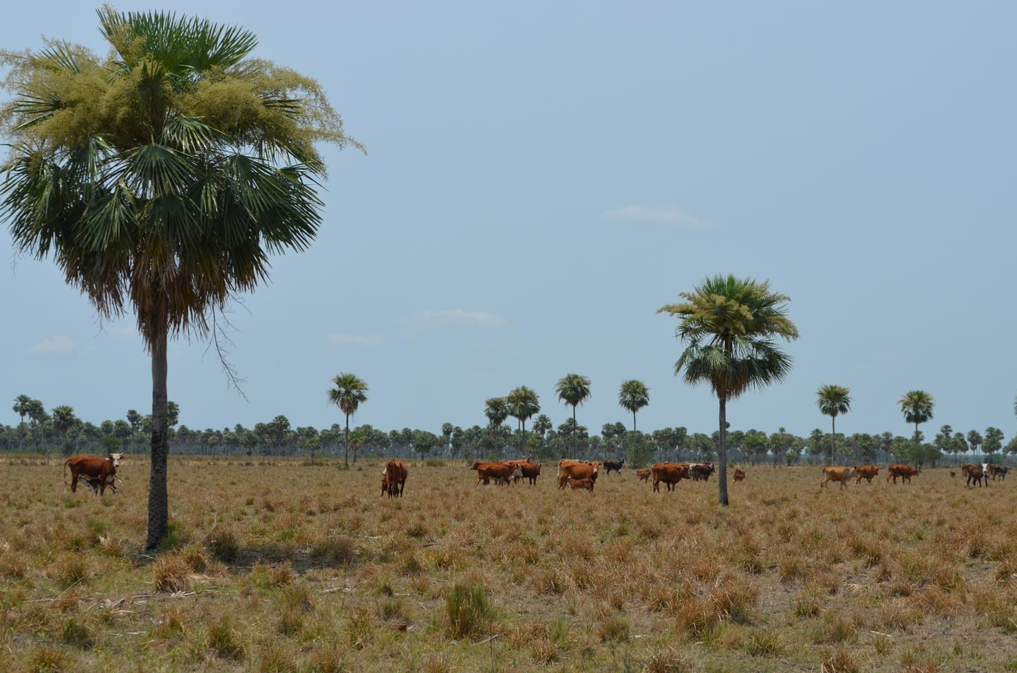
According to the Global Remote Sensing Survey, almost three quarters of deforestation that occurred in South America from 2000 to 2018 was due to livestock grazing. ©FAO/Adolfo Kindgard
The survey not only revealed new numbers on causes of land use changes and deforestation but also built the capacity of national experts to visually analyze remote sensing imagery to monitor forest and land use changes.
Through international and regional collaboration, new knowledge and experience sharing is providing countries the crucial ability to monitor how a situation is evolving, which can improve long-term national forest monitoring and sustainable forest management. Engaging local specialists and acknowledging this expertise as crucial, the survey has been a real paradigm shift in forest monitoring.
The FRA 2020 Country Report highlights Paraguay's increasing rate of net forest loss between 1990 and 2020, with 347 thousand hectares of forest lost every year from 2010-2020, making it the sixth country for forest area loss in that decade.
Forests provide crucial ecosystem services, such as biodiversity conservation, carbon sequestration, soil and water protection, along with rural livelihoods opportunities from wood, forestry products and ecotourism.
As such, forest monitoring is critical to understanding deforestation and its underlying reasons. Unsustainable forest use is often linked to poverty and unsustainable agriculture. Indeed, in Paraguay, forest loss and land use change are associated also with subsistence activities (including wood extraction and charcoal production) and illicit crop production.
While new technologies and methodologies fill gaps in monitoring the environmental impact of these activities, strategies to compensate populations in need are essential to reduce the pressure on forests. Acknowledging this, FAO helps governments address these realities to support the needs of local communities while also protecting its national forests.
Learn more
- Publication: FRA 2020 Remote Sensing Survey Report
- Interactive story: EXPLORING OUR FORESTS. See the world’s forests in a new light
- Infographics: FAO Remote Sensing Survey reveals
- Press release: Global deforestation slowing but tropical rainforests remain under threat, key FAO report shows
- Digital Report: Global Forest Resources Assessment 2020
- Website: FAO and EU Partnership

