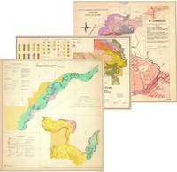
FAO soil and land legacy maps

FAO Land and Water Division (NRL) has made an effort to make Soil Legacy data and information available for their users. In that regard, FAO has just finished uploading 1228 soil and land legacy maps (mainly soil maps and also land use, geological and land cover legacy maps). FAO will continue working in this activity and will include Soil Profile Legacy data soon.
The maps are available for the following countries: Afghanistan, Algeria, Angola, Argentina, Bangladesh, Benin, Bolivia, Burundi, Botswana, Brazil, British Guiana, Burkina Faso, Cambodia, Cameroon, Central Africa Republic, Chad, Chile, China, Colombia, Comoros, Congo, Ivory Coast, Costa Rica, Cuba, Dominican Republic, Ecuador, Egypt, El Salvador, Ethiopia, French Guiana, Gabon, Gambia, Guatemala, Honduras, India, Indonesia, Iran, Israel, Jamaica, Japan, Korea, Lebanon, Malaysia, Mauritius, Mexico, Mozambique, Namibia, Nicaragua, Niger, Nigeria, Pakistan, Panama, Papa New Guinea, Paraguay, Peru, Philippines, Rwanda, Senegal, Sierra Leone, South Africa, Sri Lanka, Sudan, Swaziland, Syria, Taiwan, Tanzania, Thailand, Togo, Tunisia, Uganda, Uruguay, Venezuela, Vietnam, Zambia, Zimbabwe.
IMPORTANT : These maps were scanned as .jpg and then uploaded with standard metadata (they are not geo-referenced as this was not our aim). Once you have selected the map of interest, you need to click on the ![]() button to download the map (ca. 50/100 mbytes). Please send us an email in case of problems.
button to download the map (ca. 50/100 mbytes). Please send us an email in case of problems.
Search our soil legacy maps |
|
| Free text search | |
