Desert Locust Information Service (Rome)
The Desert Locust Information Service (DLIS) is the focal point for all locust and locust-related information that is necessary to operate an early warning system for Desert Locust plagues. DLIS produces monthly situation summaries and forecasts for each country, and sends warnings and alerts about potential invasions or other significant developments.
DLIS uses a custom GIS called SWARMS (Schistocerca Warning and Management System) to manage the large volume of daily data and facilitate analysis and forecasting. SWARMS contains historical data from 1930 to the present and allows for the display of remote sensing imagery and the use of various models to estimate egg and hopper development rates, adult migration trajectories and seasonal forecasts of rainfall and temperature.

DLIS houses an extensive collection of maps of varying types and scales that covers some 50 countries or about 32 million sq. km (equivalent to 20% of the Earth's land surface). The maps are used to check location data received from the field.

A Locust Information Assistant is responsible for managing all of the data that arrives in DLIS each day. During emergencies, the volume of this data increases dramatically so it is important to have well established procedures and systems that can effectively and reliably store, query and display the data.


The Senior Locust Forecasting Officer in DLIS, Keith Cressman, has been analyzing locust, weather and ecological data from affected countries as well as satellite imagery for assessing the locust situation and forecasting the scale, time and location of breeding and migration for more than 30 years. The quality of the analysis and precision of the forecasts not only depend on the data but also on the experience and intuition.

Analyzing the locust situation in DLIS
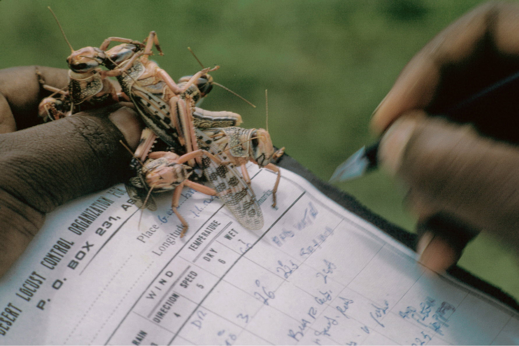
Survey and control results, observations on environmental conditions and rainfall information are analyzed in conjunction with remote sensing imagery, weather data, and historical reports using the SWARMS GIS. The forecaster looks for changes in locust numbers, behaviour, maturity and their spatial distribution in relation to changes in environmental conditions. This information is compared to past events that may be analogous and takes into consideration rainfall and seasonal forecasts.

DLIS prepares and distributes a number of products that summarizes and forecasts the locust situation. Every month, DLIS produces a monthly bulletin and six-week forecast. During periods of increased locust activity, these are supplemented by updates and alerts. Specific warnings of significant rainfall, locust developments or invasion threat are sent directly by email to the relevant country with suggested action to take, when and where. All bulletins, updates and alerts are in English, French and Arabic. They are archived in the Archives section of Locust Watch where they can be downloaded.

Data archival in DLIS

The reference library in DLIS

- Global monitoring of weather, ecology and locust conditions 24 hors/day, 7 days/week
- Updated assessment of current locust situation and forecast
- Monthly FAO Desert Locust Bulletin with six-week forecast
- Deser Locust warnings and alerts to affected countries and donors
- Updated information via Locust Watch website, Facebook and Twitter
- Development of new technologies and tools for affected countries
- Provision of practical training to end/users
- Publish Desert Locust guidelines and other technical material
- Technical support to countries for new technologies
- Technical field backstopping visits to locust-affected countries
- Maintain global reports and data repository and Desert Locust reference library
See also
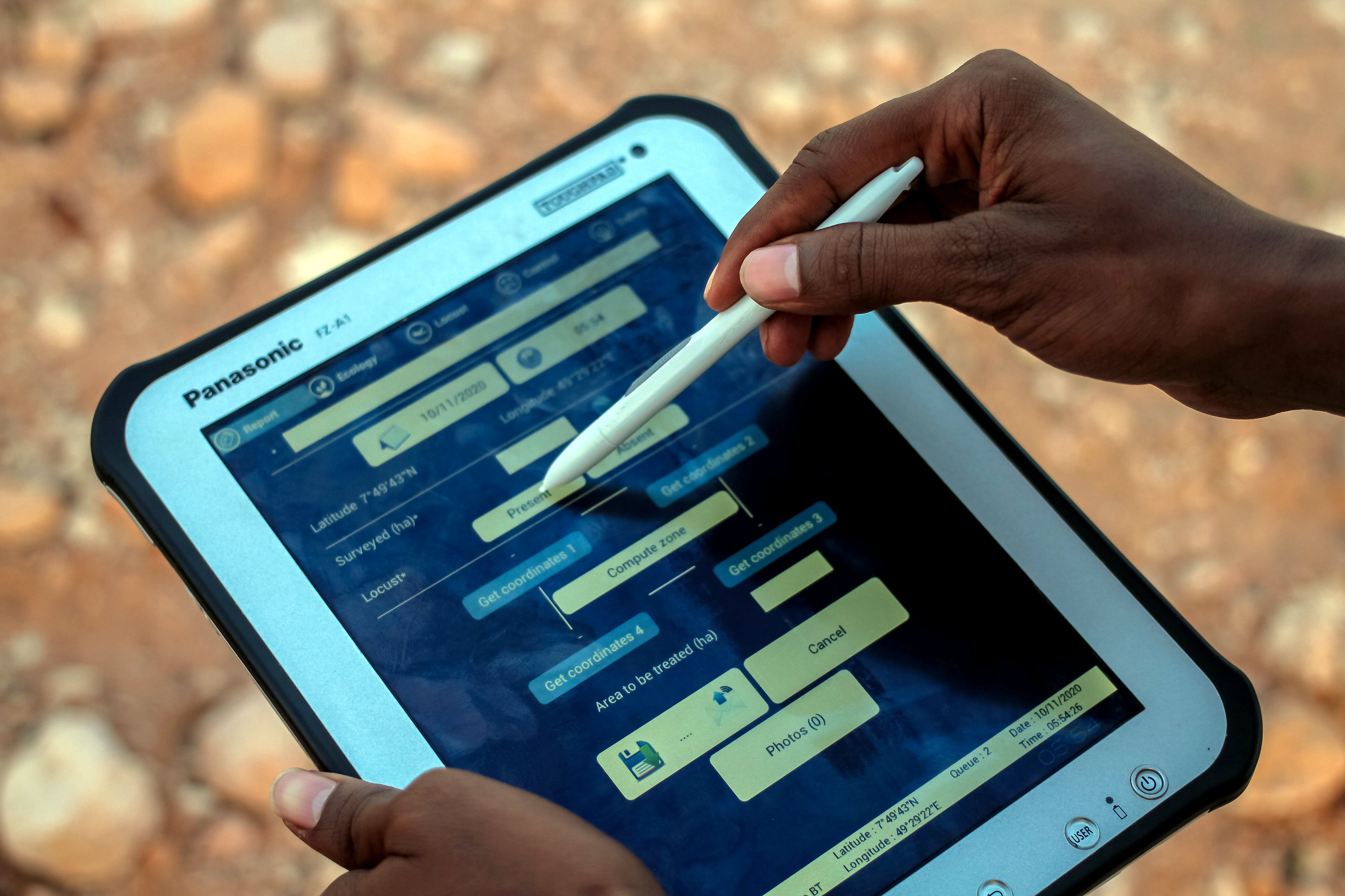
eLocust3: saisie et transmission de données de terrain actualisées
(en anglais)
eLocust3 est un appareil mobile que les agents de terrain nationaux peuvent employer pendant les opérations de prospection et de lutte antiacridienne dans les pays touchés par le criquet pèlerin.
Google Earth Engine
(en anglais)
Technologies novatrices et nouveaux outils gratuits de Google: la Division des forêts de la FAO utilise déjà Google Earth Pro, My Maps, Fusion Tables et Google Earth Engine, et leur utilisation est en train d’être étendue à la lutte contre le criquet pèlerin.
MODIS
(en anglais)
Carte dynamique qui met en évidence la végétation dans les déserts et la durée depuis laquelle cette couverture végétale est présente pour améliorer le suivi de l’habitat des criquets pèlerins.
Alerte rapide
(en anglais)
Composantes fondamentales requises pour garantir l’efficacité et la
fiabilité des systèmes d’alerte rapide.
eLocust2: saisie et transmission de données de terrain
(en anglais)
Appareil mobile qui permet aux spécialistes antiacridiens de consigner les résultats des opérations de prospection et de lutte sur le terrain et de les transmettre par satellite à leur centre national antiacridien.