ANNEX A: SITE DESCRIPTION
The site description data is collected at the beginning of the trial
establishment and should include the following:
LOCATION
Name of the site : _______________________________________
Country : _______________________________________
Province : _______________________________________
District : _______________________________________
Latitude (degrees and minutes) : _______________________________________
Longitude (degrees and minutes) : _______________________________________
Altitude (m above sea level) : _______________________________________
Managing office/institution : _______________________________________
Owner : _______________________________________
Distance to nearest office responsible for management (km) : ____________________
Distance to nearest villages/towns (km) : ____________________
Number of inhabitants in the nearest villages/towns : ____________________
Type of area (e.g. research station, managed forest, etc.) : _______________________________________
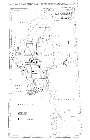
Add map(s) (see section 3,2. above).
CLIMATE
Nearest weather station:
Name of the station : _______________________________________
Latitude (degrees and minutes) : ____________________
Longitude (degrees and minutes) : ____________________
Altitude (m a.s.l.) : ____________________
| Climatic data1 |
Jan. |
Feb. |
Mar. |
Apr. |
May |
June |
July |
Aug. |
Sept. |
Oct. |
Nov. |
Dec. |
Year |
| Rainfall (mm) |
|
|
|
|
|
|
|
|
|
|
|
|
|
| Temp mean (ºC) |
|
|
|
|
|
|
|
|
|
|
|
|
|
| Temp. mean max.2 (ºC) |
|
|
|
|
|
|
|
|
|
|
|
|
|
| Temp. mean min.3 (ºC) |
|
|
|
|
|
|
|
|
|
|
|
|
|
| Evapotranspiration 4 (mm) |
|
|
|
|
|
|
|
|
|
|
|
|
|
1Period of observations : __________________________
(specify years)
2Average of daily maximum temperatures
3Average of daily minimum temperatures
4Potential evapotranspiration (ETP) - Penman's formula
Rainy season:
Number/type of seasons:
one
______________
two
______________
even
______________
irregulars
______________
Period(s) : ___________________________________
(specify months)
No. of intermediate days proximate to growing season : ____________________
No. of wet days in growing season : ____________________
Dry
months (number month per year of < 50 mm rain): : ___________________________________
Frost (number of days/year) : ____________________
Prevailing wind (direction, period, speed) : ____________________
TOPOGRAPHY
__ Flat/gentle (0-8
%)
__ Intermediate (9-30
%)
__ Steep(>30 %)
SOIL
Please tick the following soil description
|
Soil texture |
Soil depth |
Soil drainage/ Waterlogging |
Gravel content, topsoil |
| 1. Light/sandy |
|
1. Shallow (< 50 cm) |
|
1. Well drained |
|
1. None (< 15 %) |
|
| 2. Medium/Loamy |
|
2. Deep (50-100 cm) |
|
2. Seasonal |
|
2. Gravelly (15-35 %) |
|
| 3. Heavy/clayey |
|
3. Very deep (> 100 cni) |
|
3. Permanent |
|
3. Stony (> 35 %) |
|
| Organic matter content |
Reaction (pH) |
Soil salinity |
Ground water |
| 1. Poor (< 2 % DM) |
|
1. Acid (pH < 6.5) |
|
1. None |
|
1 1 - Shallow (< 50 cm) |
|
| 2. Medium (2-5 % DM) |
|
2. Neutral (6.5-7.5) |
|
2. Moderate |
|
12. Deep (50 - 150 cm) |
|
| 3. Rich (> 5 %) |
|
3. Alkaline (pH> 7.5) |
|
3. High |
|
13. Very deep(>150 cm) |
|
VEGETATION
Natural (original) vegetation type : _______________________________________
: ______________________________________________________________
Dominant natural (original) genera/species : _______________________________________
Land use history : _______________________________________
: ______________________________________________________________
: ______________________________________________________________
ADDITIONAL INFORMATION
Apparent major problems of site (pests, diseases, etc.) : __________________________
: ______________________________________________________________
Economics data, viz farm gate prices for fodder, fuel wood, small size
timber, extractives, and other minor produce
: ______________________________________________________________
: ______________________________________________________________
: ______________________________________________________________
ANNEX B: EXAMPLE OF A SKETCH MAP