Contents
-  Previous - Next
Mass movement control
Mass
movement control tends to be both expensive and far from simple.
Unlike sheet or linear erosion control, mass movement control
often means preventing rainwater from soaking into the soil,
adding to the weight of the soil cover and rapidly reaching the
slide bed-plane. The surface is therefore drained to evacuate
runoff to less vulnerable zones, generally the convex sections of
a slope. The zone over the slide bed-plane can be drained in
depth to prevent interstitial pressure from detaching the soil
cover from the stable zone beneath the slide bed-plane.
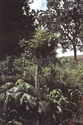
Another
method is that of drying the land by increasing plant
evapotranspiration, for example by planting eucalyptus or
other plants with a high evapotranspiration capacity. However, it
is important to prevent such vegetation from becoming
overwhelming, so shrubs must be kept on the edges of fields. If
trees are introduced they must be coppiced, i.e., the vegetation
must be kept young as it will then evapotranspire and produce
maximum biomass. Very tall trees should not be kept on slopes
where risks of sliding are high. When the slide bed-plane is
close to the soil surface, tree roots can oppose strong
mechanical resistance to shearing of the soil cover, whereas when
the potential slide surface is too deep for the roots to reach,
such resistance is no longer operative: overloading slopes with
trees may even add to slide risks. Moreover, trees can shake in
the wind, transmit vibrations to the soil and produce cracks that
favour localized infiltration of runoff water down to the slide
bed-plane. Quick-growing species with tap-root systems are
preferable, and clear felling is to be avoided, for it destroys
the whole root framework in the soil cover at one time. Trees not
only increase resistance to shearing through the mechanical
action of their roots, they also alter the water content of the
soil: evapotranspiration is high in a forest and this keeps the
interstitial pressure of water in the soil cover lower - which is
why there is a sharp increase in soil humidity after clear
felling.
Preventive
methods are the most important. Infrastructures should not be
built on unstable slopes and, if there is no other choice, the
cuts and fills that upset slope equilibrium must be kept to a
minimum. If, for example, a slope has to be cut into for a road,
the embankment must be strengthened by providing the abutment
with a riprapping mask or a supporting wall which counters
rotational sliding and improves drainage on the slope. There
should be a ditch uphill of the road to intercept runoff and
prevent it from infiltrating the traction cracks in the soil
cover above the cutting. Drains level with the weathered rock of
the threatened zone will reduce hydrostatic pressure.
If cracks
are observed on the soil surface, for example between
micro-terraces formed by untethered livestock, surface tillage
can help infiltration water to spread over the whole soil cover,
and thus delay the advance of the wetting front toward the slide
bed-plane and improve evaporation of the water mass (Rwanda:
Moeyersons 1989a, b). When a road is built on a steep slope, it
is a good idea to start stabilizing the road plate by planting
and coppicing eucalyptus on the banks above and below it, or
planting grass and ensuring it is not removed. A drained wall can
also be built, with foundations well-anchored in the rock.
Lastly, on very steep rocky slopes in mountainous areas, sheets
of wire netting can be thrown down to break the fall of rocks.
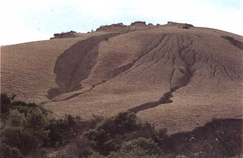
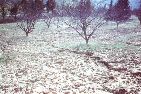
In
Tanzania, Temple and Rapp (1972) showed that mass sliding in
plates is very rare in forest zones (1 %), and that even isolated
trees can reduce its occurrence, particularly along roads.
However, reforestation is not an infallible solution, or even a
method that can be widely used in mid-altitude mountain areas
(like Mgeta) with high population densities (170 to 510 inh/km²)
and where people depend on rich and well-watered land for their
livelihood (staple food crops and vegetables for the towns). At
the most, they can be advised that the annual crops grown on
small step terraces 1 m wide would be best combined with lines of
trees on the ridges (eucalypts), on the banks around fields
(fruit trees) and along river-banks (bamboo, eucalyptus or other
local species) (Rwehumbiza and Roose 1992).
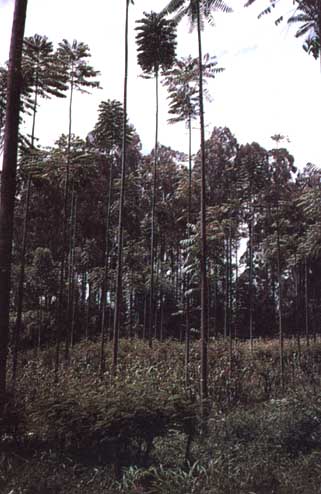
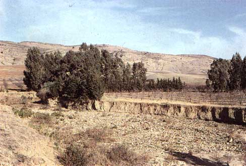
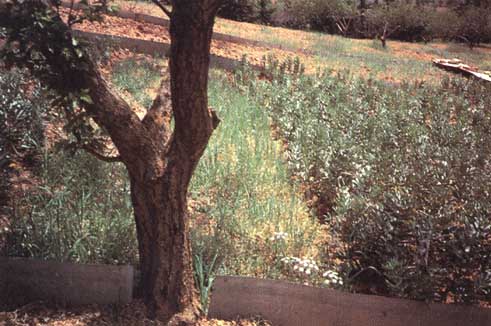
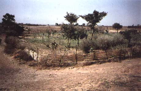
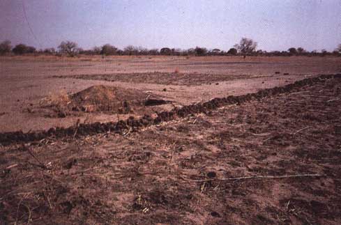
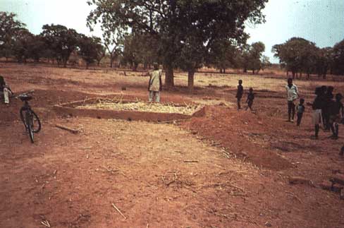
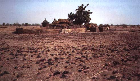
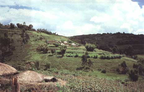
In Rwanda,
zones subject to land-slides on slopes of over 45% are often
planted to eucalyptus and left as pasture land. Houses are built
on a flat space dug out of the convex side of a stable slope, and
a double line of eucalyptus dries the bed-plate along the
principal tracks by drawing up water.
CONCLUSION
Mass
movement control must be primarily preventive: e.g.,
mapping vulnerable zones, drawing up a land use plan,
banning building work or any modification of slopes, and
protection in the form of coppice forests. However, it is
not always possible to avoid cropping in these fragile
mountain areas, which are often more densely populated
than the surrounding lowlands because the climate is
healthier (malaria-free) and the land better-watered.
Landslide
control calls for expertise and major funding in order to
drain slide bed-planes - and this is beyond the reach of
small farmers. State investment in such measures are only
justified where vital structures are at risk: road
networks, villages, dams, etc. There are, however, some
measures well-known to farmers long familiar with the
region: the use of trees - particularly eucalyptus and
bamboo - to dry out the ground and stabilize the slow
movement of soil cover on steep slopes and along
river-banks. Careful choice of species should make it
possible to transform these inhabited landscapes into a
stable landscape dominated by hedges, as has been done by
the Bamiléké (see Chapter 10).
|
Lastly, the
relative risks of the various erosion processes in each zone must
be carefully evaluated before erosion control is undertaken.
Sheet erosion control (which tends to improve infiltration) and
the digging of diversion ditches on slopes steeper than 25 %
(which drain the surface horizons but can lead water more quickly
down to slide bed-planes) are often the source of huge and even
more catastrophic land-slides. Temple and Rapp (pers. comm.)
report that after a single rainstorm of 100 to 186 mm in three
days (23-25 February 1973) in Tanzania, the overall damage caused
by about a thousand landslides was estimated at 500000 FF (US$
100000), with six dead, nine houses destroyed, 20 goats drowned,
and 500 hectares of crops wiped out; 14% of the farms lost their
harvests, roads were cut by floods for six weeks, etc.
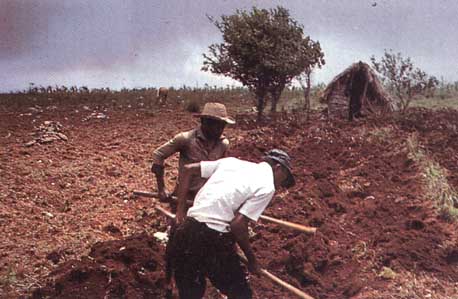
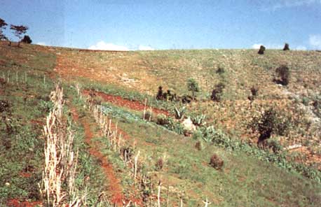
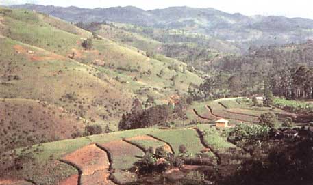
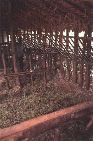
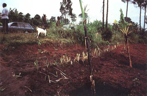
PLATE
17: TILLAGE
Hoeing
with a Manga hoe. This implement allows surface tillage of the
soil after the first rains in order to destroy both the slaking
crust and the young weeds. Later, a slight adjustment allows
hoeing and ridging of widely spaced crops (cereals, groundnuts,
cotton, etc.). Saria Station, Burkina Faso. [Photograph Dugué]
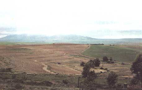
On
a gentle slope, tied ridging allows some 50 mm of rainfall to be
stored, improving infiltration by this amount. In Sudano-Sahelian
zones it allows better crop-water saving in low-rainfall years,
whereas in wet years, the crops can become waterlogged and
produce less than on the control plot. In the long run, this
technique leads to the removal of fine particles (clay, loam,
alluvium and organic matter) from the surface horizon. Puni,
Burkina Faso.
Ridging
with digging in of organic matter. After a short fallow the
farmer first rakes over the biomass so that it dries, then
collects it along a line and buries it under a thick ridge of
earth to form a contour line. Stones are piled on the closest
edge of the field. Salagnac, Haiti.
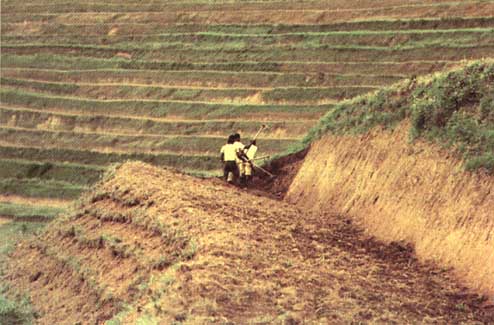
Draining
ridges. On steep slopes (20 to 40%), slightly oblique ridging
with a spillway every 10 m breaks runoff energy and collects a
large amount of well-aerated humus-bearing soil for growing root
vegetables (cassava, yam, potato, sweet potato, etc.). However,
the simple action of tillage tends to shift soil downwards,
thinning it. Additionally, during the heaviest cloudbursts,
runoff can overflow and gouge gullies in or around the fields.
Mount Okou, Cameroon. [Photograph Bedel]
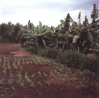
PLATE
18: AGROFORESTRY
Karité
stand in a Sudano-Sahelian savannah area. When farmers prepare
the soil (for cereals, cotton, groundnuts, etc.), they keep about
forty useful trees per hectare fruit, forage, medicine, timber,
litter-improving, etc.). Note also the attempts at water and
fertility management (line of stones, grass and branches,
corrugation of the soil to trap water and manure). Yatenga,
Burkina Faso.
Traditional
selective clearance. Fire is an indispensable tool in traditional
systems for disposing of woody vegetation progressively and
selectively. In the foreground note the soil, which remains
covered and retains its root network, and in the background, the
forest fallow, which regenerates the soil in the course of 12
years, under a continuously harvested natural palm stand. Fresco,
south-western Côte d'Ivoire.
Lakou,
agroforestry "Garden A." Around the home on the
freehold land, the farmers often plant hedges to protect an
intensive household plot + fruit trees, taking advantage of the
proximity of the stable and household waste. The positive
interaction between trees, livestock and crops is optimal here.
Salagnac, Haiti.
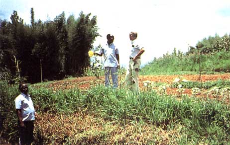
Forage
trees planted along the risers keep the soil in place and provide
large amounts of forage prized for its nutritional qualities.
These nitrogen-rich foods are essential to the digestion of dry
coarse forage during the dry season. Gulmi District, Nepal.
[Photograph Ségala]
PLATE
19: AGROFORESTRY
Alley
cropping between Leucaena hedges. The use of live hedges means
that soil fertility can be maintained by immobilizing 10 to 20%
of the usable area - a partial solution clearly unable to meet
the challenge of a doubling of the population in 20 years.
Ibadan, Nigeria.
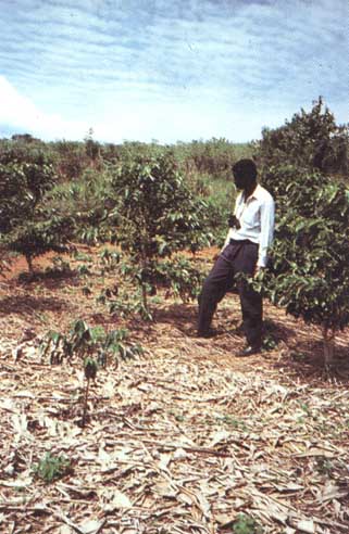
Cropping
under cover of 200 Cedrella or Grevillea trees. By removing trees
of different ages and pruning low branches and surface roots,
cereals and other foodcrops with a staggered growth cycle can be
produced under their cover. Ruhandé Arboretum, Butaré, Rwanda.
In
the Sahelian zone of Niger, only the valleys are covered with
trees (Acacia albida), which send their roots down to tap the
groundwater. Their protection is vital to reducing the
ill-effects of drying winds on crops. Tahoua Valley, Niger.
[Photograph Oumarou]
Fruit
and vegetable garden in the Sudanian zone of Côte d'Ivoire.
After selective clearance, a good number of karité, locust bean,
kapok and other useful species are left on the slopes. The
Sénoufo use the bottom lands for rice fields, and traditionally
build fruit and vegetable gardens surrounded by an earth bank.
Many varieties of fruit tree are grown here, together with some
bananas. Korhogo, Côte d'Ivoire.
PLATE
20: HAITI
Contour
channels on calcareous bluffs. The hills are covered with
shallow, grey rendzinas. The small plots are rented out to
"rich city folk," and their edges are marked by contour
channels, which quickly fill with sediment, so that they are now
of use only as paths on these very steep slopes. Since the whole
approach has never increased yields, the local small farmers do
not maintain it unless paid to do so. Clearance is general,
except around houses. Bouchereau, Jacmel.
Individual
cistern. Rural development started in the Jacmel region with the
building of cisterns to catch rainwater from roofs or small
cemented areas. The water has allowed improvements in family
hygiene and reductions in the time and labour entailed in
fetching water, and is also used to water livestock and a small
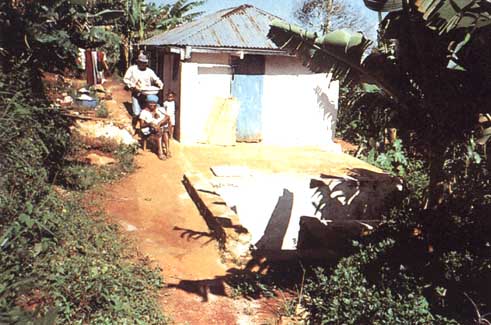
vegetable and fruit garden. Jacmel.
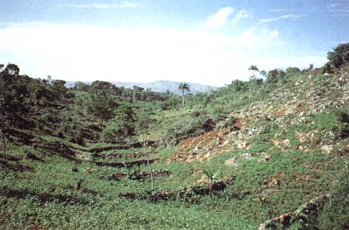
Gully
garden. Once it becomes "worn-out land, " the slopes
are scoured down to the rotten rock and left to fallow (RAK)
grazed by livestock. Only the bottom lands are still productive
where dry stone walls have been built to trap water and sediment.
Jacmel.
PLATE
21: HAITI
Stabilized
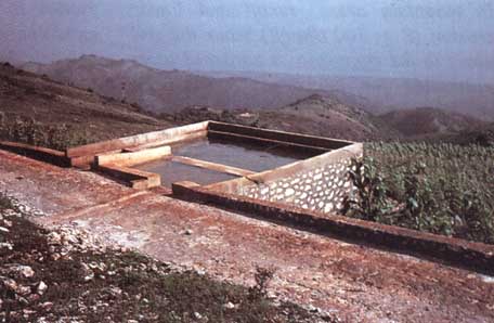
tracks and communal cisterns. One of the first development
activities in mountain areas is the creation of tracks. However,
these tracks are often the cause of serious gullying, and they
have therefore been paved so as to collect runoff from the slope
in a sand trap, from which it flows into a large communal
cistern. The water is used for livestock watering, household
purposes, and irrigation of a small off-season household
vegetable and fruit garden. Salagnac.
Water
management on the Salagnac toposequence. A little below the
track, the soil is deeper, and cassava is grown on mounds in
combination with beans and maize. Lower still, on the shelf where
the houses are located, the red soil is much deeper and is
intensely cropped (multi-storey gardens). Such plots are in
danger of gullying by runoff from the scoured hilltops, so that
it is important to catch this runoff on the track. Salagnac.
Plot-bordering
hedges. In the foreground, large cuttings, which act as hedges to
protect the cultivated plot on the left from passers-by. The
project has tried to improve these hedges by introducing forage
and fruit species. In the background, the stony surfaces (or
"worn-out land") where runoff concentrates. Salagnac.
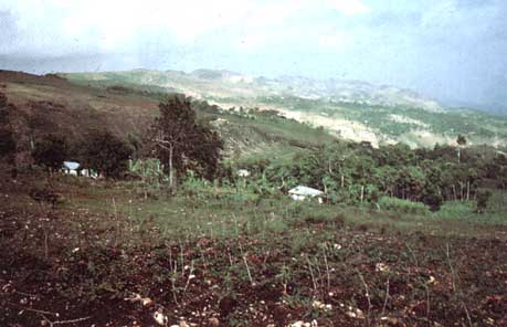
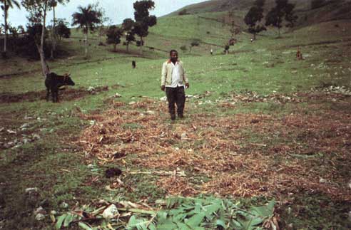
In
the Nippe area, the weathering of basaltic soils has given birth
to an undulating landscape covered with fertile vertisols.
Traditionally sorghum is sod seeded, and vetiver, which is very
resistant to overgrazing but not to gullying of the valley
bottoms, is planted on the edges of the fields. Mangoes produce
masses of fruit, and are used to feed pigs. Since the ravages of
swine fever, the dried foliage has been used as forage, but many
mango trees have been sold for timber. Petite River, Nippe.
PLATE
22: ECUADOR
In
mountain areas, runoff and linear erosion (E = 100 t/ha/yr) scour
the soil down to the cangahua, a hardened layer unsuitable for
cultivation. Cayambe Basin, altitude 2800 m. [Photograph De Noni]
Station
to measure runoff and erosion risks, soil surface conditions, and
yields as a function of natural rainfall on control plots (bare
or under traditional crops) and improved plots (1000 m²).
Mojanda, altitude 3300 m. [Photograph De Noni]
Low
contour walls built of blocks of cangahua or grass clods
according to local practices have turned the landscape into
gradual terraces, and reduced water erosion to acceptable levels
(under 5 t/ha/yr). [Photograph De Noni]
Watershed
management by the local rural community. High yields on the
experimental plots encourage the farmers to invest in land
husbandry; if they sign a contract undertaking to maintain the
works, they can receive a loan enabling them to purchase
sufficient inputs to double yields. When they repay the loan
after a year, another family is granted the same loan, so that a
small amount of aid eventually benefits a whole community. Pedro
Moncayo, altitude 3300 m. [Photograph G. Noni]
PLATE
23: ALGERIA
Marls
and soft rocks are very susceptible to water erosion. Following
clearance of steep slopes, extensive cereal cropping and
centuries of overgrazing, the hill has lost 1 metre of soil, and
sheet and rill erosion are clearly visible. The form of the tree
trunk also indicates mass movement.
On
the nearby marry hill, the effects of sheet erosion can be seen
at the top, and those of rill and gully erosion on the steep
slopes, while the wadi eats away at the foot of the hill, causing
the banks to slide.
Sheet
erosion carries only a few tonnes of sediment down to the bottom
of the hill, whereas gullying and wadi streambed displacement
carry hundreds or thousands of tonnes of sediment right down to
the dam. This should influence the choice of sites and strategies
for erosion control intervention at the watershed level.
PLATE
24: LAND HUSBANDRY
With
a view to developing mountain farming, international aid projects
introduced fruit tree crops, which considerably increase small
farmers' income. However, apricot trees lose their leaves in
winter, so that these orchards provide very poor protection to
the soil during the rainy season. On this plot with a 35% slope,
15 to 30 cm of soil has been lost after 30 years. Ouzera,
Algeria.
With
a view to reducing runoff and erosion risks and improving income
still further, the INRF-ORSTOM research team has established
grass buffer strips under the trees, combining this with
rotations (beans and cereals) that cover the soil during the
rainy season and complete their cycle before summer starts.
Without reducing fruit yields, this system assured an additional
crop of grain, produced straw useful for animal husbandry, and
cut erosion risks. It aroused considerable interest among
neighbouring peasant farmers. Algeria.
Half-orange
landform in the gneissic regions of Vietnam is perfectly
developed in terms of management of water, biomass and
fertilizing elements. The top and the steep slopes are protected
by a crop of tea. Runoff irrigates sugar cane and a rice field
before flowing into a pond that is surrounded by a collection of
useful trees. Tilapia provides food for people, hens and pigs,
and the latter recycle banana and sugar-cane residues, so that
their dung fertilizes both rice field and pond. In this way,
nutrients can be recycled several times per year. Bac Thai, Viet
Nam.
PLATE
25: LAND HUSBANDRY
On
these fields in the Sudano-Sahelian zone of Burkina Faso, there
are stone lines to curb the velocity of water, a stand of acacia,
and heaps of dung which will be dug into the soil: a mineral
supplement is indispensable. The interaction of all these ways of
managing water, biomass and nutrients allows hopes of a
relatively productive and sustainable agriculture. Burkina Faso.
[Photograph Dugué]
Land
husbandry in Nepal. The case of the foothills of Nepal
illustrates the complexity of traditional production systems
which combine sophisticated water management on irrigated
terraces on the slopes or in the valley bottoms, agroforestry and
animal husbandry in order to propagate fertility on cultivated
gradual terraces. Gulmi District, Nepal. [Photograph Ségala]
Multi-storey
gully garden. Runoff on the basaltic slopes causes gullies, which
can easily be controlled with sills of earth protected by plastic
bags. The sediment that collects is immediately planted with a
wide range of fruit trees, bananas, cane sugar and various forage
shrubs. Such gully gardens are eventually intensively farmed as
"linear oases. " Petite Rivière, Nippe, Haiti.
Risers
of blocks of rock or tufts of grass have been built in order to
treat the steep slopes of the Ecuadorian Andes, reducing water
erosion to under 5 t/ha. In order to make the most of this
system, a whole series of other inputs were necessary, such as
chemical fertilizers, improved seed and pesticides. This
technological package made it possible to both stabilize the
slopes and intensify farming. Ecuador. [Photograph De Noni]
PLATE
26: WATER MANAGEMENT
Jessours
in Tunisia. In semi-arid zones where plants cannot take root on
slopes, small dams of earth or gravel can be built to trap runoff
and sediment. Cereals are then planted under various fruit trees
(palms, olives and figs). Matmata region, Tunisia. [Photograph
Chassany]
The
authorities forced groups of peasant farmers to dig blind ditches
(0.5 × 0.5 × 10 m) to store runoff water. These ditches require
a great deal of work (250 days/ha to install + 50 days/ha to
maintain) without increasing production. Unmaintained, they fill
with sediment, causing gullying or landslides. The majority of
these ditches have now vanished, leaving risers and gradual
terraces. Central uplands of Rwanda.
Runoff
diversion terraces. This method does not reduce soil degradation
or increase yields, and requires maintenance. When exceptional
rainstorms occur, the water overflows the terraces, causing
gullying (on the left in the photograph), whereas a plot
protected by clover (on the right) shows no trace of erosion.
Biological methods prove much more effective than mechanical
terracing. Capetown, South
Grass
banks to dissipate runoff energy: runoff cannot cut a gully
unless its velocity is over 25 cm/s (Hjülstrom). Rather than
concentrating runoff water, it is better to develop techniques
that leave a very rough soil surface (rough tillage, mulching)
and pervious erosion control structures (grass banks, hedges,
stone lines) that can slow down the water and spread it out as a
sheet. CVHA Project, Burundi.
PLATE
27: WATER MANAGEMENT
Earth
bunds sealing off a tank. In Sudano-Sahelian zones of Burkina
Faso, villages are in dire need of water at the end of the dry
season. With small earth dams, runoff water from the hills can be
trapped to water livestock and a small irrigated garden. Yatenga,
Burkina Faso.
Mulching
degraded land allows restoration of both infiltration capacity
and fertility through the action of termites which redistribute
the organic matter in their galleries. Yatenga, Burkina Faso.
Multi-storey
garden irrigated by a bouli, a small earth dam. With the runoff
wafer collected by a modest dam of this kind, livestock can be
watered after the onset of the rainy season, and a small early
vegetable garden irrigated. Sabouna, Burkina Faso.
Development
of terraced rice fields along the slope is based on the
possibility of gravity irrigation. The seasonal availability of
water and the altitude then decide whether one, two or three
crops should be grown per year. Gulmi District, Nepal.
[Photograph Ségala]
PLATE
28: BIOMASS MANAGEMENT
In
the zaï method, 3 tonnes of sun-dried faeces or corral soil must
be dug into the pan. The concentration of water and available
manure restores productivity on this degraded land, even in the
first year. The organic matter not only contributes a minimum of
mineral elements but also provides the microflora needed for
assimilation of the nutrients in the soil.
A
fallow of legumes grown as a catch crop under the cereal is
another solution, allowing an increase in biomass, bringing
nutrients to the surface, and protecting the soil during early
storms. However, it is possible only in Sudanian areas where
rainfall is over 1000 mm and distributed over more than 5 months
of the year.
Compost
pit irrigated by runoff water. This system consists of building a
field compost pit, thus eliminating the need to transport crop
residues and compost. Unfortunately, the time needed for
decomposition (18 months) and the quality of the organic product
leave much to be desired. In future, efforts will be focused on
setting up "compost-dung-rubbish" heaps or pits near
the dwellings, which will allow each family to produce 5 m³ of a
compost that is well-decomposed and recycled even by the
following season. Ziga, Burkina Faso.
PLATE
29: BIOMASS MANAGEMENT
Under
coffee trees, a thick mulch (25 t/ha/yr) retains soil moisture in
the dry season, protects the surface against erosion, lowers
competition from weeds, and concentrates nutrients from all over
the farm. The trick is to produce enough biomass without
upsetting the whole farm.
Maintaining
field fertility by adding dung, a practice that is part of a
complex foddering system. There is a real transferral of
fertility from uncultivated to cultivated areas. Gulmi District,
Nepal. [Photograph Ségala]
After
a short fallow, the farmer brings tethered livestock a forage
supplement, the residue of which will be recycled directly during
tillage. Jacmel, Haiti.
The
transport of dung is one of the factors that limit its use to the
immediate vicinity of dwellings, i. e. home gardens. [Photograph
Ségala]
PLATE
30: ANIMAL HUSBANDRY
Dung
contract. Farmers in the African savannah traditionally propose
that herdsmen have their livestock graze on crop residues in
exchange for leaving them on the fields during the night. This
produces localized dung, possibly in considerable quantities,
although it is poor in nitrogen, since the faeces are exposed to
the sun and are trampled by the animals. Boukere, Burkina Faso.
Night
corralling. When the livestock are herded into a corral for the
night, they produce so much dung that nothing more will grow
there. Powdered faeces crushed by the animals' feet and mixed
with varying amounts of soil from the corral are removed. The
quality of this product, which is unfermented (and hence full of
seeds ready to germinate), can be improved by the addition of a
litter of coarse straw. Production of this improved dung can be
as high as 1.5 t/ha/cow/yr. Southern Mali.
A
movable corral can also be made using barbed wire, thus improving
distribution of dung on cultivated fields.
PLATE
31: ANIMAL HUSBANDRY
Dung
stable. In farms using animal traction, a pair of oxen are often
stabled under a rudimentary roof that allows storage of crop
residues. Combined with the urine and faeces, the litter is then
taken to the dung pit where it ferments, lowering the content of
live weed seeds. When household refuse, ash and other organic
waste are added, a farmer can produce up to 5 t/yr of
good-quality composted manure, especially if he digs in a mineral
supplement (N. P. Ca) with it to compensate for soil
deficiencies. Kaniko, southern Mali.
Village
compost-dung pit which could be made more efficient if the pit
were surrounded by trees. The roots would recover nutrients in
solution now carried away by drainage water, the litter would
return nutrient-rich biomass, and the shade would maintain an
environment favourable to decomposition. Yatenga, Burkina Faso.
The
top system is a stable where the livestock are kept permanently
on litter. Watered daily and trodden down by the animals, the
litter is quickly transformed into good-quality manure. CVHA
Project, Bugaramé, Burundi.
Paddock
surrounded by contour hedges (Leucaena, eucalyptus, etc.). The
stable is joined on to the house. CVHA Project, Bugaramé,
Burundi.
PLATE
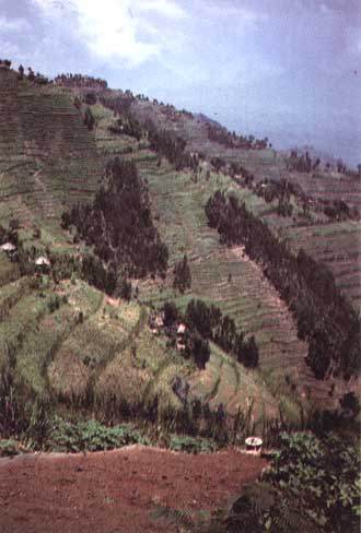
32: RWANDA
Grass
lines and step microterraces on steep slopes. The lines of
Pennisetum that can be seen in the foreground do somewhat slow
erosion on these 60% slopes. In the middle ground on the right
are micro-terraces 50 cm deep dug into the topsoil and protected
by grass risers. This network of grass keeps the soil in place
while producing foodcrops on slopes of up to 80%. Note also the
eucalyptus stands in areas where there is a risk of sliding.
Ruhengeri region, Rwanda.
Radical
terraces in Rwanda. In order to absorb all the rainfall and
maintain the fertility levels needed for intensified cropping,
radical terraces were built. This involved building risers with
clods of grass from the land, removing the topsoil, building the
terrace with a 4% reverse slope, and shifting the topsoil back
onto this almost horizontal surface. Unfortunately, since the
subsoil is sterile, apart from the necessary investment of I 000
working days per hectare for the terracing, the method requires
10 tonnes of dung, 3 tonnes of lime, and 300 kg of NPK if it is
to produce viable results. It is therefore unaffordable for most
Rwandan farmers. There are also many hills where it would be
dangerous to build such terraces, because the slopes are
susceptible to landslides. Rwanda.
Grass
bank with bananas planted below it. Some experts hope to reduce
the density of bananas between erosion control structures in
order to intensify foodcropping. Meanwhile, banana is a
cost-effective crop because of the organic residue dug into the
planting hole. Burundi.
The
grass bank retains the earth pushed by runoff and above all by
tillage. Central uplands, Burundi.
Chapter 8. Wind erosion
Processes
Forms of wind structures
Effects of wind erosion
Factors affecting the extent of wind
erosion
Wind
erosion control
There is
considerable wind erosion in West Africa in dry tropical zones
where annual rainfall is below 600 mm, the dry season lasts more
than six months, and steppe-type vegetation leaves large
stretches of bare soil. It can also develop elsewhere when the
soil is being prepared and large amounts of surface matter are
crushed fine.
Processes
[Plate 16]
The wind
exercises a pressure on solid particles in repose. This pressure
is exerted above the centre of gravity on the surface exposed to
wind and is opposed by a friction centred on the base of the
particles. The two forces combined tend to rock heavy particles
(0.5 to 2 mm) and make them roll.
Moreover,
the difference in speed between the top and bottom of particles
means that they are drawn upwards. The lighter particles rise
vertically until the gradient of velocity is too low to bear
them, at which point they fall back, pushed by the wind,
following a subhorizontal curve. As they fall, these grains of
sand transmit their energy to other grains of sand (as in a game
of bowls) or degrade loamy-clay aggregates, releasing dust
(Heusch 1988).
The three
processes described below can be observed in the field when the
wind-speed exceeds 15 to 25 km/in (or 4 to 7 m/s) depending on
air turbulence (De Ploey 1980, Mainguet 1983, Heusch 1988)
(Figure 58).
• Saltation
of fine sand (0.1 to 0.5 mm): in this process, sheets of sand
raised by violent wind travel several dozen metres over smooth
surfaces, leaving sheets of ripplemarked sand on the ground or
small mounds of sand trapped by plant tufts. These sand sheets
lash at rocks in desert areas, giving them a typical mushroom
shape (corrasion), and cause serious crop damage.
• Deflation:
in this process light particles of soil (clay, loam and organic
matter) are carried away in suspension. This dust is sucked up by
vortices as high as several thousand metres, and then dispersed
as a dry mist, or it may travel several thousand kilometres as a
dust cloud. This category covers both wind-borne loam torn from
periglacial loess steppes, and the Sahara dust that falls in
Montpellier three times a year and once or twice a year in Paris.
• Creep:
grains of sand 0.5 to 2 mm and too heavy to be sucked very high
are thrown off balance by gusts of wind, and rolled and dragged
over the soil surface to the tops of dunes, which can advance
several metres per hour in this way in strong winds.
FIGURE
58 Three processes of wind erosion: suspension, saltation,
traction
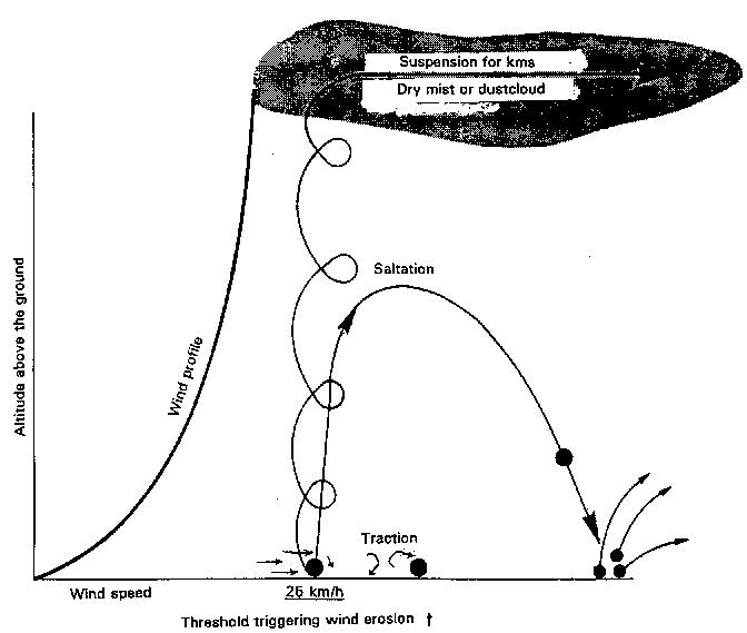
dry,
fairly loose soil
1.
Suspension: cloud of superfine silt (e.g. dust in dry season =
dust bowl) rising as high as 10 km and extending over hundreds of
km
2.
Saltation: fine sand grains, ø ~ 100 µ / major ill-effects:
moving dunes - damage to crops and other vegetation
3. Traction
along the ground:
• coarse sand
rolling along the surface of dunes
• fine sheets of
sand
Forms of wind structures
The form of
dunes depends on the prevailing winds.
If the
prevailing winds come from only one direction, the dunes can
be straight, paralleling the coast (formed by the winds
that sweep across the beach at low tide) or crescent-shaped, with
the side toward the wind gently sloped. In the second form, the
wind pushes grains of sand up to the top of the gentle slope, and
they then fall on to the steep slope inside the semicircle. Dunes
advance more slowly as they grow in size. According to studies by
Bourgoin (1956) along the route of the Mauritanian railway, dunes
3 metres high will advance between 40 and 80 metres per year,
dunes 12 metres high will advance between 12 and 35 metres, and
those 24 metres high, between 8 and 17 metres.
In order to
avoid the risk of sanding-up, lines of communication are not
taken through areas with live dunes. A 50-cm bank with a very
gentle slope (1/5 to 1/10) is also built so that the wind speeds
up as it crosses the road, preventing it from depositing sand.
The wind-speed can be increased still further at particularly
vulnerable points by setting up 3 × 1 m deflecting panels at a
60° slant, or triangular cross-sectioned sand mounds 8 metres
from the road, with the top and sides covered with a 20- to 50-cm
layer of gravel.
If the
prevailing winds are multidirectional, sand dunes can
sometimes stretch several hundred kilometres; lying at a tangent
to the wake of an obstacle, the Silk is oblique with
respect to what could be termed the annual wind. During storms,
sand travels along the dune, parallel to this structure, which
continues growing in the same direction (Mainguet 1983). The
profile is of two steep slopes of moving sands, meeting in a
sharp ridge.
There are
also pyramidal dunes (ghourd) with several ridges leading
down from the top, as evidence of multidirectional winds.
There
are also hollowed dunes - corridors between two dunes where
the wind pours through and digs out yardangs. The sheets
of sand carried between the dunes in this way will be trapped by
tufted plants, gradually forming what are called nebkas,
which continue to grow, eventually forming larger and larger
dunes.
The
material often comes from matter previously removed by water
erosion - inland or marine sediment, products of weathering or
disintegration of coarse-grained rocks, or else from soil finely
powdered by tillage techniques, particularly the ill-advised use
of disc ploughs, especially on volcanic soil (for example the
basaltic soil of Nicaragua or the loam of the Great Plains in the
United States).
Contents
- Previous - Next
![Hoeing with a Manga hoe. This implement allows surface tillage of the soil after the first rains in order to destroy both the slaking crust and the young weeds. Later, a slight adjustment allows hoeing and ridging of widely spaced crops (cereals, groundnuts, cotton, etc.). Saria Station, Burkina Faso. [Photograph Dugué]](t1765e1t.jpg)
![Draining ridges. On steep slopes (20 to 40%), slightly oblique ridging with a spillway every 10 m breaks runoff energy and collects a large amount of well-aerated humus-bearing soil for growing root vegetables (cassava, yam, potato, sweet potato, etc.). However, the simple action of tillage tends to shift soil downwards, thinning it. Additionally, during the heaviest cloudbursts, runoff can overflow and gouge gullies in or around the fields. Mount Okou, Cameroon. [Photograph Bedel]](t1765e1w.jpg)
![Forage trees planted along the risers keep the soil in place and provide large amounts of forage prized for its nutritional qualities. These nitrogen-rich foods are essential to the digestion of dry coarse forage during the dry season. Gulmi District, Nepal. [Photograph Ségala]](t1765e20.jpg)
![In the Sahelian zone of Niger, only the valleys are covered with trees (Acacia albida), which send their roots down to tap the groundwater. Their protection is vital to reducing the ill-effects of drying winds on crops. Tahoua Valley, Niger. [Photograph Oumarou]](t1765e23.jpg)
![In mountain areas, runoff and linear erosion (E = 100 t/ha/yr) scour the soil down to the cangahua, a hardened layer unsuitable for cultivation. Cayambe Basin, altitude 2800 m. [Photograph De Noni]](t1765e2c.jpg)
![Station to measure runoff and erosion risks, soil surface conditions, and yields as a function of natural rainfall on control plots (bare or under traditional crops) and improved plots (1000 m²). Mojanda, altitude 3300 m. [Photograph De Noni]](t1765e2d.jpg)
![Low contour walls built of blocks of cangahua or grass clods according to local practices have turned the landscape into gradual terraces, and reduced water erosion to acceptable levels (under 5 t/ha/yr). [Photograph De Noni]](t1765e2e.jpg)
![Watershed management by the local rural community. High yields on the experimental plots encourage the farmers to invest in land husbandry; if they sign a contract undertaking to maintain the works, they can receive a loan enabling them to purchase sufficient inputs to double yields. When they repay the loan after a year, another family is granted the same loan, so that a small amount of aid eventually benefits a whole community. Pedro Moncayo, altitude 3300 m. [Photograph G. Noni]](t1765e2f.jpg)
![On these fields in the Sudano-Sahelian zone of Burkina Faso, there are stone lines to curb the velocity of water, a stand of acacia, and heaps of dung which will be dug into the soil: a mineral supplement is indispensable. The interaction of all these ways of managing water, biomass and nutrients allows hopes of a relatively productive and sustainable agriculture. Burkina Faso. [Photograph Dugué]](t1765e2m.jpg)
![Land husbandry in Nepal. The case of the foothills of Nepal illustrates the complexity of traditional production systems which combine sophisticated water management on irrigated terraces on the slopes or in the valley bottoms, agroforestry and animal husbandry in order to propagate fertility on cultivated gradual terraces. Gulmi District, Nepal. [Photograph Ségala]](t1765e2n.jpg)
![Risers of blocks of rock or tufts of grass have been built in order to treat the steep slopes of the Ecuadorian Andes, reducing water erosion to under 5 t/ha. In order to make the most of this system, a whole series of other inputs were necessary, such as chemical fertilizers, improved seed and pesticides. This technological package made it possible to both stabilize the slopes and intensify farming. Ecuador. [Photograph De Noni]](t1765e2p.jpg)
![Jessours in Tunisia. In semi-arid zones where plants cannot take root on slopes, small dams of earth or gravel can be built to trap runoff and sediment. Cereals are then planted under various fruit trees (palms, olives and figs). Matmata region, Tunisia. [Photograph Chassany]](t1765e2q.jpg)
![Development of terraced rice fields along the slope is based on the possibility of gravity irrigation. The seasonal availability of water and the altitude then decide whether one, two or three crops should be grown per year. Gulmi District, Nepal. [Photograph Ségala]](t1765e2x.jpg)
![Maintaining field fertility by adding dung, a practice that is part of a complex foddering system. There is a real transferral of fertility from uncultivated to cultivated areas. Gulmi District, Nepal. [Photograph Ségala]](t1765e32.jpg)
![The transport of dung is one of the factors that limit its use to the immediate vicinity of dwellings, i. e. home gardens. [Photograph Ségala]](t1765e34.jpg)