![]()
![]()
![]()
General features
During the NE monsoon the water movement to the north of the Equator are generally from east to west. This circulation pattern starts developing in November, reaches it greatest strength in February and subsides in April. The coast of Pakistan, however, is most of the year influenced by the high-salinity surface water formed by the strong excess of evaporation in the central and northern Arabian Sea. This results in eastflowing current along the Makran coast and southflowing along the Sind coast. From November to January low salinity water from the Bay of Bengal flows along the western coast of India and penetrates into the coastal waters of Pakistan and a reverse current pattern occasionally occur.
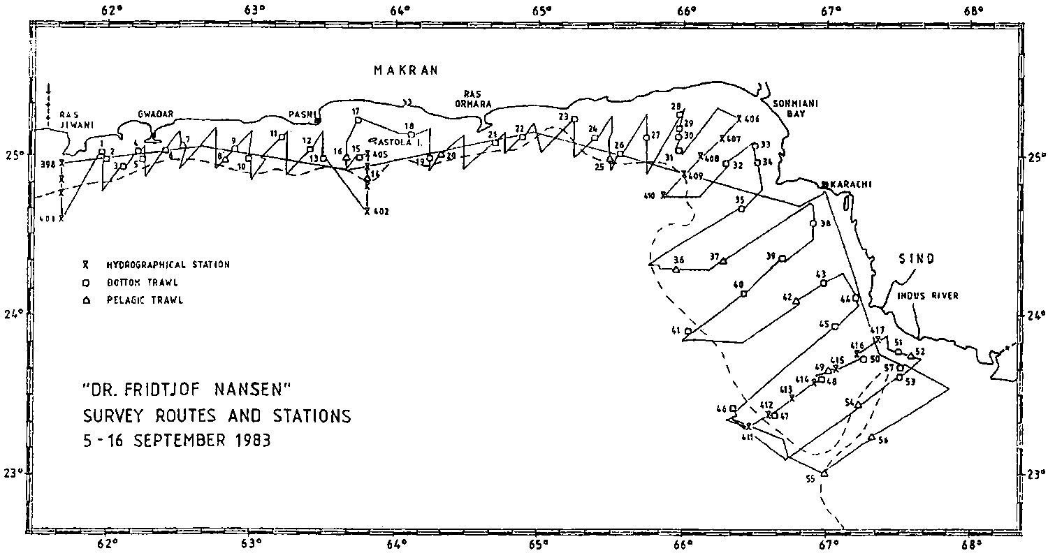
Fig. 1. Cruise tracks, hydrographic profiles and fishing stations from Survey I.
Situation during the present investigations
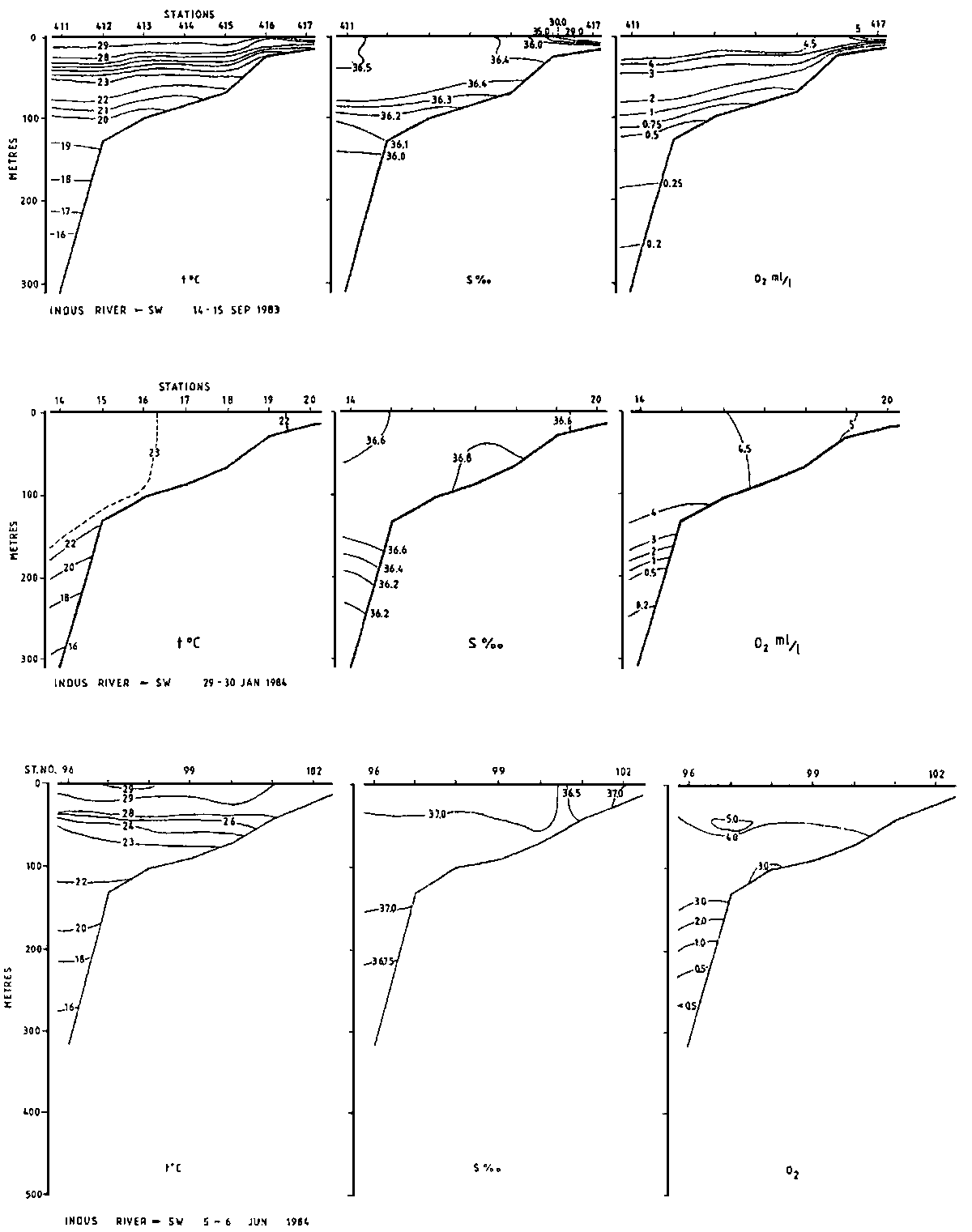
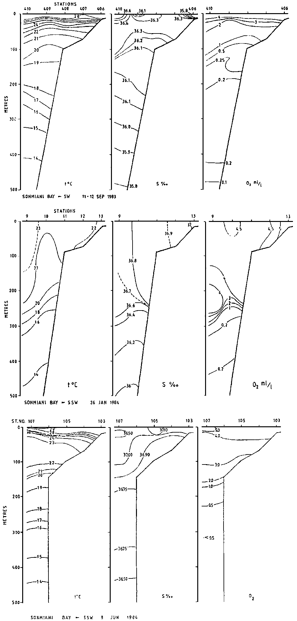
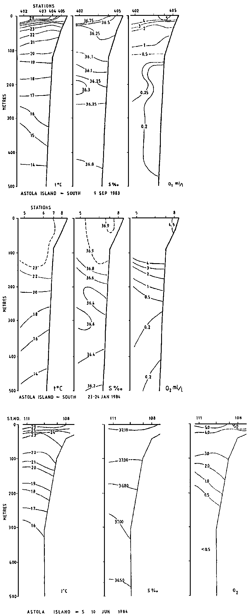
Figs. 2-4 show the vertical distribution of temperature, salinity and oxygen in three sections off the Pakistan coast in September, June and January. The sections from September and June represent the SW monsoon situation while that from January represent the NE monsoon type of distribution.
Figure 2. Hydrographic section: Indus River - SW.
Figure 3. Hydrographic section: Sonmiani Bay - SSW.
Figure 4. Hydrographic section: Astola Island - S.
The surface temperature during the SW monsoon season is 28-29°C while during the NE monsoon it is 22°-23°C. In January there is a homogeneous, well-mixed upper layer reaching to about 150 m compared to about 20 m in June and September. Off the Sind coast the effect of the fresh water outflow from the River Indus can clearly be seen in the September section (Fig. 2). A similar effect was observed during the same month in Sonmiani Bay (Fig. 3).
In September water of low oxygen contents covered substantial parts of the continental shelf. Along the Makran Coast the 2 ml/l isoline was observed at 20-30 m depth (Figs. 3-4) while off the Indus delta the fresh water outflow caused this isoline to reach to about 15 m. In June the 2 ml/l isoline was situated around 150 m and in January from 150 to 250 m. As a result of the increased vertical mixing in January, water of oxygen content higher than 4 ml/l was occupying the upper 100 m.
![]()
![]()
![]()