![]()
![]()
![]()
2.1 The soil
2.2 Entry of water into the soil
2.3 Soil moisture conditions
2.4 Available water content
2.5 Groundwater table
2.6 Soil erosion by water
2.1.1 Soil composition
2.1.2 Soil profile
2.1.3 Soil texture
2.1.4 Soil structure
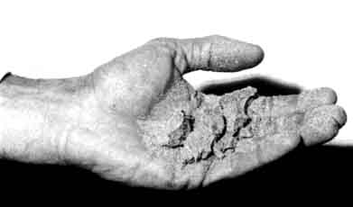
When dry soil is crushed in the hand, it can be seen that it is composed of all kinds of particles of different sizes.
Most of these particles originate from the degradation of rocks; they are called mineral particles. Some originate from residues of plants or animals (rotting leaves, pieces of bone, etc.), these are called organic particles (or organic matter). The soil particles seem to touch each other, but in reality have spaces in between. These spaces are called pores. When the soil is "dry", the pores are mainly filled with air. After irrigation or rainfall, the pores are mainly filled with water. Living material is found in the soil. It can be live roots as well as beetles, worms, larvae etc. They help to aerate the soil and thus create favourable growing conditions for the plant roots (Fig. 26).
Fig. 26. The composition of the soil

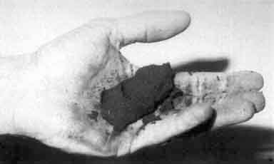
If a pit is dug in the soil, at least 1 m deep, various layers, different in colour and composition can be seen. These layers are called horizons. This succession of horizons is called the profile of the soil (Fig. 27).
Fig. 27. The soil profile

A very general and simplified soil profile can be described as follows:
a. The plough layer (20 to 30 cm thick): is rich in organic matter and contains many live roots. This layer is subject to land preparation (e.g. ploughing, harrowing etc.) and often has a dark colour (brown to black).b. The deep plough layer: contains much less organic matter and live roots. This layer is hardly affected by normal land preparation activities. The colour is lighter, often grey, and sometimes mottled with yellowish or reddish spots.
c. The subsoil layer: hardly any organic matter or live roots are to be found. This layer is not very important for plant growth as only a few roots will reach it.
d. The parent rock layer: consists of rock, from the degradation of which the soil was formed. This rock is sometimes called parent material.
The depth of the different layers varies widely: some layers may be missing altogether.
The mineral particles of the soil differ widely in size and can be classified as follows:
|
Name of the particles |
Size limits in mm |
Distinguisable with naked eye |
|
gravel |
larger than 1 |
obviously |
|
sand |
1 to 0.5 |
easily |
|
silt |
0.5 to 0.002 |
barely |
|
clay |
less than 0.002 |
impossible |
The amount of sand, silt and clay present in the soil determines the soil texture.
In coarse textured soils: sand is predominant (sandy soils).
In medium textured soils: silt is predominant (loamy soils).
In fine textured soils: clay is predominant (clayey soils).
In the field, soil texture can be determined by rubbing the soil between the fingers (see Fig. 28).
Farmers often talk of light soil and heavy soil. A coarse-textured soil is light because it is easy to work, while a fine-textured soil is heavy because it is hard to work.
|
Expression used by the farmer |
Expression used in literature | |
|
light |
sandy |
coarse |
|
medium |
loamy |
medium |
|
heavy |
clayey |
fine |
The texture of a soil is permanent, the farmer is unable to modify or change it.
Fig. 28c. Fine textured soil sticks to the fingers when wet and can form a ball when pressed.
Soil structure refers to the grouping of soil particles (sand, silt, clay, organic matter and fertilizers) into porous compounds. These are called aggregates. Soil structure also refers to the arrangement of these aggregates separated by pores and cracks (Fig. 29).
The basic types of aggregate arrangements are shown in Fig. 30, granular, blocky, prismatic, and massive structure.
Fig. 29. The soil structure

When present in the topsoil, a massive structure blocks the entrance of water; seed germination is difficult due to poor aeration. On the other hand, if the topsoil is granular, the water enters easily and the seed germination is better.
In a prismatic structure, movement of the water in the soil is predominantly vertical and therefore the supply of water to the plant roots is usually poor.
Unlike texture, soil structure is not permanent. By means of cultivation practices (ploughing, ridging, etc.), the farmer tries to obtain a granular topsoil structure for his fields.
Fig. 30. Some examples of soil structures
|
GRANULAR
|
BLOCKY
|
|
|
|
|
|
|
|
|
|
2.2.1 The infiltration process
2.2.2 Infiltration rate
2.2.3 Factors influencing the infiltration rate
When rain or irrigation water is supplied to a field, it seeps into the soil. This process is called infiltration.
Infiltration can be visualized by pouring water into a glass filled with dry powdered soil, slightly tamped. The water seeps into the soil; the colour of the soil becomes darker as it is wetted (see Fig. 31).
Fig. 31. Infiltration of water into the soil

Repeat the previous test, this time with two glasses. One is filled with dry sand and the other is filled with dry clay (see Fig. 32a and b).
The infiltration of water into the sand is faster than into the clay. The sand is said to have a higher infiltration rate.
Fig. 32a. The same amount of water is supplied to each glass

Fig. 32b. After one hour the water has infiltrated in the sand, while some water is still ponding on the clay

The infiltration rate of a soil is the velocity at which water can seep into it. It is commonly measured by the depth (in mm) of the water layer that the soil can absorb in an hour.
An infiltration rate of 15 mm/hour means that a water layer of 15 mm on the surface of the soil, will take one hour to infiltrate (see fig. 33).
Fig. 33. Soil with an infiltration rate of 15 mm/hour

A range of values for infiltration rates is given below:
|
Low infiltration rate |
less than 15 mm/hour |
|
medium infiltration rate |
15 to 50 mm/hour |
|
high infiltration rate |
more than 50 mm/hour |
The infiltration rate of a soil depends on factors that are constant, such as the soil texture. It also depends on factors that vary, such as the soil moisture content.
i. Soil TextureCoarse textured soils have mainly large particles in between which there are large pores.
On the other hand, fine textured soils have mainly small particles in between which there are small pores (see Fig. 34).
Fig. 34. Infiltration rate and soil texture

In coarse soils, the rain or irrigation water enters and moves more easily into larger pores; it takes less time for the water to infiltrate into the soil. In other words, infiltration rate is higher for coarse textured soils than for fine textured soils.
ii. The soil moisture content
The water infiltrates faster (higher infiltration rate) when the soil is dry, than when it is wet (see Fig. 35). As a consequence, when irrigation water is applied to a field, the water at first infiltrates easily, but as the soil becomes wet, the infiltration rate decreases.
Fig. 35. Infiltration rate and soil moisture content

iii. The soil structure
Generally speaking, water infiltrates quickly (high infiltration rate) into granular soils but very slowly (low infiltration rate) into massive and compact soils.
Because the farmer can influence the soil structure (by means of cultural practices), he can also change the infiltration rate of his soil.
2.3.1 Soil moisture content
2.3.2 Saturation
2.3.3 Field capacity
2.3.4 Permanent wilting point
The soil moisture content indicates the amount of water present in the soil.
It is commonly expressed as the amount of water (in mm of water depth) present in a depth of one metre of soil. For example: when an amount of water (in mm of water depth) of 150 mm is present in a depth of one metre of soil, the soil moisture content is 150 mm/m (see Fig. 36).
Fig. 36. A soil moisture content of 150 mm/m

The soil moisture content can also be expressed in percent of volume. In the example above, 1 m3 of soil (e.g. with a depth of 1 m, and a surface area of 1 m2) contains 0.150 m3 of water (e.g. with a depth of 150 mm = 0.150 m and a surface area of 1 m2). This results in a soil moisture content in volume percent of:
Thus, a moisture content of 100 mm/m corresponds to a moisture content of 10 volume percent.
Note: The amount of water stored in the soil is not constant with time, but may vary.
During a rain shower or irrigation application, the soil pores will fill with water. If all soil pores are filled with water the soil is said to be saturated. There is no air left in the soil (see Fig. 37a). It is easy to determine in the field if a soil is saturated. If a handful of saturated soil is squeezed, some (muddy) water will run between the fingers.
Plants need air and water in the soil. At saturation, no air is present and the plant will suffer. Many crops cannot withstand saturated soil conditions for a period of more than 2-5 days. Rice is one of the exceptions to this rule. The period of saturation of the topsoil usually does not last long. After the rain or the irrigation has stopped, part of the water present in the larger pores will move downward. This process is called drainage or percolation.
The water drained from the pores is replaced by air. In coarse textured (sandy) soils, drainage is completed within a period of a few hours. In fine textured (clayey) soils, drainage may take some (2-3) days.
After the drainage has stopped, the large soil pores are filled with both air and water while the smaller pores are still full of water. At this stage, the soil is said to be at field capacity. At field capacity, the water and air contents of the soil are considered to be ideal for crop growth (see Fig. 37b).
Little by little, the water stored in the soil is taken up by the plant roots or evaporated from the topsoil into the atmosphere. If no additional water is supplied to the soil, it gradually dries out.
The dryer the soil becomes, the more tightly the remaining water is retained and the more difficult it is for the plant roots to extract it. At a certain stage, the uptake of water is not sufficient to meet the plant's needs. The plant looses freshness and wilts; the leaves change colour from green to yellow. Finally the plant dies.
The soil water content at the stage where the plant dies, is called permanent wilting point. The soil still contains some water, but it is too difficult for the roots to suck it from the soil (see Fig. 37c).
Fig. 37. Some soil moisture characteristics

The soil can be compared to a water reservoir for the plants. When the soil is saturated, the reservoir is full. However, some water drains rapidly below the rootzone before the plant can use it (see Fig. 38a).
Fig. 38a. Saturation

When this water has drained away, the soil is at field capacity. The plant roots draw water from what remains in the reservoir (see Fig. 38b).
Fig. 38b. Field capacity

When the soil reaches permanent wilting point, the remaining water is no longer available to the plant (see Fig. 38c).
Fig. 38c. Permanent wilting point

The amount of water actually available to the plant is the amount of water stored in the soil at field capacity minus the water that will remain in the soil at permanent wilting point. This is illustrated in Fig. 39.
Fig. 39. The available soil moisture or water content

|
Available water content = water content at field capacity - water content at permanent wilting point ..... (13) |
The available water content depends greatly on the soil texture and structure. A range of values for different types of soil is given in the following table.
|
Soil |
Available water content in mm water depth per m soil depth (mm/m) |
|
sand |
25 to 100 |
|
loam |
100 to 175 |
|
clay |
175 to 250 |
The field capacity, permanent wilting point (PWP) and available water content are called the soil moisture characteristics. They are constant for a given soil, but vary widely from one type of soil to another.
2.5.1 Depth of the groundwater table
2.5.2 Perched groundwater table
2.5.3 Capillary rise
Part of the water applied to the soil surface drains below the rootzone and feeds deeper soil layers which are permanently saturated; the top of the saturated layer is called groundwater table or sometimes just water table (see Fig. 40).
Fig. 40. The groundwater table

The depth of the groundwater table varies greatly from place to place, mainly due to changes in topography of the area (see Fig. 41).
Fig. 41. Variations in depth of the groundwater table

In one particular place or field, the depth of the groundwater table may vary in time.
Following heavy rainfall or irrigation, the groundwater table rises. It may even reach and saturate the rootzone. If prolonged, this situation can be disastrous for crops which cannot resist "wet feet" for a long period. Where the groundwater table appears at the surface, it is called an open groundwater table. This is the case in swampy areas.
The groundwater table can also be very deep and distant from the rootzone, for example following a prolonged dry period. To keep the rootzone moist, irrigation is then necessary.
A perched groundwater layer can be found on top of an impermeable layer rather close to the surface (20 to 100 cm). It covers usually a limited area. The top of the perched water layer is called the perched groundwater table.
The impermeable layer separates the perched groundwater layer from the more deeply located groundwater table (see Fig. 42).
Fig. 42. A perched groundwater table

Soil with an impermeable layer not far below the rootzone should be irrigated with precaution, because in the case of over irrigation (too much irrigation), the perched water table may rise rapidly.
So far, it has been explained that water can move downward, as well as horizontally (or laterally). In addition, water can move upward.
If a piece of tissue is dipped in water (Fig. 43), the water is sucked upward by the tissue.
Fig. 43. Upward movement of water or capillary rise
The same process happens with a groundwater table and the soil above it. The groundwater can be sucked upward by the soil through very small pores that are called capillars. This process is called capillary rise.
In fine textured soil (clay), the upward movement of water is slow but covers a long distance. On the other hand, in coarse textured soil (sand), the upward movement of the water is quick but covers only a short distance.
|
Soil texture |
Capillary rise (in cm) |
|
coarse (sand) |
20 to 50 cm |
|
medium |
50 to 80 cm |
|
fine (clay) |
more than 80 cm up to several metres |
Erosion is the transport of soil from one place to another. Climatic factors such as wind and rain can cause erosion, but also under irrigation it may occur.
Over a short period, the process of erosion is almost invisible. However, it can be continuous and the whole fertile top layer of a field may disappear within a few years.
Soil erosion by water depends on:
- the slope: steep, sloping fields are more exposed to erosion;
- the soil structure: light soils are more sensitive to erosion;
- the volume or rate of flow of surface runoff water: larger or rapid flows induce more erosion.
Erosion is usually heaviest during the early part of irrigation, especially when irrigating on slopes. The dry surface soil, sometimes loosened by cultivation, is easily removed by flowing water. After the first irrigation, the soil is moist and settles down, so erosion is reduced. Newly irrigated areas are more sensitive to erosion, especially in their early stages.
There are two main types of erosion caused by water: sheet erosion and gully erosion. They are often combined.
Sheet erosion is the even removal of a very thin layer or "sheet" of topsoil from sloping land. It occurs over large areas of land and causes most of the soil losses (see Fig. 44).
The signs of sheet erosion are:
- only a thin layer of topsoil; or the subsoil is partly exposed; sometimes even parent rock is exposed;- quite large amounts of coarse sand, gravel and pebbles in the arable layer, the finer material has been removed;
- exposure of the roots;
- deposit of eroded material at the foot of the slope.
Gully erosion is defined as the removal of soil by a concentrated water flow, large enough to form channels or gullies.
These gullies carry water during heavy rain or irrigation and gradually become wider and deeper (see Fig. 45).
The signs of gully erosion on an irrigated field are:
- irregular changes in the shape and length of the furrows;
- accumulation of eroded material at the bottom of the furrows;
- exposure of plant roots.
![]()
![]()
![]()


