新闻
本节介绍粮农组织利用地理空间技术和方法所开展活动的相关文章和新闻。
18 April 2024
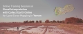
The online training session conducted on the 18 April, 2024 focused exclusively on enhancing the visual interpretation skills of our partners from the FAO Yemen and Yemen Remote Sensing Center using the Collect Earth Online (CEO) tool. This specialized training...

FAO's upcoming webinar on April 17, 2024, titled "Adaptive and innovative tools and approaches for crop mapping," addresses the crucial need for accurate crop mapping to enhance productivity and sustainability.
It aims to explore cutting-edge strategies and technologies such as remote...

In the rapidly evolving landscape of agricultural technology, the capacity to accurately map and monitor crop types and manage soil, land and water resources sustainably has emerged as a cornerstone for enhancing productivity, sustainability, and better productivity for food security....

The Food and Agriculture Organization of the United Nations (FAO) Geospatial Unit provided a session on field data collection protocols for crop mapping during a Crop Cutting Survey Training of Trainers (ToT) workshop organized by FAO Afghanistan. The two-day workshop,...
29 March 2024
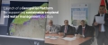
The Italian Agency for Development Cooperation (AICS) and the Food and Agriculture Organization of the United Nations (FAO), in collaboration with the Ministry of Water Resources, the Ministry of Agriculture and Livestock and the Libyan Centre for Remote Sensing and...