粮农组织地理空间领域工作
农业为全球25亿人口直接提供生计手段,为全球所有人口提供粮食。到2050年,随着人口增长和膳食变化,粮食生产必须比2012年增加49%。然而,气候变化、生物多样性丧失、土地退化、水资源匮乏、污染及其他众多挑战,对我们为地球提供充足粮食的工作形成阻碍。
《2030年可持续发展议程》所做承诺就是为所有人解决上述问题;但显而易见的是,如果没有及时、准确数据来为决策者提供信息和指导,就无法采取有意义的有效行动。这就是为什么地理空间数据、方法和工具(简言之为具有地理组分的信息)对农业具有相关性。
粮农组织在开发利用地理空间数据、方法和工具方面有着30多年的经验,应用于国家、区域和全球可持续发展的规划和实施。粮农组织帮助各国实施适当的地理空间解决方案,协助建立可持续粮食系统。通过在总部以及区域和分区域办事处、驻国家代表处开展项目活动,在发展中国家组织并交付这项工作,以确保采用并实施最佳做法和标准。
项目

Designing projects and policies to address climate change risks to agriculture often includes a linear process where a limited number of modeling studies are prepared...
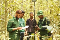
National Forest Monitoring (NFM) is a systematic process involving the collection, analysis, and periodic reporting of forest-related data to track changes in forests over time....
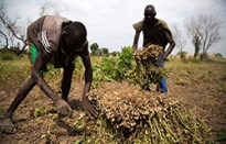
The use, distribution and temporal dynamics of natural resources as well as human activities is fundamental information needed for sustainable land management, particularly in zones...
近期出版物
28 February 2024
28 February 2024

