土地资源规划工具箱
该类工具在土地评估过程中突出了生物自然属性(气候、土壤、地形、水等)及其相互作用。大多数情况下,主要基于生物自然属性的输出结果会引导用户选择合适的土地利用方案。土地适宜性和相似性分析是典型的例子。包括描述土地评价的原理、方法和准则的文件,以及基于特定用途、能力或潜力、肥力限制和管理、产量、生产力、物理和化学性质的不同的土壤分类工具。复杂或简化的作物生长和产量预测模型也属于这一类。
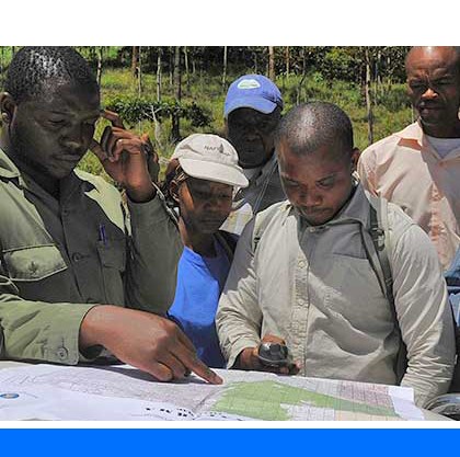
该类工具利用生物自然特征和社会经济条件作为输入信息,并通常包括参与式土地利用规划的原理、方式和方法,其总体目标是实现所有利益相关者互利共赢。
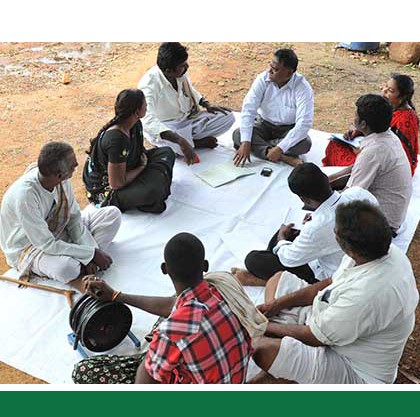
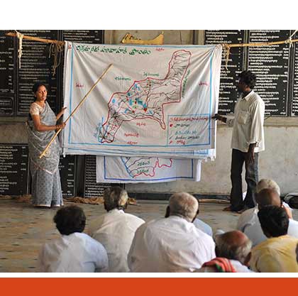
该类工具突出了土地利用规划所需要的社会和经济环境特征,包括参与决策的方式和方法。这些工具也可以考虑生物自然条件,但不作深度考虑。

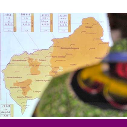
该类包括可促进土地评价和土地利用规划的数据库,通过为这些过程提供输入信息而实现。这些数据库提供了多种地图和数据,包括土壤和地形特征、土地退化、土地覆盖、土地利用、气候数据(包括未来的预测)、作物和产量、粮食、农业、水资源、植物物种对特定环境的适应性/适宜性、关于贫穷、人口、职位和性别的社会经济数据和统计数据
该类工具并不产生直接用于土地评估和土地利用规划的结果。但它提供了各种类型的数据,可用于土地评价研究和作为土地利用规划的输入数据集。
Number of records: 171

GLADA is an attempt to follow up on the GLASOD study through a more detailed and more accurate global assessment of the status and trends of land degradation and the identification of hotspots suffering extreme constraints or at severe risk, as well as areas where degradation...
Type: Documentation/Manuals
Scale: Global, National
Thematic areas: Land degradation, Remote sensing
User Category: 技术专家, 科学顾问
Global Agroecological Zones (GAEZ) is both a methodology for assessing global land resources and a spatial database. The methodology has been jointly developed over the past 30 years by FAO and the International Institute for Applied Systems Analysis (IIASA) and is explained in the Model Documentation....
Type: Data
Scale: Global, Regional, National, Sub-national/Province/District
Thematic areas: Climate, Crops - suitability, Land use/cover, Soils - distribution and properties
User Category: 技术专家, 科学顾问
WOCAT is an established global network which supports innovation and decision-making processes in sustainable land management (SLM). WOCAT has developed standardized tools for documenting, monitoring, evaluating, and sharing know-how on Sustainable Land Management (SLM) – as well as for disseminating this know-how around...
Type: Crowdsourcing,Data,Documentation/Manuals,Questionnaire/Survey
Scale: Sub-national/Province/District, Locality/Farm/Site, Watershed/Basin/Landscape
Thematic areas: Soils - management and conservation
User Category: 技术专家, 科学顾问, 协助人员, 利益相关者
Terrestrial Ecoregions of the World (TEOW) is a map with a bio-geographic regionalization of the Earth's terrestrial biodiversity. The bio-geographic units are eco-regions, which are defined as relatively large units of land or water containing a distinct assemblage of natural communities sharing a large majority of species, dynamics, and...
Type: Documentation/Manuals,Maps/GIS
Scale: Global, Regional, National, Sub-national/Province/District
Thematic areas: Land use/cover, Topography
User Category: 技术专家, 科学顾问, 政策制定者, 协助人员
The Storie Index is a semi-quantitative method for evaluating potential soil productivity by multiplying ratings for individual soil attributes. The rated attributes are the soil profile, essentially the features of the subsurface layers (factor A), the texture of the surface soil (factor B), the slope (factor C), and conditions of...
Type: Documentation/Manuals
Scale: Locality/Farm/Site, Watershed/Basin/Landscape
Thematic areas: Land evaluation
User Category: 技术专家, 利益相关者
Soil potential ratings (SPR) are classes that indicate the relative quality of a soil for a particular use as compared with those of other soils in a given area. The following are considered in soil potential ratings: yield or performance level, the relative cost of applying modern technology to minimize...
Type: Framework/Guidelines
Scale: Sub-national/Province/District, Locality/Farm/Site, Watershed/Basin/Landscape
Thematic areas: Soils - distribution and properties
User Category: 技术专家, 利益相关者
SOTER is a standard for developing soil and terrain databases, which consist of a map (in GIS polygon format) that delineates the SOTER map units and a set of tables in a relational database (in MS Access or PostGreSQL format) with terrain and soil data. The information in the...
Type: Data
Scale: Regional, National, Sub-national/Province/District
Thematic areas: Soils - distribution and properties
User Category: 技术专家
SoilGrids is (i) a system for automated mapping of soil properties based on global soil profile and covariate data and machine learning algorithms and (ii) a collection of updatable soil property and class maps of the world at two spatial resolutions: 1 km and 250 m. The statistical models...
Type: Data,Documentation/Manuals
Scale: Global, Regional, National, Sub-national/Province/District
Thematic areas: Soils - distribution and properties
User Category: 技术专家

QGIS is a user-friendly Open Source Geographic Information System (GIS) licensed under the GNU General Public License. It runs on Linux, Unix, Mac OSX, Windows and Android and supports numerous vector, raster, and database formats and functionalities. The program’s core functionality is extended through plugins (e.g....
Type: Software
Scale: Global, Regional, National, Sub-national/Province/District, Locality/Farm/Site, Watershed/Basin/Landscape
Thematic areas: General
User Category: 技术专家
New_LocClim is a software program and database that provides estimates of average climatic conditions at locations for which no observations are available. Besides providing climatic characteristics at individual points, the software offers the possibility of producing climate maps from user provided station data, or where such stations are not...
Type: Data
Scale: National, Sub-national/Province/District, Watershed/Basin/Landscape
Thematic areas: Climate
User Category: 技术专家, 科学顾问, 利益相关者