土地资源规划工具箱
该类工具在土地评估过程中突出了生物自然属性(气候、土壤、地形、水等)及其相互作用。大多数情况下,主要基于生物自然属性的输出结果会引导用户选择合适的土地利用方案。土地适宜性和相似性分析是典型的例子。包括描述土地评价的原理、方法和准则的文件,以及基于特定用途、能力或潜力、肥力限制和管理、产量、生产力、物理和化学性质的不同的土壤分类工具。复杂或简化的作物生长和产量预测模型也属于这一类。
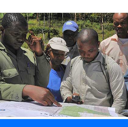
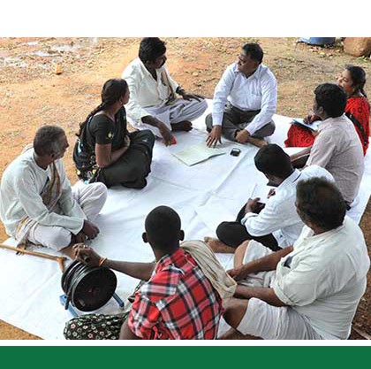
该类工具利用生物自然特征和社会经济条件作为输入信息,并通常包括参与式土地利用规划的原理、方式和方法,其总体目标是实现所有利益相关者互利共赢。
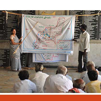
该类工具突出了土地利用规划所需要的社会和经济环境特征,包括参与决策的方式和方法。这些工具也可以考虑生物自然条件,但不作深度考虑。

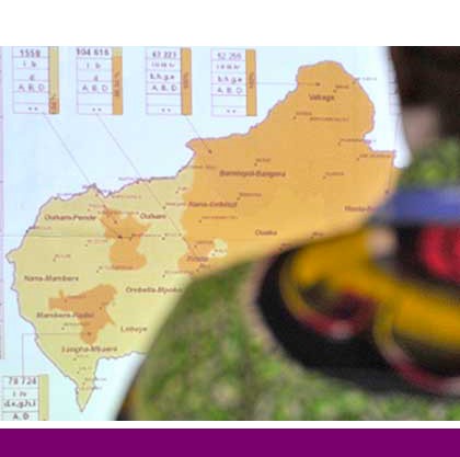
该类包括可促进土地评价和土地利用规划的数据库,通过为这些过程提供输入信息而实现。这些数据库提供了多种地图和数据,包括土壤和地形特征、土地退化、土地覆盖、土地利用、气候数据(包括未来的预测)、作物和产量、粮食、农业、水资源、植物物种对特定环境的适应性/适宜性、关于贫穷、人口、职位和性别的社会经济数据和统计数据
该类工具并不产生直接用于土地评估和土地利用规划的结果。但它提供了各种类型的数据,可用于土地评价研究和作为土地利用规划的输入数据集。
Number of records: 32

This guidebook is part of a series of publications UNDP is developing under its Territorial Approach to Climate Change (TACC) platform to provide guidance to regional governments on climate change planning. Its specific objective is to support sub-national areas (“territories”) to become resilient to anticipated climate...
Type: Educational materials,Framework/Guidelines
Scale: Sub-national/Province/District
Thematic areas: Climate, Land management/planning
User Category: 政策制定者
The TerrAfrica partnership between FAO, the World Bank, NEPAD and other implementing agencies offers a knowledge platform for sharing lessons and developing tools and learning materials for scaling up and mainstreaming sustainable land management (SLM) into development planning and relevant sectoral and investment plans, portfolios and...
Type: Documentation/Manuals,Framework/Guidelines
Scale: National, Sub-national/Province/District, Watershed/Basin/Landscape
Thematic areas: Land management/planning
User Category: 技术专家, 科学顾问, 政策制定者
The Spatial Planning and Monitoring of Landscape Interventions (SPMLI) publication is one of the training manuals developed as part of the TerrAfrica program. It is designed to stimulate the use of maps in cross-sectoral collaborations to locate, design and monitor interventions in rural landscapes. The manual provides guidance on...
Type: Documentation/Manuals,Framework/Guidelines
Scale: Locality/Farm/Site, Watershed/Basin/Landscape
Thematic areas: Land management/planning
User Category: 技术专家, 协助人员, 利益相关者
Rapid Rural Appraisal (RRA) is generally described as a systematic but semi-structured activity carried out in the field by a multidisciplinary team, designed to obtain new information and to formulate new hypotheses about rural life. The RRA methodology was developed to overcome the disadvantages of formal survey methods in rural...
Type: Framework/Guidelines
Scale: Locality/Farm/Site, Watershed/Basin/Landscape
Thematic areas: Farming systems
User Category: 技术专家, 协助人员
This FAO publication explains concepts relevant to integrated planning, important elements to consider in such approach, issues to be resolved, objectives and implementation, and institutional aspects .Key concepts for Integrated planning are defined: land, land resources and other environmental resources to be considered in land use planning, zoning and links...
Type: Framework/Guidelines
Scale: National, Sub-national/Province/District, Locality/Farm/Site, Watershed/Basin/Landscape
Thematic areas: Land management/planning
User Category: 政策制定者
Land and Water Division Working Paper 6 explains the rationale for the four key principles of participatory planning of natural resource management through the Participatory and Negotiated Territorial Development (PNTD) approach: (1) integrated approach; (2) decentralization; (3) participation; (4) negotiation. 1) Need for integration The need for an integrated approach...
Type: Framework/Guidelines
Scale: National, Sub-national/Province/District, Locality/Farm/Site, Watershed/Basin/Landscape
Thematic areas: Social - participatory approaches
User Category: 政策制定者
A micro-region is a distinct territorial unit with clearly marked boundaries below the regional level, but above the village level, and associated network of different actors from government, local government, the private sector and civil society. Characteristics of good micro-regional planning (MRP) are: (1) it is bottom-up (initiated by the...
Type: Framework/Guidelines
Scale: Watershed/Basin/Landscape
Thematic areas: Land management/planning
User Category: 政策制定者
The Global Partnership on Forest and Landscape Restoration (GPFLR) is a proactive global network that unites governments, organizations, academic/research institutes, communities and individuals under a common goal: to restore the world’s lost and degraded forests and their surrounding landscapes.
Specifically, the GPFLR responds directly to the Bonn...
Type: Framework/Guidelines,Maps/GIS
Scale: Locality/Farm/Site, Watershed/Basin/Landscape
Thematic areas: Forestry - statistics, Land management/planning, Land use/cover
User Category: 技术专家, 科学顾问
The Guidelines for Land Use Planning, published in 1993, summarize experiences gained by FAO on land use planning through numerous field projects and the consensus reached through expert consultations. In the guidelines land use planning is interpreted as the systematic assessment of physical, social and economic factors in such a...
Type: Framework/Guidelines
Scale: National, Sub-national/Province/District, Locality/Farm/Site, Watershed/Basin/Landscape
Thematic areas: Land management/planning
User Category: 政策制定者
LEFSA outlines the development and application of an integrated land evaluation and farming systems analysis sequence. In the present guidelines it is argued that integration of land evaluation and farming systems analysis can substantially improve current practices in land use planning as an aid for sustainable land use and rural...
Type: Framework/Guidelines
Scale: National, Sub-national/Province/District, Watershed/Basin/Landscape
Thematic areas: Farming systems, Land evaluation, Land management/planning
User Category: 技术专家, 科学顾问