项目
下面是粮农组织利用地理空间方法和工具开发的以往和正在开展的农业监测及土地覆被评估项目。
01 March 2021
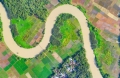
Indonesia is the fourth most populated country in the world and is a major producer of agricultural products. With 45% of the population living in rural areas, agriculture is largely dominated by smallholder farmers (>90%), takes up 32%...
01 September 2020
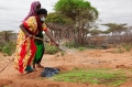
The Somalia Water and Land Information Management (SWALIM) system has been instrumental in addressing knowledge gaps and building capacity in Somalia, which has lagged behind its neighboring countries in terms of scientific and academic institutions. SWALIM has amassed a significant...
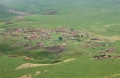
The project “Sustainable Land Management in target landscapes of Central Angola (GCP/ANG/055/GFF)” aims at reversing negative land degradation trends in selected landscapes in Central Angola by combining sustainable and rational approaches to planning, decision-making and land-use management with...
02 March 2020
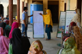
The project “Transforming the Indus Basin with Climate Resilient Agriculture and Climate-Smart Water Management (GCP/PAK/146/GCF)” has the objective to increase resilience to climate change among the most vulnerable farmers in the Indus Basin and to strengthen government’s capacity to support...
07 October 2019
Since the presentation of the National Action Plan (NAP) in 2005, the legal framework, planning and institutional processes in areas related to the United Nations Convention to Combat Desertification (UNCCD) have changed in Uruguay. In this context, the...