土地资源规划工具箱
该类工具在土地评估过程中突出了生物自然属性(气候、土壤、地形、水等)及其相互作用。大多数情况下,主要基于生物自然属性的输出结果会引导用户选择合适的土地利用方案。土地适宜性和相似性分析是典型的例子。包括描述土地评价的原理、方法和准则的文件,以及基于特定用途、能力或潜力、肥力限制和管理、产量、生产力、物理和化学性质的不同的土壤分类工具。复杂或简化的作物生长和产量预测模型也属于这一类。
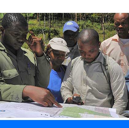
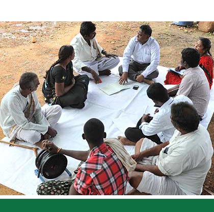
该类工具利用生物自然特征和社会经济条件作为输入信息,并通常包括参与式土地利用规划的原理、方式和方法,其总体目标是实现所有利益相关者互利共赢。
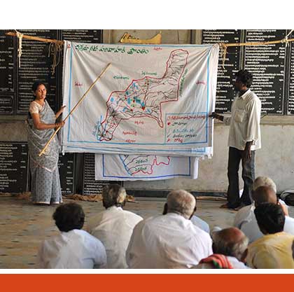
该类工具突出了土地利用规划所需要的社会和经济环境特征,包括参与决策的方式和方法。这些工具也可以考虑生物自然条件,但不作深度考虑。

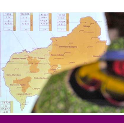
该类包括可促进土地评价和土地利用规划的数据库,通过为这些过程提供输入信息而实现。这些数据库提供了多种地图和数据,包括土壤和地形特征、土地退化、土地覆盖、土地利用、气候数据(包括未来的预测)、作物和产量、粮食、农业、水资源、植物物种对特定环境的适应性/适宜性、关于贫穷、人口、职位和性别的社会经济数据和统计数据
该类工具并不产生直接用于土地评估和土地利用规划的结果。但它提供了各种类型的数据,可用于土地评价研究和作为土地利用规划的输入数据集。
Number of records: 171

The Soil-Landscape Estimation and Evaluation Program (SLEEP) is a software tool for use in the ArcGIS-environment developed to predict soil attributes and provide inputs to the Soil and Water Assessment Tool (SWAT). The latter is used to simulate stream flow, crop yield, sediment transport and nutrient
Type: Model
Scale: Watershed/Basin/Landscape
Thematic areas: Soils - distribution and properties
User Category: 技术专家, 模型建立者
The System of Environmental-Economic Accounting (SEEA) is a framework that integrates economic and environmental data to provide a more comprehensive and multipurpose view of the interrelationships between the economy and the environment and the stocks and changes in stocks of environmental assets. It contains internationally agreed standard concepts, definitions,...
Type: Framework/Guidelines
Scale: National
Thematic areas: Economy - statistics, Environment - statistics
User Category: 技术专家

The SEDLAC web site contains statistics on poverty and other distributional and social variables from all Latin American and several Caribbean (LAC) countries. All statistics are computed from microdata from major household surveys carried out in these countries. Statistics are updated periodically.
One of SEDLAC’s objectives is to...
Type: Data,Questionnaire/Survey
Scale: National
Thematic areas: Social - statistics
User Category: 技术专家, 科学顾问, 政策制定者
The World Food Program (WFP) Handbook on Safe Access to Firewood and Alternative Energy (SAFE) provides guidance on fuel-efficient programming and typically includes some or all of the following activities:
Assessment of fuel and cooking needs;
Provision of fuel-efficient stoves and alternative sources of fuel (including local production of...
Type: Documentation/Manuals
Scale: Regional, National, Sub-national/Province/District
Thematic areas: General
User Category: 协助人员, 利益相关者

This resource documents the farming systems development (FSD) approach in community planning implemented in the Philippines between 1995 and 2002 through FAO project “Sustainable Agrarian Reform Communities–Technical Support to Agrarian Reform and Rural Development” (SARC–TSARRD).
FSD is a total development approach that aims to improve the productivity, income and...
Type: Documentation/Manuals
Scale: Locality/Farm/Site, Watershed/Basin/Landscape
Thematic areas: Land management/planning, Social - participatory approaches
User Category: 协助人员, 利益相关者
This approach uses a participatory mapping method involving community members to rapidly identify and map ecosystem services and changes in their supply across multiuse agricultural landscapes. The mapping exercise involves using free, high resolution satellite imagery from Google Earth Pro, which presents an aerial view of...
Type: Framework/Guidelines,Questionnaire/Survey
Scale: Watershed/Basin/Landscape
Thematic areas: Farming systems, Remote sensing, Social - participatory approaches
User Category: 科学顾问, 协助人员, 利益相关者

The Pan-European Soil Erosion Risk Assessment model (PESERA) offers a methodology to assess regional risk of soil erosion by water. The model is intended as a regional diagnostic tool, replacing comparable existing methods, such as the Universal Soil Loss Equation (USLE), which are less suitable for European conditions...
Type: Model
Scale: Regional, National, Sub-national/Province/District
Thematic areas: Soils - distribution and properties
User Category: 技术专家, 科学顾问
The Mediterranean Land Evaluation Information System (Micro-LEIS) is an agro-ecological decision support system that contains a set of useful tools for decision-making in a wide range of agro-ecological schemes. The design philosophy follows a toolkit approach, integrating many software tools: databases, statistics, expert systems, neural networks, Web and GIS...
Type: Model
Scale: Sub-national/Province/District, Watershed/Basin/Landscape
Thematic areas: Land degradation, Land evaluation
User Category: 技术专家, 科学顾问
The Land Use Planning Catalogue for Tajikistan (LUPC-TAJ) has been developed to provide “food for thought” for the local population in the form of easily and understandably presented options. The description of options is not exhaustive but should provide ideas on improving land use practice, promote thinking outside traditional...
Type: Educational materials,Framework/Guidelines,Questionnaire/Survey
Scale: Regional, National
Thematic areas: Land management/planning
User Category: 协助人员, 利益相关者
This report outlines a procedure for rating the suitability of land for production of spring-seeded small grains (and hardy oilseeds) in Canada.
The system is interpretive and based on limitations for crop production. The framework of the system is suitable for all crops but specific rating factors are developed,...
Type: Documentation/Manuals
Scale: Locality/Farm/Site, Watershed/Basin/Landscape
Thematic areas: Land evaluation
User Category: 技术专家, 科学顾问, 利益相关者