الفعاليات
ستجد هنا معلومات عن الفعاليات والحلقات الدراسية والاجتماعات والمؤتمرات القادمة بشأن المعلومات الجغرافية المكانية التي ستنظمها المنظمة أو ستشارك فيها بشكل نشط.
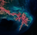
Training on accuracy assessment of the updated national land cover of JORDAN
From 19 September 2017 to 21 September 2017
From 19 September 2017 to 21 September 2017

The training course on land cover mapping and accuracy assessment is organized by the Geospatial Unit of FAO (CBDS) under the Regional Food Security Analysis Network (RFSAN) within the Project “Strengthening of an inclusive food security information network...
GEOGLAM meeting
From 04 September 2017 to 08 September 2017
From 04 September 2017 to 08 September 2017
GEOGLAM is the Group on Earth Observations Global Agricultural Monitoring Initiative. The main objective of GEOGLAM is to reinforce the international community's capacity to produce and disseminate relevant, timely and accurate forecasts of agricultural production at national, regional...