FAO.org
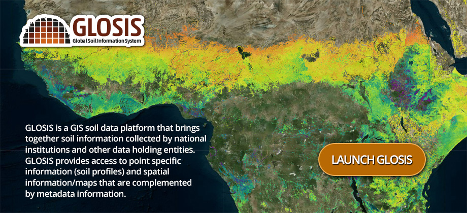
Introducing the Global Soil Information System
GSP's open-access Global Soil Information System is a spatial data infrastructure that brings together soil information collected by national
institutions and other data holding entities. High quality soil information and data in terms of comparability and spatial coverage are of
paramount importance to address global, national and field-scale challenges. GLOSIS connects Soil Information Systems and provides a decentralized global soil data platform that is nationally/regionally federated and globally harmonized. It delivers a spatial data infrastructure that allows national institutes to compile and share their own soil data and enables end-users to perform comparative studies on environmental issues that are trans-boundary. The implementing body of GLOSIS is the International Network of Soil Information Institutions (INSII). find out more.
Latest stories
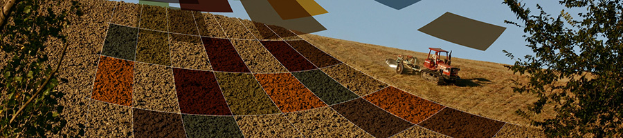
FAO's Global Soil Partnership kicks start a country-driven process to map soil nutrients and soil nutrient budgets at all scales
11/08/2022
Rapidly increasing fertilizer prices as well as growing food insecurity driven by the global COVID-19 pandemic, current conflicts as well as intensifying climatic patterns have exacerbated the need for informed decision-making based on digital soil mapping and monitoring.
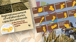
Unlocking the Potential of Soil Data in the NENA Region: Findings of the FAO's Technical Cooperation Programme
09/03/2023
A two-day regional event on sustainable soil management in the Near East and North Africa region was held on the 7 and 8 March 2023 in Muscat, the Sultanate of Oman.
Training workshop on ‘Reporting Soil Carbon Stock Change in National Greenhouse Gas Inventories’
16/12/2022
An online training workshop on ‘Reporting Soil Carbon Stock Change in National Greenhouse Gas Inventories’ took place at the perfect time – between the UN Climate Conference COP27– where the establishment of Sharm el-Sheikh joint work on implementation of climate action on agriculture and food security was agreed upon, and the World Soil Day on 5 December.
In action

GBSmap
Global Map of Black Soils V1.1
The Global Black Soil Distribution Map (GBSmap) uses a country-driven approach based on the endorsed definition of black soils.
GSOCseq
Global Soil Organic Carbon Sequestration Potential Map V1.1
The estimation of topsoil SOC sequestration potential in agriculture under 4 soil management scenarios.
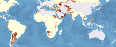
GSASmap
Country-driven Global Map of Salt-affected Soils V1.0
This product collects and harmonizes contributions from 118 countries with 257 419 locations of measured soil data.
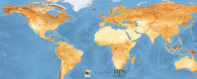
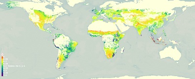
GSOCmap
The first global soil organic carbon data set of GLOSIS
The Global Soil Organic Carbon map has been produced by countries through a participatory process.
INSII
The International Network of Soil Information Institutions
Nationally mandated institutions and GSP partners developing the Global Soil Information System.

SoilSTAT
A common denominator for soil information systems
SoilSTAT is a system for monitoring, forecasting and reporting periodically on the status of global soil resources.
Regional and National Soil Information Systems
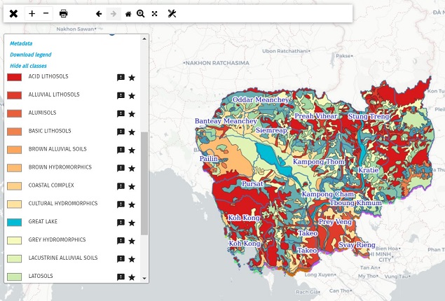
CamSIS
Cambodian Soil Information System
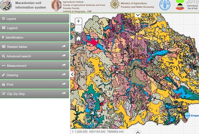
MaSIS
Macedonian Soils Information System
SISLAC
Latin America Soil Information System
Capacity development
Building upon the successful launch of four global soil property maps FAO's Global Soil Partnership (GSP) has perfected its country-driven approach over the years. This process focuses on leveraging, enhancing and promoting national expertise. Unlike previous top-down global
mapping exercises, countries are supported in generating meaningful soil information themselves, ensuring both the sovereignty of national data and the effective bridging of global data gaps.
Countries: the International Network of Soil Information Institutions (INSII)
One hundred twenty-two countries form part of the GSP’s International Network of Soil Information Institutions (INSII) and are involved over the entire workflow, from concept development to final endorsement of the global maps. With its global outreach, its direct work with governments, and its consideration of local expertise and needs, the GSP has proven proficient at overcoming soil data gaps and fragmentation in a uniquely participatory way. Find out more.

1400+
National experts

72+
Training workshops

127+
Countries
Online courses: EduSoils
Aware of new trends in education and the growing demand for soil-related information, the GSP offers e-learning courses, video tutorials and training materials through the open source Educational Platform 'EduSoils'. Find out more.