土地资源规划工具箱
该类工具在土地评估过程中突出了生物自然属性(气候、土壤、地形、水等)及其相互作用。大多数情况下,主要基于生物自然属性的输出结果会引导用户选择合适的土地利用方案。土地适宜性和相似性分析是典型的例子。包括描述土地评价的原理、方法和准则的文件,以及基于特定用途、能力或潜力、肥力限制和管理、产量、生产力、物理和化学性质的不同的土壤分类工具。复杂或简化的作物生长和产量预测模型也属于这一类。
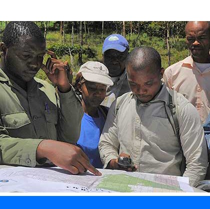
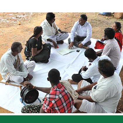
该类工具利用生物自然特征和社会经济条件作为输入信息,并通常包括参与式土地利用规划的原理、方式和方法,其总体目标是实现所有利益相关者互利共赢。
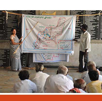
该类工具突出了土地利用规划所需要的社会和经济环境特征,包括参与决策的方式和方法。这些工具也可以考虑生物自然条件,但不作深度考虑。
该类包括可促进土地评价和土地利用规划的数据库,通过为这些过程提供输入信息而实现。这些数据库提供了多种地图和数据,包括土壤和地形特征、土地退化、土地覆盖、土地利用、气候数据(包括未来的预测)、作物和产量、粮食、农业、水资源、植物物种对特定环境的适应性/适宜性、关于贫穷、人口、职位和性别的社会经济数据和统计数据
该类工具并不产生直接用于土地评估和土地利用规划的结果。但它提供了各种类型的数据,可用于土地评价研究和作为土地利用规划的输入数据集。
Number of records: 171

The Crop Monitoring Box (CM_Box) offers full documentation to the AgroMetShell software suite as well as a manual on the various aspects of relevance to crop forecasting. It contains introductory sections on crop yield forecasting, crop modelling, establishing a crop monitoring network, collecting weather and crop data and calculating...
Type: Documentation/Manuals
Scale: National, Sub-national/Province/District
Thematic areas: Climate, Crops - productivity
User Category: 技术专家, 模型建立者

CLIMWAT is a climatic database to be used in combination with the computer program CROPWAT. It provides the meteorological data from over 5000 climate stations worldwide, which allow CROPWAT to calculate crop water requirements, irrigation supply and irrigation scheduling for various crops. CLIMWAT provides for the stations in its database...
Type: Data
Scale: Locality/Farm/Site
Thematic areas: Climate
User Category: 技术专家
The Global Precipitation Climatology Centre (GPCC) is a specialized Centre supporting climate monitoring and research, operated by the Deutscher Wetterdienst under the auspices of the World Meteorological Organization. GPCC disseminates global daily or monthly precipitation data (ftp://ftp-anon.dwd.de/pub/data/gpcc/html/download_gate.html) in spatial resolutions (from 0.5° to 2.5°, or roughly 50-250 km) for...
Type: Data
Scale: Global, Regional, National
Thematic areas: Climate
User Category: 技术专家
The Canadian Soil Information Service (CanSis) is a dissemination platform for Canada’s land resource data. It provides public access to the National Soil Database (NSDB), which contains soil, landscape, and climatic data for all of Canada and serves as the national archive for land resources information collected by federal and...
Type: Data
Scale: National
Thematic areas: Climate, Soils - distribution and properties
User Category: 技术专家
AQUASTAT is FAO’s global information system on water and agriculture. It collects, analyses and disseminates data and information by country and by region. Its aim is to provide policy-makers, decision-makers and researchers with the most accurate and up-to-date information available on water resources and agricultural water management. AQUASTAT contains country...
Type: Data
Scale: National
Thematic areas: Water - statistics
User Category: 科学顾问, 政策制定者
AquaCrop is a crop growth model developed by the Land and Water Division of FAO to assess the effect of environment and management on crop production. AquaCrop simulates yield response to water of herbaceous crops, and is particularly suited to address conditions where water is a key limiting factor in...
Type: Model
Scale: Locality/Farm/Site
Thematic areas: Water - productivity
User Category: 技术专家, 模型建立者
ALES (Automated Land Evaluation System) is a computer program that allows land evaluators to build their own expert systems to evaluate land according to the FAO Framework for Land Evaluation of 1976. The entities evaluated by ALES are map units, which may be defined either broadly (as e.g. in reconnaissance...
Type: Framework/Guidelines,Software
Scale: Locality/Farm/Site, Watershed/Basin/Landscape
Thematic areas: Land evaluation
User Category: 技术专家, 模型建立者
AgroMetShell is a software toolbox for assessing the impact of climatic conditions on crops, analyzing climate risks and performing regional crop forecasting using statistical and crop modeling approaches. It allows an integrated analysis of ground data and low resolution satellite information under a common interface. The program includes a database...
Type: Software
Scale: National, Sub-national/Province/District
Thematic areas: Climate
User Category: 技术专家, 模型建立者
Agro-MAPS is an interactive web-based information system which contains statistics on primary food crops, aggregated by sub-national administrative districts. It contains basically tabular data, presented on a map background, on crops. Agro-MAPS allows to select by country, eventually sub-national unit (if available for the selected year), crop, crop theme (production,...
Type: Data
Scale: National, Sub-national/Province/District
Thematic areas: Crops - distribution
User Category: 科学顾问, 政策制定者
AFSIS is a data dissemination platform that contains digital soil maps, soil profile databases, remote sensing and field data for Africa. Digital soil maps are spatial databases of soil properties generated through the integration of field and laboratory methods coupled with spatial and non-spatial soil inference systems. Digital soil mapping...
Type: Data,Maps/GIS
Scale: National, Sub-national/Province/District, Watershed/Basin/Landscape
Thematic areas: Soils - distribution and properties
User Category: 技术专家, 科学顾问