FAO CBDS supporting innovative capacity building on land cover classification

The recent availability of new satellite optical and radar Earth Observation missions, coupled with the development of Artificial Intelligence (AI) pattern recognition technologies and integrated in cloud-based platforms such as SEPAL and Google Earth Engine) have completely changed how we are able to assess and interpret our world. This process is now more efficient, accurate, timely and cost-effective than ever. Yet, the ability to interpret and use free available resources and technologies is hampered by the technical capacities of national remote sensing experts that are not able to keep up with a continually evolving technology.
To fill this gap, FAO CBDS is organizing a series of on-the-job trainings to cover all the components of land cover mapping from data acquisition to automatic classification and accuracy assessments. The trainings are modular, allowing each national team to cover only those aspects where capacities need to be enhanced. In addition, the workshops help countries to better identify needs and gaps to assess and monitor natural and human-made resources.
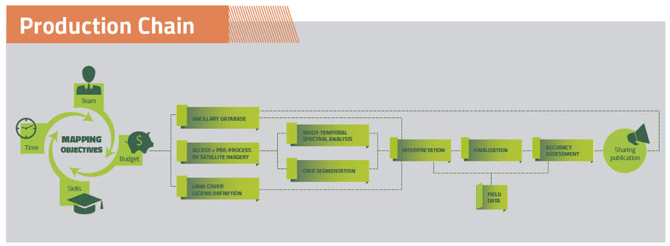
The modules follow the basic production chain of land cover mapping as displayed in the graphics below:
FAO CBDS training cover the following topics:
- Land cover classification systems and standards
- Satellite imagery pre-processing
- Optical imagery
- RADAR (microwave) imagery - Selection of satellite imagery on cloud-computing platforms
- Object-Based Image Analysis
- Artificial Intelligence and Machine Learning for land cover classification
- Land cover, land use and vegetation change detection
- Map accuracy assessment.
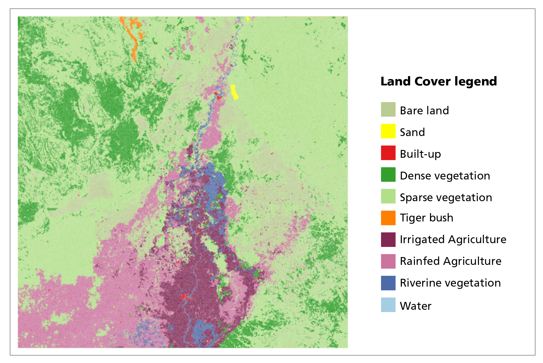
In May 2019, FAO CBDS visited the FAO Somalia team to enhance capacities on the use of radar images (Sentinel-1) and automatic Machine Learning classifiers (i.e. Random Forest). The result of a week of on-the-job training is presented in the image below:
“The use of multi-temporal and multi-sensor remote sensing, coupled with Machine Learning techniques is helping us to better assess the impact of natural disasters on the livelihood of people, particularly in remote areas” concluded Ugo Leonardi, Chief Technical Advisor of the Somalia SWALIM programme.