Land & Water

Land Resources Planning Toolbox

This category of tools gives prominence to biophysical attributes (climate, soil, terrain, water, etc.) and their interactions in the land evaluation process. The output, in most cases, guides the users to suitable options for land use alternatives, based mainly on biophysical attributes. Land suitability and similarity analysis are typical examples. Documents describing principles, approaches and guidelines for land evaluation are included, as well as different tools for classifying soils based on the suitability for a specific use, capability or potential, fertility constraints and management and linkages to yield, productivity, physical and chemical properties. Sophisticated or simplified modelling of crop growth and yield predictions, also fall into this category.

The tools in this category use as inputs information on both biophysical characteristics  and social and economic conditions and generally incorporate principles, approaches and methods of participatory land use planning, with the overall objective of reaching mutually beneficial outcomes for all stakeholders.

The tools in this category give prominence to the characterization of social and economic settings required for land use planning and includes approaches and methods of participatory decision-making. Biophysical conditions may be considered in these tools, but not in depth.

This category includes databases that can facilitate land evaluation and land use planning by providing information that may serve as inputs for the process. These databases provide maps and data on soil and terrain characteristics, land degradation, land cover, land use, climatic data including future projections, crops and yields, food, agriculture, water resources, adaptability/suitability of identified plant species for a given environment, and socio-economic data and statistics on poverty, population, tenure and gender.
This category of tools do not produce results that have direct use for land evaluation and land use planning, but has a supporting role by providing various types of data  that can be used in land evaluation studies and as input data sets for land use planning.

Number of records: 32
The Land Use Dynamics Simulator (LUDAS) is a spatially-explicit, integrated biophysical-socio-economic modelling approach that aims to predict the longer-term impacts of land use/cover changes under different management/planning/policy scenarios. It has been described by
Type: Model
Scale: Sub-national/Province/District, Watershed/Basin/Landscape
Thematic areas: Land management/planning, Land use/cover
User Category: Technical specialist, Scientific advisor, Modeller, Policy maker
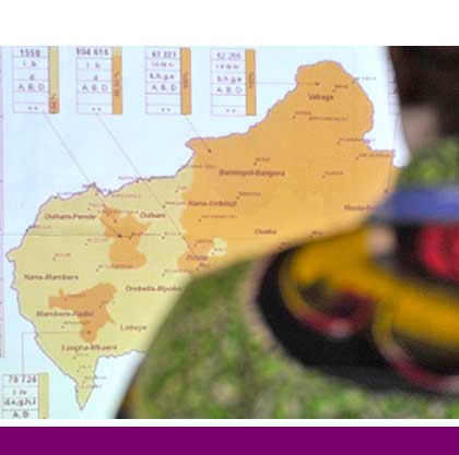
The Keita Project (KEITA) offers a case study of the biophysical and socio-economic impacts of a large-scale, long-term, externally funded, integrated territorial development project to enhance food security and sustainable land management. The Keita Department is located in the center of the Republic of Niger and covers an area...
Type: Documentation/Manuals,Educational materials
Scale: Watershed/Basin/Landscape
Thematic areas: Agriculture - productivity, Land degradation, Social - participatory approaches
User Category: Scientific advisor, Policy maker, Facilitator, Stakeholder
­The main purpose of LADA_LOC is to provide a standard methodological approach and toolkit for the assessment of land degradation processes, their causes and impacts at local level, and in collaboration with local stakeholders and communities. Th­e focus is on human-induced land degradation,...
Type: Documentation/Manuals
Scale: Locality/Farm/Site
Thematic areas: Land degradation, Soils - management and conservation
User Category: Technical specialist, Scientific advisor, Stakeholder
LADA-WOCAT QM  is an evaluation tool for land degradation and the conservation activities undertaken in a country or provinces / regions within a country with added ability to link to a country-level LUS spatial database, thus allowing the production of...
Type: Documentation/Manuals
Scale: National, Sub-national/Province/District
Thematic areas: Land degradation, Soils - management and conservation
User Category: Technical specialist, Scientific advisor, Stakeholder
The Land Use Planning for Low Emission Development Strategy (LUWES) is a platform for developing a multiple stakeholder decision-making process to establish land use plans for sustainable development, which can reduce greenhouse gas emissions from land-based activity while simultaneously maintaining economic growth. It can simulate emissions reduction scenarios within...
Type: Framework/Guidelines
Scale: National, Sub-national/Province/District, Watershed/Basin/Landscape
Thematic areas: Climate, Land management/planning, Land use/cover
User Category: Technical specialist, Scientific advisor, Policy maker
 This resource documents the farming systems development (FSD) approach in community planning implemented in the Philippines between 1995 and 2002 through FAO project  “Sustainable Agrarian Reform Communities–Technical Support to Agrarian Reform and Rural Development” (SARC–TSARRD). FSD is a total development approach that aims to improve the productivity, income and...
Type: Documentation/Manuals
Scale: Locality/Farm/Site, Watershed/Basin/Landscape
Thematic areas: Land management/planning, Social - participatory approaches
User Category: Facilitator, Stakeholder
This approach uses a participatory mapping method involving community members to rapidly identify and map ecosystem services and changes in their supply across multiuse agricultural landscapes. The mapping exercise involves using free, high resolution satellite imagery from Google Earth Pro, which presents an aerial view of...
Type: Framework/Guidelines,Questionnaire/Survey
Scale: Watershed/Basin/Landscape
Thematic areas: Farming systems, Remote sensing, Social - participatory approaches
User Category: Scientific advisor, Facilitator, Stakeholder
 The Land Use Planning Catalogue for Tajikistan (LUPC-TAJ) has been developed to  provide “food for thought” for the local population in the form of easily and understandably presented options. The description of options is not exhaustive but should provide ideas on improving land use practice, promote thinking outside traditional...
Type: Educational materials,Framework/Guidelines,Questionnaire/Survey
Scale: Regional, National
Thematic areas: Land management/planning
User Category: Facilitator, Stakeholder
There are many approaches and entry points for integrated landscape management (ILM). Some are not ‘approaches’ as such, but more or less well-funded international programs with goals to realize across several landscapes. The African Landscape Restoration Initiative or AFR100, the Great Green Wall,...
Type: Educational materials
Scale: National, Sub-national/Province/District
Thematic areas: Land management/planning
User Category: Scientific advisor, Policy maker
This document proposes a land use planning approach for sustainable management of land resources based on an interactive partnership between governments and people. The advocated  approach is centered on the concept of stakeholders and their objectives, and the role of government in creating the conditions within which rural...
Type: Framework/Guidelines
Scale: National, Sub-national/Province/District, Locality/Farm/Site, Watershed/Basin/Landscape
Thematic areas: Land management/planning
User Category: Technical specialist, Scientific advisor, Policy maker
1 2 3 4