
News
FAO urges swift action as La Niña threatens global food security
20/09/2024
The Organization’s Anticipatory Action Plan outlines ways to safeguard millions of people at risk in view of the climate phenomenon’s potential devastating...

News
Sudan: Conflict, access constraints and floods undermine FAO efforts to support agriculture and food security
12/09/2024
From FAO Regional Office for Near East and North Africa
Highlights


The role of agriculture in addressing acute child malnutrition in the African Drylands
29/07/2024
Acute malnutrition is persistently on the rise worldwide, with children suffering its consequences for their whole lives.
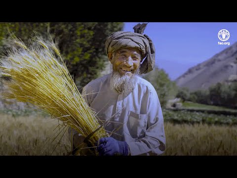
Afghanistan Rural Insight
18/02/2024
Discover Afghanistan's rural views in this engaging video, which showcases farmers' different perspectives. Hear personal perspectives from wheat farmers, livestock owners, vegetable farmers, irrigation canal beneficiaries, and unconditional cash transfer recipients as they tell their stories and shed light on their livelihoods.

In focus
Sustaining peace
Conflict is a major driver of food crises, followed by weather extremes and economic shocks.
_11zon.jpg?sfvrsn=4e8a1f44_11)
In focus
Forced displacement
The increasingly protracted nature of forced displacement calls for sustainable and durable solutions.