FAO hosts the Workshop(s) on Geospatial Technology
17/09/2019

Geospatial technology is an important topic for all FAO staff across all technical areas because it now plays a fundamental role in supporting sustainable and climate resilient agricultural practices to ensure food security.
This two part workshop was organised under the Digital Innovation Dialogues an initiative by FAO CIO Division to increase FAO staff knowledge and capacity and support them in fulfilling their mandates. The workshop (s) was held on the 17th of September 2019, in FAO HQ in Rome, Italy.
In her opening address, Ms. Meng Zeng, FAOs Information Technology Officer, noted that this workshop is timely as meeting FAO’s mandate requires also an investment in technologies, tools and approaches. Geospatial technology plays a fundamental supporting role in achieving food security by identifying and monitoring natural resource use and propose adequate information for policy related solutions.
Ms Meng Zeng also noted, “Digital technologies are key drivers of sustainable development and economic growth in developing countries. Digital agriculture is transforming the food and agriculture sectors at every level, from enabling evidence-based decision-making to bringing youth back to agriculture”
The Geospatial Technology Workshop structureDigital Innovation Dialogues, were launched in early 2019 to serve as a forum for increasing and exchanging knowledge between industry experts and FAO staff actively working on innovation projects or new technologies with the ultimate aim of transforming small-scale successes into large-scale digital services.
The workshop is structured in two parts, (i) the morning session that will focus on the Introduction to Geospatial Technology, and the afternoon session, on advanced workshop session for Geospatial Technologies.
Workshop 1 - Digital Innovation Dialogues – Introduction to Smart Mapping and Geographic Data Visualizations
This workshop focused on exploring, understanding and finding meaning in data by using ArcGIS to build beautiful thematic maps and engaging web apps. Participants were engaged and a number of exercises from the developmental sector were provided.
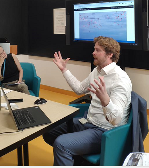 Facilitator: Mr Brendan O'Neill
Workshop 2 - Digital Innovation Dialogues – Advanced Workshop on ArcGIS Pro, Next-Generation Desktop GIS
This session presented the ArcGIS Pro’s powerful capabilities for data visualization, advanced analysis and authoritative data maintenance, on the desktop or in the cloud, in both 2D and 3D.
The session provided best practices and answered questions about transitioning from ArcMap or other desktop GIS apps
About the Geospatial Technology WorkshopThe workshop was facilitated by Mr. Brendan O’Neill from Esri who shared his expertise on the topic.
Previous Digital Innovation Dialogue series have included workshops with Alibaba Cloud and IBM’s The Weather Company.
Are you based in Rome? Do you want to be included in the future Digital Innovation Dialogue series? Write us at [email protected]
The next edition will be on:-
Digital Transformation and Gender Equality at 10:00 - 11:30 FAO HQ Rome, on September the 30th