Projets
On trouvera ici des exemples de projets clos ou en cours sur le suivi agricole et l’évaluation de la couverture des sols qui ont été menés par la FAO au moyen de méthodes et d’outils géospatiaux.
Designing projects and policies to address climate change risks to agriculture often includes a linear process where a limited number of modeling studies are prepared for consideration by a limited number of stakeholders within the government and key beneficiary groups....
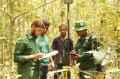
National Forest Monitoring (NFM) is a systematic process involving the collection, analysis, and periodic reporting of forest-related data to track changes in forests over time. Historically, NFM initiatives focused on National Forest Inventories (NFIs), primarily measuring trees within forested areas,...
19 June 2023
The use, distribution and temporal dynamics of natural resources as well as human activities is fundamental information needed for sustainable land management, particularly in zones with protracted crises and severe environmental challenges (e.g. inefficient management of natural resources, frequent natural...
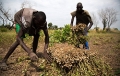
The agriculture sector has played a critical role in the Somali economy, but remains vulnerable to external shocks, which are likely to intensify due to negative impacts of climate change. The country’s economy is mainly based on traditional, primary productive...
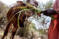
The National Development Plan 9 (NDP-9) identifies critical constraints to the growth of Somalia's livestock sector, including land degradation, deforestation of rangeland, water scarcity, disease prevalence, and inadequate pasture and fodder availability. FAO Somalia has been addressing these issues through...