
Mapping in Tanzania
Land use system
- Land Use Systems of Tanzania (Kagera region)
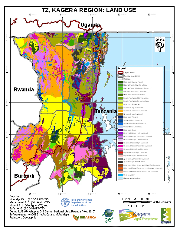
The use of land is the main driver of land degradation. After a planning and data collection phase in collaboration with the Nile Equatorial Lakes Subsidiary Action Program of the Nile Basin Initiative (NBI NELSAP), LUS workshops started 18 November to 3 December 2010 at the GIS centre of the National University of Rwanda (CGIS‐NUR) in Butare with 4 participants experienced in GIS. Further to that, a validation phase was undertaken in 2012- 2013.
Land degradation and SLM mapping
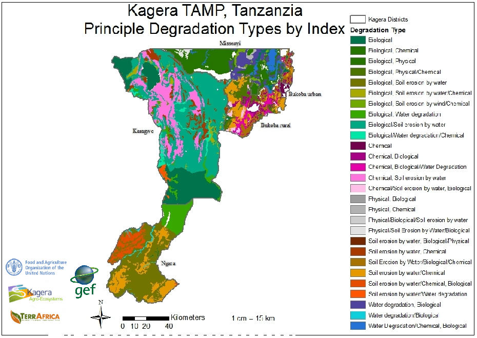 This identification builds on baseline information regarding land degradation (LD) and sustainable land management (SLM) at a geographical scale is undertaken through the LADA-WOCAT Questionnaire for mapping. The LD and SLM maps are built using the Land degradation assessment in drylands (LADA) method including two phases:
- the definition of the units of assessment by building the Land Use Systems (LUS) maps adapted for the use at the Kagera watershed scale and
- the use of the LADA-WOCAT questionnaire for mapping (QM). The participatory assessment of LD and SLM was undertaken in Masaka, Uganda in January 2012 and a validation workshop was organized in April 2012.
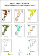
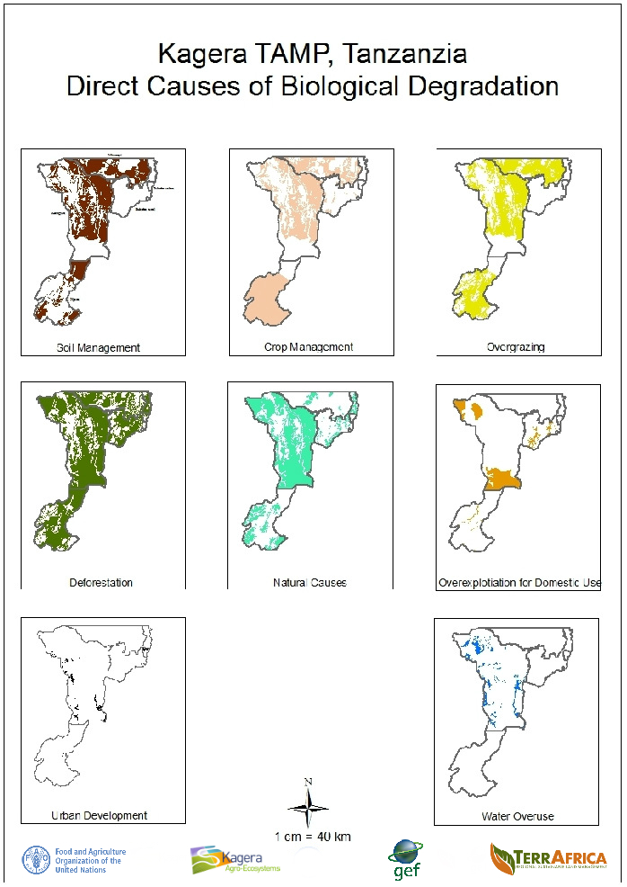
- Tanzania Direct Causes of Biological Degradation

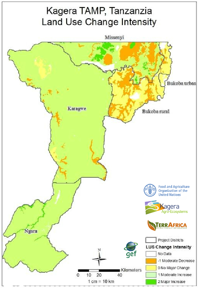
- Tanzania Land Use Change Intensity
The LUS and QM maps were validated both through field visit conducted in 2012 by national and international experts and by comparison with map and satellite images. Also, experts participating at the QM participatory assessment were requested to analyze and assess map quality. During the second workshop, both LUS and QM quality were assessed.
LUS Map authors | |
|---|---|
Kipondya Winfrida | SCC-VI AGROFORESTRY KAGERA PROJECT, BUKOBA |
Godwin Safari Edmund Athanas | SCC-VI AGROFORESTRY MARA PROJECT MUSOMA |
Frank Onesmo Mkiramwinyi | UKINGURU TRAINING INSTITUTE MWANZA |
Elmens Kaboni | MINISTRY OF AGRICULTURE AND FOOD SECURITY, MWANZA |
Kimambe Lyoba | Ministry of Agriculture Food Security and Cooperatives, Land use Planning and Management Department |
* All intellectual property rights, including copyright, in the work performed under the “Transboundary Agro-Ecosystem Management Programme for the Kagera River Basin” (thereafter referred as “Kagera TAMP”) shall be vested in FAO, including without any limitations, the right to use, publish, translate, sell or distribute, privately or publicly, any item or part thereof for non-commercial purposes. FAO hereby grants to the delegated institution(s) of beneficiary country a non-exclusive royalty-free license to use, publish, translate and distribute, privately or publicly, any item or part of the work performed under Kagera TAMP for non-commercial purposes. Delegated institutions In Tanzania are Ukiliguro Research Institute, Ministry of Agriculture, Mlingamo Research Institute, and Nile Basin Initiative.