Noticias
En esta sección se presentan artículos y noticias sobre las actividades que lleva a cabo la FAO con apoyo de tecnología y métodos geoespaciales.
In a significant step towards achieving a land degradation-neutral world, the Food and Agriculture Organization of the United Nations (FAO) has introduced a cutting-edge online module on the SEPAL platform. This initiative is part of the broader UN Decade on...
18 April 2024
The online training session conducted on the 18 April, 2024 focused exclusively on enhancing the visual interpretation skills of our partners from the FAO Yemen and Yemen Remote Sensing Center using the Collect Earth Online (CEO) tool. This specialized training...

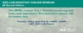
FAO's upcoming webinar on April 17, 2024, titled "Adaptive and innovative tools and approaches for crop mapping," addresses the crucial need for accurate crop mapping to enhance productivity and sustainability.
It aims to explore cutting-edge strategies and technologies such as remote...

In the rapidly evolving landscape of agricultural technology, the capacity to accurately map and monitor crop types and manage soil, land and water resources sustainably has emerged as a cornerstone for enhancing productivity, sustainability, and better productivity for food security....

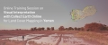
The Food and Agriculture Organization of the United Nations (FAO) Geospatial Unit provided a session on field data collection protocols for crop mapping during a Crop Cutting Survey Training of Trainers (ToT) workshop organized by FAO Afghanistan. The two-day workshop,...