Accessing WaPOR data
WaPOR data access
WaPOR data is accessible in different ways depending on the needs and skill level of the user, as well as the platforms and interfaces they use:

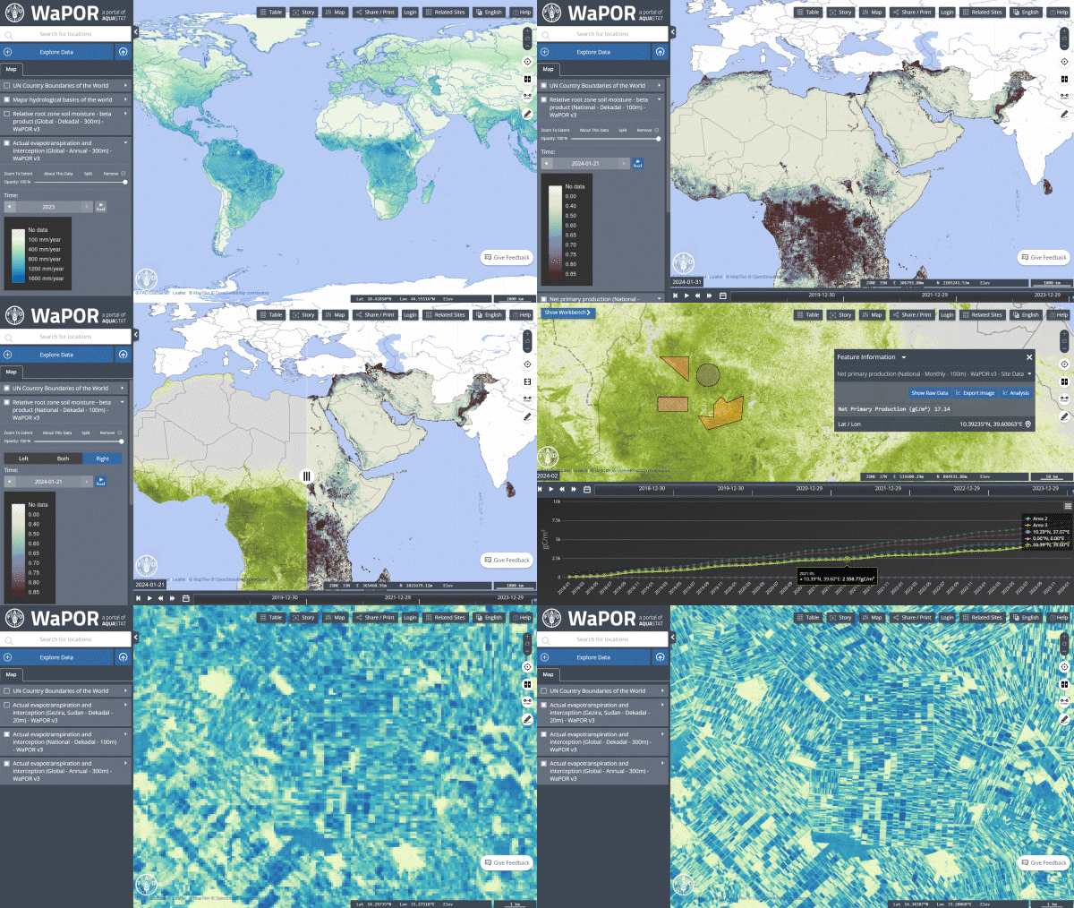
User-friendly and accessible portal designed for the use of WaPOR data. WaPOR version 3 and version 2 available alongside the FAO spatial data catalogue.
The portal enables: comparisons between layers and between time different time frames, analysis, the download of data for a predefined area (drawn or uploaded), among other features.
Similar interface to the WaPOR portal but with more limited analysis and data download options. All the FAO spatial data catalogue is available, including WaPOR version 2 and version 3.
This python package can be added to your data processing pipeline and helps you retrieve and pre-process WaPOR version 3 data for a given area of interest.
Allows the retrieval of WaPOR version 3 data and its integration in applications.
Tutorial on how to download WaPOR data using the API: version 3 download notebook (also available in Google Collab).
Please note that you do not need an API key/token or any credentials.
For developers, please find the API documentation here.
Level 1 and level 2 WaPOR version 3 data are available for GEE users. Level 1 data is available on the public catalogue.
Version 2 data (African and Near East coverage) remains available.
Level 2 data, though not findable on the public catalogue, is available to GEE users through Cloud Optimized GeoTiffs.
Level 2 data is not findable in the catalogue through its search function, but it can be accessed using the datasets' collection identifiers. Same goes for level 1 data, even though it is findable in the public catalogue.
List of collection identifiers:
- projects/UNFAO/wapor/v3/L1-AETI-D
- projects/UNFAO/wapor/v3/L1-E-D
- projects/UNFAO/wapor/v3/L1-I-D
- projects/UNFAO/wapor/v3/L1-T-D
- projects/UNFAO/wapor/v3/L1-NPP-D
- projects/UNFAO/wapor/v3/L1-RET-D
- projects/UNFAO/wapor/v3/L1-RET-E *
- projects/UNFAO/wapor/v3/L2-AETI-D
- projects/UNFAO/wapor/v3/L2-E-D
- projects/UNFAO/wapor/v3/L2-I-D
- projects/UNFAO/wapor/v3/L2-T-D
- projects/UNFAO/wapor/v3/L2-NPP-D
As an example, in the code editor, dekadal level 1 actual evapotranspiration WaPOR data can be loaded using the following statement:
var ic = ee.ImageCollection("projects/UNFAO/wapor/v3/L1-AETI-D");
* Level 1 RET is also available at daily time-step.
Descriptions of the layer acronyms:
AETI: actual evapotranspiration
E: evaporation
T: transpiration
I: interception
NPP: net primary production
RET: reference evapotranspiration
Additional resources listed below allow access and in some cases processing of WaPOR data. They are supplied and maintainted by third parties. In case of difficulties, please reach out directly to the developers whose contacts can be found through the corresponding links:
This plugin provides QGIS users access to all available WaPOR data (v2 and v3) straight into the QGIS canvas. Furthermore, this plugin has a water accounting and productivity component that can support water management by offering the opportunity to the user to calculate key indicators through the creation of maps and reports.
🔗 Github page of the plugin
This QGIS plugin allows the user to download all geospatial data made available by the FAO, including WaPOR data.
Notifications log
⚠️ A correction has been applied to Level 3 net primary production (NPP) and above ground biomass production (AGBP) for the following areas:
|
|
If you have downloaded this data for these areas before March 21 2025, the issue likely led to an under-estimation of these plant production variables. We recommend re-downloading the NPP and AGBP data. If you would like to find out more about this, feel free to reach out to us at [email protected].
Version 3, level 3 (sub-national) data has been re-released due to the need of adjustments in the methodology.
If you have downloaded level 3 data before July 2024, we regret to inform you that the parameters used to calculate it might have led to an under-estimation of the values of WaPOR variables.
Q&A
🗨 Do I need a token for the WaPOR API? What about credentials?
No, you do not need an access token for the WaPOR version 3 API. That used to be the case for WaPOR version 2. Resources refering to the need for a token are now outdated.
Same goes for credentials: they are not required for accessing WaPOR data through an API.
Links to relevant resources here.
🗨 Is it possible to bulk-download the data?
Yes, at the moment this is possible through API programming, the WaPOR python package (WaPOR dl) and through Google Earth Engine (although you might want to perform your analysis on the engine itself given the size of the data).
This page was last updated in August 2025.
🔄 WaPOR portal updates:
18/08/25
Jericho (Palestine) crop maps added to the portal
09/07/25
Daily datasets for Jendouba (Tunisia) added to the WaPOR portal
08/07/25
L3 area for Valle del Cauca (Colombia) added to the portal
28/05/25
Correction of data gaps in northern latitudes
05/05/25
L3 area for Tay Nguyen (Vietnam) added to the portal
21/03/05
⚠️ L3 NPP and AGBP correction. More information in the notifications log.
05/02/25
L3 area for Najaf (Iraq) added to the portal
01/01/25
L3 for Malwatu Oya West Sub Catchment (Sri Lanka) discontinued in the portal
04/09/24
L3 data for Magdalena (Colombia) added to the portal
21/07/24
⚠️ Version 3, level 3 (sub-national) data re-release. More information in the notifications log.
30/05/24
L3 data for Moulay Bousselham (Morocco) added to the portal
14/03/24
L3 data for Mwea and Tana & Bura (Kenya) added to the portal
L3 data for Baixo Limpopo (Mozambique) added to the portal
08/03/24
L3 data for the Nile Delta has been added to the portal
02/02/24
L3 data for Pakistan (Khanewal and Sanghar) has been added to the portal
01/02/24
Improvements in the performance of the time series analysis resulting in significant decrease in response time
15/01/24
WaPOR version 3 level 1 and level 2 are fully available on the portal for the last 6 years (2018 to date)
