Noticias
En esta sección se presentan artículos y noticias sobre las actividades que lleva a cabo la FAO con apoyo de tecnología y métodos geoespaciales.
19 December 2019

Agriculture contributes approximately one-quarter of provincial gross domestic product (GDP) in the Punjab Province. The provincial share is two-third of the total national agricultural output, leading in major commodities meant for food security in the country. The sector employs roughly...
06 December 2019

Improving productivity, increasing climate resilience of agricultural production, and making better informed policies in North Macedonia is now easier thanks to the establishment of national agro-ecological zones and an agro-environmental information system.
22 November 2019
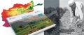
An agro-climatic atlas of Afghanistan has been developed by The Food and Agriculture Organization of the United Nations in close collaboration with the Ministry of Agriculture Irrigation and Livestock through the financial support of the European Union Delegation in the...
18 November 2019

Rome – A recent report on the first phase of the project ‘Improve agriculture monitoring systems through satellite imagery for the Islamic Republic of Iran’, reveals how the introduction of multi-temporal high-resolution satellite imagery means Iran’s Ministry of Agriculture Jahad (MAJ)...

A new atlas expanding the coverage database of the Hashemite Kingdom of Jordan is providing valuable baseline reference data that will support monitoring of land changes in the future.
The atlas, recently published by the FAO geospatial unit. represents...