eLocust2: field data entry & transmission
The use of eLocust2
With the introduction of eLocust2, the locust officer suddenly has a new and powerful tool that can be used in the field during survey and control operations. eLocust2 allows the officer to enter survey and control data into a handheld device that transmits the information via satellite from the field site to the national locust centre. eLocust2 does not rely on batteries that are often difficult to find and keep charged; instead, it uses the vehicle's cigarette lighter for power. eLocust2 can be used in the most remotest parts of the Desert Locust habitat.
With the introduction of eLocust2, the locust officer suddenly has a new and powerful tool that can be used in the field during survey and control operations. eLocust2 allows the officer to enter survey and control data into a handheld device that transmits the information via satellite from the field site to the national locust centre. eLocust2 does not rely on batteries that are often difficult to find and keep charged; instead, it uses the vehicle's cigarette lighter for power. eLocust2 can be used in the most remotest parts of the Desert Locust habitat.

The components of eLocust2
The latest version of eLocust2 consists of a handheld data logger connected to an antenna that is used for receiving GPS signals and transmitting data via satellite. It is rugged and can be used in the extreme conditions typically found in Desert Locust habitats in Africa, the Near East and Southwest Asia.
The latest version of eLocust2 consists of a handheld data logger connected to an antenna that is used for receiving GPS signals and transmitting data via satellite. It is rugged and can be used in the extreme conditions typically found in Desert Locust habitats in Africa, the Near East and Southwest Asia.

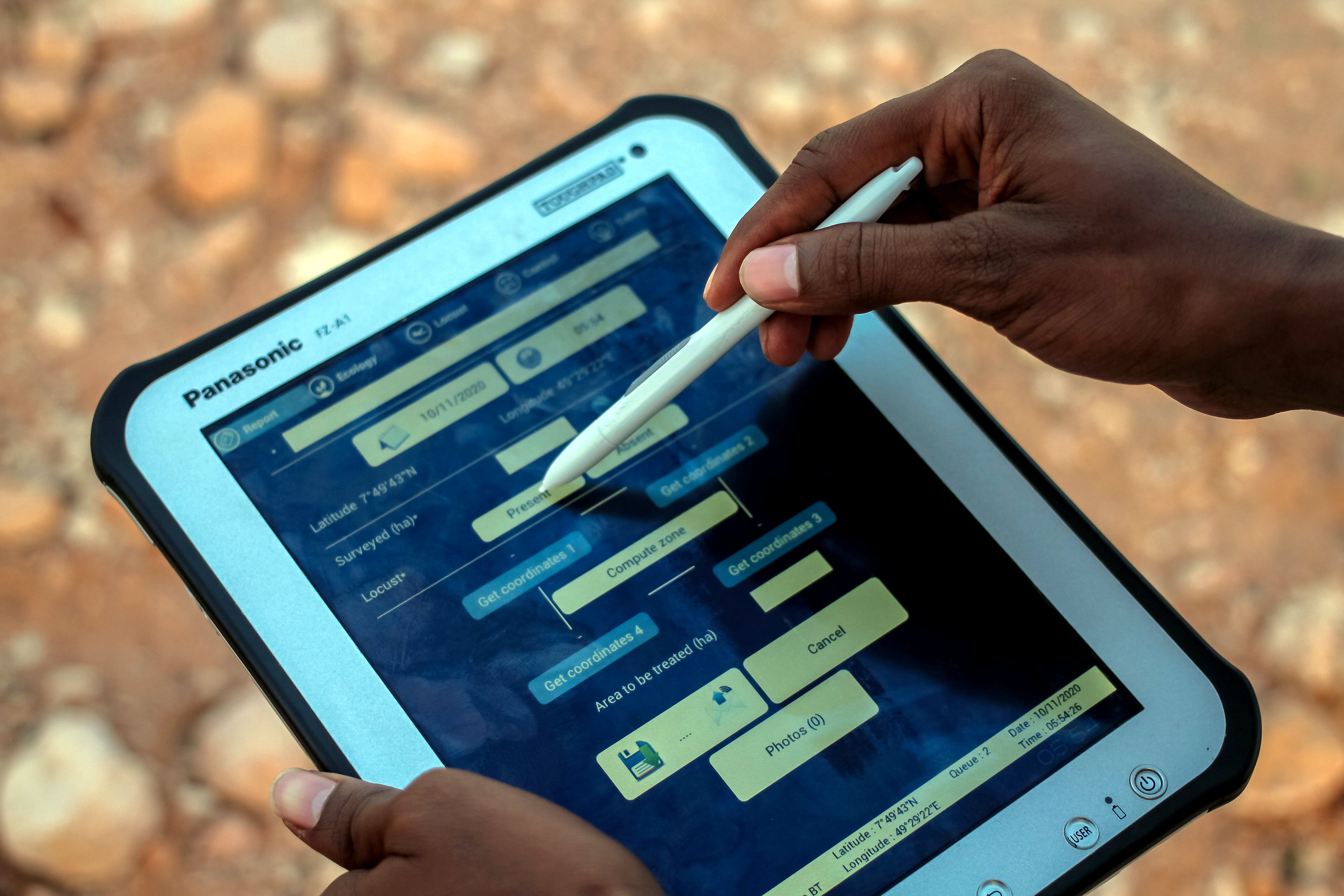
The screen of eLocust2
The field officer enters observations on habitat conditions, rainfall and locusts as well as control results by tapping the screen to add the relevant information. eLocust2 is bilingual - English and French - and relies on simple icons and words so users do not have to be computer literate.
The field officer enters observations on habitat conditions, rainfall and locusts as well as control results by tapping the screen to add the relevant information. eLocust2 is bilingual - English and French - and relies on simple icons and words so users do not have to be computer literate.

The spread of eLocust2
eLocust2 is straightforward and simple to use yet it is a very powerful tool that can record and transmit in real-time the key data required for decision-makers and forecasters. Data is transmitted via satellite or downloaded to a PC so that it can be incorporated into GIS systems used in affected countries and by FAO DLIS for data management and analysis.
eLocust2 is straightforward and simple to use yet it is a very powerful tool that can record and transmit in real-time the key data required for decision-makers and forecasters. Data is transmitted via satellite or downloaded to a PC so that it can be incorporated into GIS systems used in affected countries and by FAO DLIS for data management and analysis.

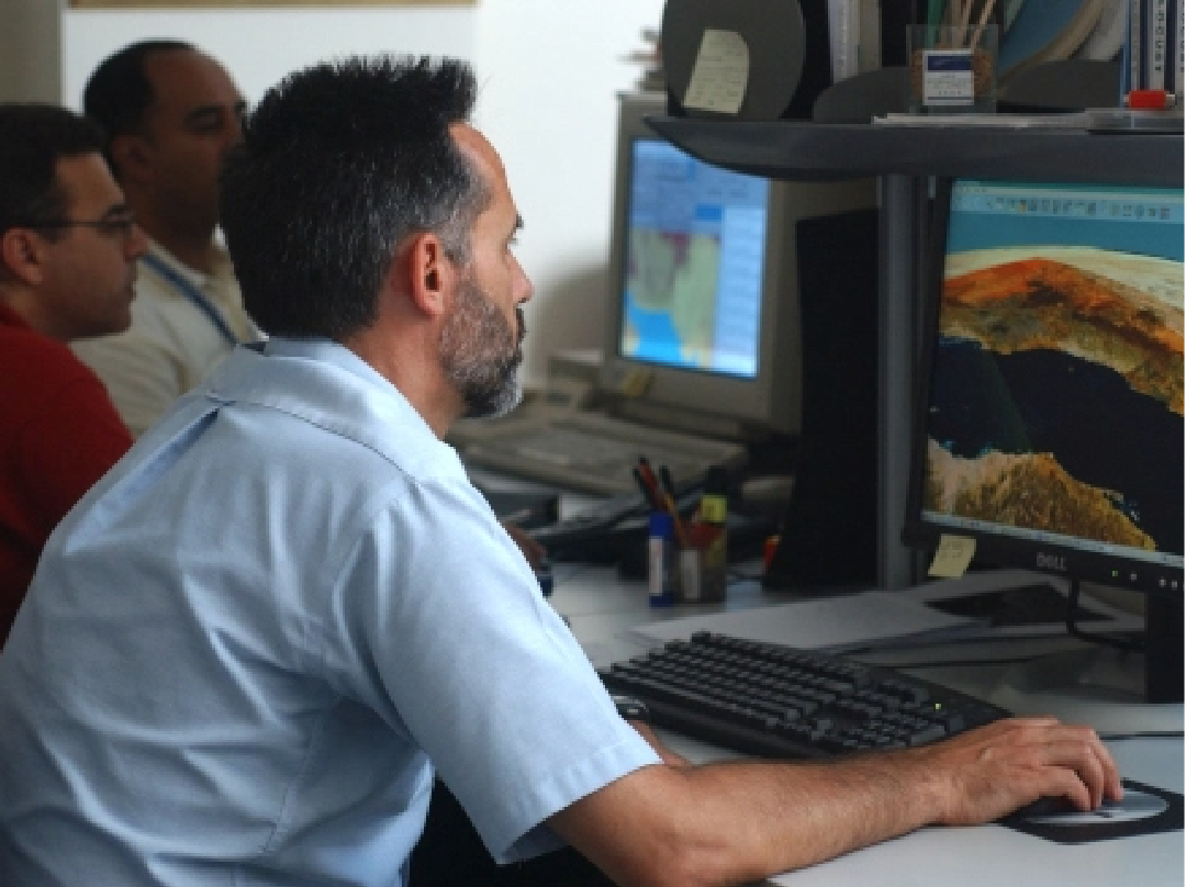
Internet display of eLocust2 data
eLocust2 data transmitted by satellite can be accessed and displayed via the Internet on the Novacom web page. The information is password protected, allowing countries to see only their own data. The data is displayed in tables as well as on maps. The data can also be downloaded from the Internet to the PC at the National Locust Centre.
eLocust2 data transmitted by satellite can be accessed and displayed via the Internet on the Novacom web page. The information is password protected, allowing countries to see only their own data. The data is displayed in tables as well as on maps. The data can also be downloaded from the Internet to the PC at the National Locust Centre.

The original eLocust
eLocust2 replaces the original eLocust that was developed in 2000 by DLIS. eLocust consisted of several peripheral devices (GPS, HF radio and modem) and cables connected to a handheld Psion computer that is no longer manufactured. Nevertheless, the original eLocust proved that an electronic handheld device could be used for data entry but that improvements were required in its simplicity and data transmission. eLocust2 addresses these weaknesses and should become an essential tool in all survey and control operations.
eLocust2 replaces the original eLocust that was developed in 2000 by DLIS. eLocust consisted of several peripheral devices (GPS, HF radio and modem) and cables connected to a handheld Psion computer that is no longer manufactured. Nevertheless, the original eLocust proved that an electronic handheld device could be used for data entry but that improvements were required in its simplicity and data transmission. eLocust2 addresses these weaknesses and should become an essential tool in all survey and control operations.

eLocust2 data visualize on GoogleEarth
This is an example of field data that was recorded and sent via satellite by eLocust2 to the National Locust Centre in Cairo, Egypt by a survey team on the Sinai Peninsula on 30-31 March 2006. The data can be easily displayed on GoogleEarth.
This is an example of field data that was recorded and sent via satellite by eLocust2 to the National Locust Centre in Cairo, Egypt by a survey team on the Sinai Peninsula on 30-31 March 2006. The data can be easily displayed on GoogleEarth.

eLocust2 data from a survey stop in the Sinai Peninsula displayed in GoogleEarth
The 3D functionality of GoogleEarth can help to visualize survey and control data sent by eLocust2 from field teams to their national Locust Centre. Here, data collected at 7:20 AM local time on 30 March 2006 from a remote location on the Sinai Peninsula coast was received in Cairo about ten minutes later.
The 3D functionality of GoogleEarth can help to visualize survey and control data sent by eLocust2 from field teams to their national Locust Centre. Here, data collected at 7:20 AM local time on 30 March 2006 from a remote location on the Sinai Peninsula coast was received in Cairo about ten minutes later.

See also
eLocust3: updated field data entry & transmission
eLocust3 is a handheld device used by national field officers during survey and control operations in countries affected by the Desert Locust
Earth observation
Monitoring rainfall, vegetation and soil moisture from space
Google Earth Engine
Innovative Google technology and free new tools: Google Earth Pro, My Maps, Fusion Tables, and Google Earth Engine, already used by FAO Forestry and being extended for Desert Locust
Early Warning
The basic components that are required for any early warning system to be effective and reliable
Desert Locust Information Service
The Desert Locust Information Service (DLIS) at FAO Headquarters (Rome, Italy)