Innovative monitoring of forest and landscape restoration in the Mediterranean region
Experts from the Mediterranean region gathered at the European Forest Institute Mediterranean Facility headquarters in Barcelona, Spain, to advance forest and landscape restoration to achieve nationally determined contributions.
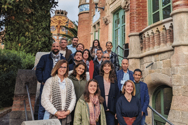
10 November 2023, Barcelona – The regional workshop “Monitoring tools available for forest and landscape restoration in the Mediterranean region” took place with remarkable success in Barcelona, Spain, from 6 to 10 November 2023. The five-day event was organized by the Food and Agriculture Organization of the United Nations (FAO) with the financial support of the Union for the Mediterranean and hosted by the European Forest Institute Mediterranean Facility.
Designed to build the regional capacity to monitor forest and landscape restoration (FLR), this workshop was implemented as a part of the project “The Paris Agreement in action: upscaling forest and landscape restoration to achieve nationally determined contributions” – funded by the International Climate Initiative. It was a unique occasion to gather European Union Mediterranean countries and North African and Near East countries, with a full Mediterranean regional approach.
The training utilized hands-on learning by guiding experts from Italy, Jordan, Lebanon, Morocco, Portugal, Spain, Tunisia and Türkiye in the processes of analysing satellite imagery and collecting land use and land use change data with the latest remote sensing tools for monitoring FLR in the Mediterranean region. Moreover, by facilitating knowledge sharing on personal expertise in the sector, participants benefited from the opportunity to learn about the experiences, challenges and successes of their peers in neighbouring countries from the Mediterranean region.
Key workshop results
The data collection guided by experts of the Global Forest Resources Assessment (FRA) gave way for discourse about the definition of Mediterranean forests and their classification according to FAO land use classes. For example, extreme climatic conditions (e.g. drought) often do not allow Mediterranean tree vegetation to reach the minimum density or height to be classified as forests according to FAO definitions, while at the national level they account for a critical share of forest resources.
In addition, a fruitful discussion on land use and forest cover was enabled by sharing images selected by national experts from various Mediterranean forest contexts; participants agreed on the importance of adjusting forest management with regard to the effects of climate change and improving assessments of forest resources for better planning and monitoring.
Furthermore, the workshop allowed participants to converse about the need to enhance a regional approach for knowledge exchanges and to leverage additional funds for the restoration and sustainable management of degraded Mediterranean forests.
Tools for monitoring restoration progress
Technologically advanced monitoring tools for ecological restoration were utilized in this training to better inform future planning and managing decisions and to enhance the FRA Remote Sensing Survey (RSS) in the Mediterranean region. These tools include the following:
• The Adaptation, Biodiversity and Carbon Mapping Tool (ABC-Map) is a geospatial application to assess the environmental impact in the agriculture, forestry and other land use sectors.
• The Assessment, Understanding and Reporting Of Restoration Actions (AURORA) helps stakeholders develop a monitoring system tailored to their needs and goals.
• Collect Earth Online enables land use data collection to establish reference levels and monitor the dynamics of land use change with high-resolution satellite imagery.
• Earth Map provides free and user-friendly access to satellite imagery and geospatial datasets for analyses of changes on the Earth’s surface to aid policy and investment decisions.
• The Framework for Ecosystem Restoration Monitoring (FERM) is the official monitoring and reporting platform of the United Nations Decade on Ecosystem Restoration 2021–2030.
• Se.plan is a spatially explicit tool to identify where restoration is possible by defining the benefits relative to cost as well as biophysical and socioeconomic constraints.
Strengthening forest and landscape restoration for climate action
FAO has been given the responsibility of implementing the project “The Paris Agreement in action: upscaling forest and landscape restoration to achieve nationally determined contributions” from 2018 to 2024. This will be done through the Forest and Landscape Restoration Mechanism (FLRM), which assists partner countries in fulfilling their commitments made under the Paris Agreement. The treaty recognizes the value of FLR in achieving nationally determined contributions by using climate change mitigation and adaptation approaches that result in carbon and non-carbon benefits.
The FLRM works with implementing partners to develop regional dynamics in Mediterranean forests. This results in the expansion of ecosystem services through large-scale FLR. The project achieves this by funding regional platforms for knowledge sharing, capacity building, innovative financing and FLR monitoring. Additionally, it supports the planning, implementing and monitoring of existing FLR programs at the national level. The project is currently active in three regions: the Pacific Islands (the Philippines and Fiji), the Great Green Wall (Ethiopia and Niger) and the Mediterranean (Lebanon and Morocco).
Remote sensing for comprehensive global forest reporting
Since 1948, FAO has been conducting forest resources assessments on the extent, condition, management and use of global forest resources. The high-quality assessments compile comprehensive country reports every five years to provide evidence for the decisions of civil society, the private sector, governments and international conventions. Moreover, FRA facilitates data collecting and reporting for Sustainable Development Goal Indicators 15.1.1 Forest area as a proportion of total land area and 15.2.1 Progress towards sustainable forest management, and manages the custodianship of Indicator 15.4.2 a) Mountain Green Cover Index and b) Proportion of Degraded Mountain Land.
First applied in 1990 to complement the country reporting process, a remote sensing survey was implemented by FRA to assess the status and changes in tree cover and land use with satellite imagery. Since then, other FRA RSS exercises built the capacities of countries with advanced remote sensing tools to produce independent and thorough analyses of forest areas and their changes over time at global, regional and biome levels.
Learn more
• Website: Remote Sensing | Global Forest Resources Assessment
• Website: Monitoring | United Nations Decade on Ecosystem Restoration 2021–2030
• Website: About FERM
• E-learning course: Forest area and sustainable forest management
• E-learning course: Monitoring forest and landscape restoration
• Publication: FRA 2020 RSS
• Publication: The road to restoration