Events
From 01 December 2021 to 01 December 2021
From 17 November 2021 to 17 November 2021

17 November 2021 marks the celebration of Geospatial Information Systems day, a map on each SDG will be released everyday for subsequent 17 days ! This event is organised by the UN Geospatial Network, a coalition of entities within the United...
From 17 November 2021 to 17 November 2021
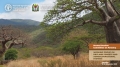
The Working Group on Dryland Forests and Agrosilvopastoral Systems aims to develop a comprehensive understanding of dryland forests and agrosilvopastoral systems and to promote the scaling and adoption of good practices for their protection, sustainable management and restoration, while enhancing...
From 11 November 2021 to 11 November 2021
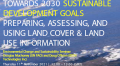
This webinar will present the importance of land cover & land use information, classification systems in UN agencies and major multilateral environmental agreements. It will cover the development of the Food and Agriculture Organisation's (FAO) Land Cover Legend Registry (
From 09 November 2021 to 09 November 2021
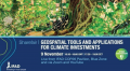
As changing climates affect farming conditions across the world, how can geospatial and remote sensing tools
help IFAD and others decide on where adaptation investments are best needed and what impact these
interventions will have? You can register to the sharefair here.