Projects
01 August 2013
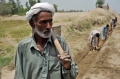
The project, Agricultural Information System - Building Provincial Capacity in Pakistan for Crop Estimation, Foreca-sting, and Reporting based on the inte-gral use of Remotely Sensed Data; GCP/PAK/125/USA, focused on enhan-cing and improving current systems for the integral...
06 February 2012
GEOCARBON was a global European FP7 project with the ultimate aim of laying the foundations for an operational Glo-bal Carbon Observing and Analysis Sy-stem in support to both science and policy. So far a series of methodologies...
01 October 2010
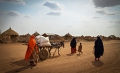
ClimAfrica was an international project funded by the European Commission under the 7th Framework Program (FP7). The project aimed to develop and apply climate forecasting models, both on a seasonal scale and for ten years, for Sub-Saharan...
GTOS is a program for observation, mo-delling, and analysis of terrestrial ecosystems to support sustainable develop-ment. GTOS will further facilitate access to data and information to users, inclu-ding researchers and policy-makers. The funding from the project allowed...
01 October 2003
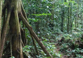
The Global Land Cover Network initiative was the result of a joint effort by FAO and UN Environment to respond to the need of international community for the availability of reliable and harmonized land cover information at...