Publications

2020
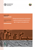
The project “Strengthening Agro-climatic Monitoring and Information Systems (SAMIS) to improve adaptation to climate change and food security in Lao PDR” has the objective to enhance capacities to gather, process, analyse, and share climatic and geospatial information so that these can be applied to planning and decision-making. The present Training Need Assessment determines the training needs for the activities of the project related to the development of the Land Resources Information Management System (LRIMS), the Agro-Ecological Zoning (AEZ) and the socio-agricultural scenarios. This document also discussed the procedure for implementing the training process including in-country and overseas trainings. This assessment has been developed by the Department of Agricultural Land Management (DALaM) within the Ministry of Agriculture and Forestry but will benefit a multiplicity of national level actors.

2020
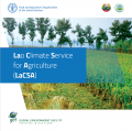
The project "Strengthening Agro-climatic Monitoring and Information Systems (SAMIS) to improve adaptation to climate change and food security in Lao PDR” has the objective to broadcast the weather information and weather warning in advance to the public widely throughout the website. Climate change results in severe damage to agriculture sectors in the whole country which stems from a flash flood, drought, plant disease, and natural disaster. To respond to the risk of disasters, daily, weekly, and monthly weather forecasts and weather warnings in advance are necessarily needed to inform farmers on time. The broadcast on the risk of weather prediction will directly benefit farmers in which impacts on farmers' crops and enhance farmers to access widely the weather forecast via the website.

2019
Land Resource Information Management System (LRIMS)
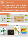
The GIS unit of the Department of Agricultural Land Management (DALaM) of the Ministry of Agriculture and Forest of Lao PDR developing of Land Resource Information Management System (LRIMS) database. First, the DALaM has been establishing formal agreements for data sharing with a multiplicity of national partners for data exchange, including provincial administration boundary, district administration boundary, built up areas of Laos, roads, and rivers, population growth rate, migration, reservoir, and flooding and irrigated areas. The national data collection process include the preparation of a cropland cover map and the updating of the soil map. In addition, district level Land Utilization Type data is being finalized. Secondly, all these data will be included in the LRIMS that is constituted by a web enabled geo-spatial database system aimed to support policy options designing and land management planning. All these data will be used to establish present and future Agro-Ecological Zoning (AEZ) which will enable policy and decision makers to access detailed future prevision of crop distribution and productivity as well as socio-economical acceptability of farming and cropping systems the impact of climate change in crop production will be calculated (for example, in 20, 50 and 100 years’ time).

2019
The Laos Climate Services in Agriculture (LaCSA) system. LaCSA archives and processes agro-meteorological and climatological data. By means of such data, it interpolates and provides agro-meteorological services to end-users. The system generates and delivers agro-met services to farmers by analyzing the meteorological and crop cycle data. It produces seasonal forecast and seven days bulletins. The seven days bulletin contains weekly weather bulletin, climate smart agriculture recommendations and pest and diseases risk advisory

2019
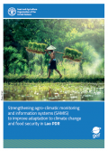
This project flyer describes the objectives, expected impact and benefits of the work to imporve agrometeorological information systems and data. The project will enhance the existing agro-meteorological networks and develop the infrastructure, procedures and capacity to provide high quality data and information services. The project will design policy options and guide land management planning for sustainably, enhance food security and support risk response in a context of current and future climate change.
